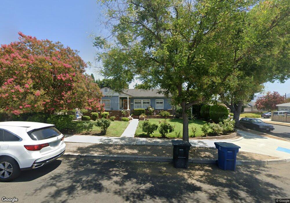
620 Price Dr Burbank, CA 91504
Hillside District NeighborhoodEstimated Value: $1,148,983 - $1,492,000
4
Beds
2
Baths
1,472
Sq Ft
$923/Sq Ft
Est. Value
About This Home
This home is located at 620 Price Dr, Burbank, CA 91504 and is currently estimated at $1,358,496, approximately $922 per square foot. 620 Price Dr is a home located in Los Angeles County with nearby schools including Thomas Jefferson Elementary School, John Muir Middle School, and Burbank High School.
Ownership History
Date
Name
Owned For
Owner Type
Purchase Details
Closed on
Jan 5, 1994
Sold by
Langer Richard and Langer Mary
Bought by
Silva Gerardo J and Silva Maritza
Current Estimated Value
Home Financials for this Owner
Home Financials are based on the most recent Mortgage that was taken out on this home.
Original Mortgage
$203,150
Interest Rate
7.21%
Purchase Details
Closed on
Nov 17, 1993
Sold by
California Federal Bank
Bought by
Langer Richard and Langer Mary
Home Financials for this Owner
Home Financials are based on the most recent Mortgage that was taken out on this home.
Original Mortgage
$203,150
Interest Rate
7.21%
Purchase Details
Closed on
Sep 20, 1993
Sold by
Cal Fed Service Corp
Bought by
California Federal Bank
Home Financials for this Owner
Home Financials are based on the most recent Mortgage that was taken out on this home.
Original Mortgage
$152,000
Interest Rate
6.89%
Create a Home Valuation Report for This Property
The Home Valuation Report is an in-depth analysis detailing your home's value as well as a comparison with similar homes in the area
Home Values in the Area
Average Home Value in this Area
Purchase History
| Date | Buyer | Sale Price | Title Company |
|---|---|---|---|
| Silva Gerardo J | $227,500 | -- | |
| Langer Richard | $190,000 | Chicago Title Company | |
| California Federal Bank | $170,561 | -- |
Source: Public Records
Mortgage History
| Date | Status | Borrower | Loan Amount |
|---|---|---|---|
| Closed | Silva Gerardo J | $203,150 | |
| Previous Owner | Langer Richard | $152,000 |
Source: Public Records
Tax History Compared to Growth
Tax History
| Year | Tax Paid | Tax Assessment Tax Assessment Total Assessment is a certain percentage of the fair market value that is determined by local assessors to be the total taxable value of land and additions on the property. | Land | Improvement |
|---|---|---|---|---|
| 2025 | $4,395 | $386,650 | $240,153 | $146,497 |
| 2024 | $4,395 | $379,070 | $235,445 | $143,625 |
| 2023 | $4,349 | $371,638 | $230,829 | $140,809 |
| 2022 | $4,154 | $364,352 | $226,303 | $138,049 |
| 2021 | $4,133 | $357,209 | $221,866 | $135,343 |
| 2019 | $3,969 | $346,617 | $215,287 | $131,330 |
| 2018 | $3,888 | $339,821 | $211,066 | $128,755 |
| 2016 | $3,684 | $326,627 | $202,871 | $123,756 |
| 2015 | $3,610 | $321,722 | $199,824 | $121,898 |
| 2014 | $3,607 | $315,421 | $195,910 | $119,511 |
Source: Public Records
Map
Nearby Homes
- 724 Price Dr
- 2528 N Orchard Dr
- 2748 Mansfield Dr
- 736 Irving Dr
- 2615 Woodstock Ln
- 2420 N Keystone St
- 3032 Amigos Dr
- 906 Groton Dr
- 1809 Peyton Ave Unit 313
- 1923 Grismer Ave
- 2000 Peyton Ave
- 2755 N Lincoln St
- 2014 Peyton Ave
- 2310 Washington Cir
- 2950 N Lincoln St
- 1711 Grismer Ave Unit 20
- 3003 Mesa Verde Dr
- 1702 Landis St
- 1622 Keeler St
- 1608 Grismer Ave
- 626 Price Dr
- 1706 1706 Grismer Unit 205
- 0 Dobbs Rd Unit SR22098720
- 621 Jamestown Rd
- 632 Price Dr
- 60 E Cor Ave F 60 Ste
- 0 Great Location Unit CC41763
- 627 Jamestown Rd
- 2619 Jolley Dr
- 633 Jamestown Rd
- 2613 Jolley Dr
- 2625 Jolley Dr
- 621 Price Dr
- 638 Price Dr
- 2607 Jolley Dr
- 627 Price Dr
- 2701 Jolley Dr
- 639 Jamestown Rd
- 633 Price Dr
- 644 Price Dr