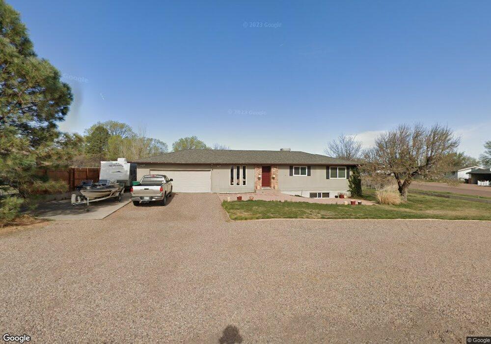
620 S 5th St W Snowflake, AZ 85937
Estimated Value: $276,000 - $330,000
--
Bed
--
Bath
1,177
Sq Ft
$256/Sq Ft
Est. Value
About This Home
This home is located at 620 S 5th St W, Snowflake, AZ 85937 and is currently estimated at $300,866, approximately $255 per square foot. 620 S 5th St W is a home located in Navajo County with nearby schools including Highland Primary School, Snowflake Intermediate School, and Snowflake Junior High School.
Ownership History
Date
Name
Owned For
Owner Type
Purchase Details
Closed on
Jun 15, 2018
Sold by
Cabrera David Antonio and Dillion Amelia
Bought by
Snowflake Oasis Llc
Current Estimated Value
Purchase Details
Closed on
Oct 5, 2016
Sold by
Hoyt Coleman D and Hoyt Nikki R
Bought by
Hoyt Coleman D and Hoyt Nikki R
Purchase Details
Closed on
Feb 17, 2016
Sold by
Cabrera Mary Ann
Bought by
Snowflake Oasis Llc
Purchase Details
Closed on
Dec 30, 2013
Sold by
Snowflake Oasis Llc
Bought by
Cabrera Mary Ann
Create a Home Valuation Report for This Property
The Home Valuation Report is an in-depth analysis detailing your home's value as well as a comparison with similar homes in the area
Home Values in the Area
Average Home Value in this Area
Purchase History
| Date | Buyer | Sale Price | Title Company |
|---|---|---|---|
| Snowflake Oasis Llc | -- | Lawyers Title | |
| Hoyt Coleman D | -- | None Available | |
| Snowflake Oasis Llc | -- | None Available | |
| Cabrera Mary Ann | -- | None Available |
Source: Public Records
Tax History Compared to Growth
Tax History
| Year | Tax Paid | Tax Assessment Tax Assessment Total Assessment is a certain percentage of the fair market value that is determined by local assessors to be the total taxable value of land and additions on the property. | Land | Improvement |
|---|---|---|---|---|
| 2026 | $539 | -- | -- | -- |
| 2025 | $524 | $24,053 | $4,014 | $20,039 |
| 2024 | $560 | $23,730 | $3,491 | $20,239 |
| 2023 | $524 | $16,288 | $747 | $15,541 |
| 2022 | $560 | $0 | $0 | $0 |
| 2021 | $607 | $0 | $0 | $0 |
| 2020 | $610 | $0 | $0 | $0 |
| 2019 | $599 | $0 | $0 | $0 |
| 2018 | $580 | $0 | $0 | $0 |
| 2017 | $566 | $0 | $0 | $0 |
| 2016 | $580 | $0 | $0 | $0 |
| 2015 | $509 | $6,265 | $1,147 | $5,118 |
Source: Public Records
Map
Nearby Homes
- 381 W 7th St S
- 416 S 2nd St W
- 940 S 2nd St W
- 0 S 1st St W
- 420 S Astante Dr
- 960 S Highland Dr
- 1052 W 8th St S
- 274 W Sycamore Unit 1
- 44 S 3rd St W Unit W
- 44 S 3rd St W
- 461 W Center St
- 864 S 1st St E
- 552 W Mclaws Ave
- 120 E 9th St S
- 177 W 1st St N
- 215 E 10th St S
- 1156 W Mclaws Ave
- 276 N 2nd St W
- 276 N 2nd St W Unit West
- 1362 Lobo Trail
- 650 S 5th St W
- 650 S 5th St W Unit W
- 491 W 6th St S Unit S1
- 647 S 5th St W
- 573 W 6th St S
- 465 W 6th St S
- 690 S 5th St W
- 251 6th South St
- 176 6th South St
- 0 6th South St
- 556 W 6th St S
- 516 W 6th St S
- 445 W 6th St S
- 460 W 7th St S
- 581 W 6th St S
- 591 S 6th St W
- 580 W 6th St S
- 436 W 6th St S
- 685 S 6th St W
- 648 S 4th St W