Estimated Value: $208,000 - $247,000
4
Beds
2
Baths
1,204
Sq Ft
$185/Sq Ft
Est. Value
About This Home
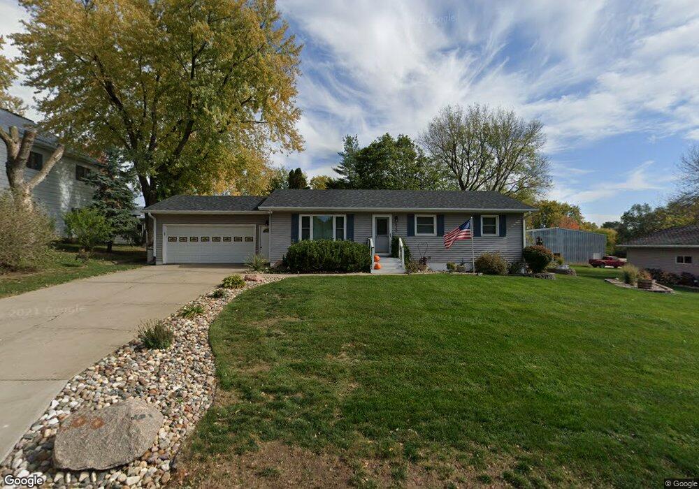
This home is located at 620 S 8th St, Akron, IA 51001 and is currently estimated at $223,137, approximately $185 per square foot. 620 S 8th St is a home located in Plymouth County with nearby schools including Akron Westfield Elementary School, Akron Westfield Middle School, and Akron Westfield Senior High School.
Ownership History
Date
Name
Owned For
Owner Type
Purchase Details
Closed on
Apr 9, 2010
Sold by
Lawrence Rick and Lawrence Richard
Bought by
Rozell Joshua L and Rozell Mitchell I
Current Estimated Value
Home Financials for this Owner
Home Financials are based on the most recent Mortgage that was taken out on this home.
Original Mortgage
$137,464
Outstanding Balance
$91,290
Interest Rate
5.02%
Mortgage Type
FHA
Estimated Equity
$131,847
Create a Home Valuation Report for This Property
The Home Valuation Report is an in-depth analysis detailing your home's value as well as a comparison with similar homes in the area
Home Values in the Area
Average Home Value in this Area
Purchase History
| Date | Buyer | Sale Price | Title Company |
|---|---|---|---|
| Rozell Joshua L | $140,000 | None Available |
Source: Public Records
Mortgage History
| Date | Status | Borrower | Loan Amount |
|---|---|---|---|
| Open | Rozell Joshua L | $137,464 |
Source: Public Records
Tax History Compared to Growth
Tax History
| Year | Tax Paid | Tax Assessment Tax Assessment Total Assessment is a certain percentage of the fair market value that is determined by local assessors to be the total taxable value of land and additions on the property. | Land | Improvement |
|---|---|---|---|---|
| 2025 | $2,874 | $206,840 | $16,920 | $189,920 |
| 2024 | $2,580 | $183,080 | $16,920 | $166,160 |
| 2023 | $2,442 | $167,310 | $12,690 | $154,620 |
| 2022 | $2,430 | $138,300 | $12,690 | $125,610 |
| 2021 | $2,042 | $138,300 | $12,690 | $125,610 |
| 2020 | $2,042 | $121,420 | $12,690 | $108,730 |
| 2019 | -- | $121,420 | $12,690 | $108,730 |
| 2018 | -- | $106,960 | $12,690 | $94,270 |
| 2017 | -- | $101,680 | $0 | $0 |
| 2016 | -- | $101,680 | $0 | $0 |
| 2015 | -- | $98,130 | $0 | $0 |
| 2014 | -- | $0 | $0 | $0 |
Source: Public Records
Map
Nearby Homes
- 631 South St
- 2040 Clover Dr
- 530 S 5th St
- 640 4th St
- 400 Reed St
- 8223 Tract 0460411080000 Apn
- 130 Dakota St
- 430 Torbert Blvd
- 18546 140th St
- 11724 K18 N
- 31780 476th Ave
- 48201 304th St St
- 409 E Rose St
- 18231 Weber Rd
- 405 E Main St
- 903 E Main St
- 112 Central Ave
- 506 S Pearl St
- 603 S Park Place
- 31302 471st Ave