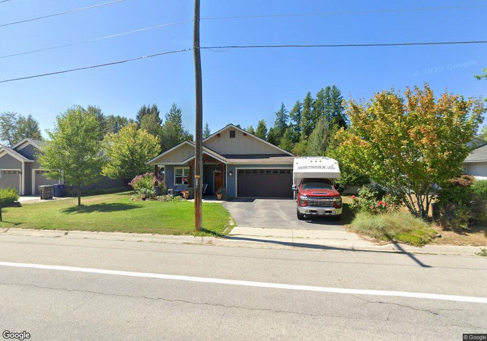
620 S Lincoln Ave Sandpoint, ID 83864
Estimated Value: $626,268 - $692,000
3
Beds
2
Baths
1,972
Sq Ft
$335/Sq Ft
Est. Value
About This Home
This home is located at 620 S Lincoln Ave, Sandpoint, ID 83864 and is currently estimated at $661,067, approximately $335 per square foot. 620 S Lincoln Ave is a home with nearby schools including Washington Elementary School, Sandpoint Middle School, and Sandpoint High School.
Ownership History
Date
Name
Owned For
Owner Type
Purchase Details
Closed on
Apr 29, 2020
Sold by
Haley Daniel J and Haley Mary E
Bought by
Haley Daniel J and Haley Mary E
Current Estimated Value
Purchase Details
Closed on
May 8, 2013
Sold by
Haley Daniel and Haley Mary
Bought by
Haley Daniel J and Haley Mary E
Home Financials for this Owner
Home Financials are based on the most recent Mortgage that was taken out on this home.
Original Mortgage
$234,000
Interest Rate
3.5%
Mortgage Type
New Conventional
Create a Home Valuation Report for This Property
The Home Valuation Report is an in-depth analysis detailing your home's value as well as a comparison with similar homes in the area
Home Values in the Area
Average Home Value in this Area
Purchase History
| Date | Buyer | Sale Price | Title Company |
|---|---|---|---|
| Haley Daniel J | -- | North Idaho Title Company | |
| Haley Daniel J | -- | None Available |
Source: Public Records
Mortgage History
| Date | Status | Borrower | Loan Amount |
|---|---|---|---|
| Closed | Haley Daniel J | $234,000 |
Source: Public Records
Tax History Compared to Growth
Tax History
| Year | Tax Paid | Tax Assessment Tax Assessment Total Assessment is a certain percentage of the fair market value that is determined by local assessors to be the total taxable value of land and additions on the property. | Land | Improvement |
|---|---|---|---|---|
| 2025 | $2,855 | $626,445 | $233,955 | $392,490 |
| 2024 | $3,127 | $557,246 | $163,146 | $394,100 |
| 2023 | $2,499 | $577,846 | $163,146 | $414,700 |
| 2022 | $2,921 | $514,503 | $137,146 | $377,357 |
| 2021 | $2,514 | $347,600 | $78,340 | $269,260 |
| 2020 | $2,580 | $333,842 | $78,340 | $255,502 |
| 2019 | $2,889 | $339,159 | $78,340 | $260,819 |
| 2018 | $2,774 | $331,906 | $72,400 | $259,506 |
| 2017 | $2,774 | $311,944 | $0 | $0 |
| 2016 | $2,440 | $272,020 | $0 | $0 |
| 2015 | $2,523 | $272,020 | $0 | $0 |
| 2014 | $3,589 | $266,620 | $0 | $0 |
Source: Public Records
Map
Nearby Homes
- 135 Madera Dr
- 414 Creekside Ln
- 2123 Browning Way
- 207 S Lincoln Ave
- 1020 Park Ave
- 1309 Westwood Ln
- 17 Canoe Cove
- 1320 Mathison Dr
- 1405 Autumn Ln
- 1721 Northshore Dr
- 1410 J r Ct
- 1406 J r Ct
- 1515 Northshore Dr
- 71 Widgeon Hollow
- 424 S Olive Ave
- 424 S Olive Ave Unit 303
- 424 S Olive Ave Unit 103
- 424 S Olive Ave Unit 203
- 702 S Merton Ave
- 614 S Lincoln Ave
- 702 S Lincoln Ave
- 708 S Lincoln Ave
- 703 Creekside Ln
- 617 Creekside Ln
- 623 Creekside Ln
- 707 Creekside Ln
- 1903 Mountain Meadows Way
- 611 Creekside Ln
- 1908 Ontario St
- 1902 Ontario St
- 1920 Ontario St
- 1920 Ontario St
- 605 Creekside Ln
- 713 Creekside Ln
- 714 Creekside Ln
- 708 Creekside Ln
- 25 Creekside Ln
- NNA Creekside Ln
- Lot 25 Creekside Ln