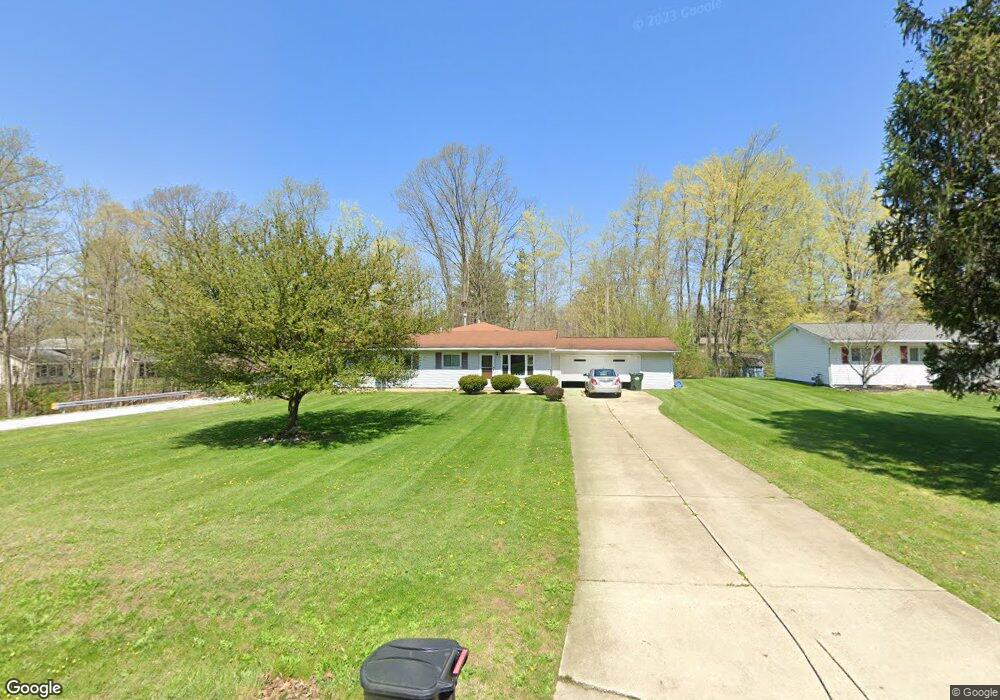
620 Sherwood Dr Aurora, OH 44202
Estimated Value: $280,082 - $285,000
4
Beds
2
Baths
1,510
Sq Ft
$187/Sq Ft
Est. Value
About This Home
This home is located at 620 Sherwood Dr, Aurora, OH 44202 and is currently estimated at $282,771, approximately $187 per square foot. 620 Sherwood Dr is a home located in Portage County with nearby schools including Miller Elementary School, Craddock/Miller Elementary School, and Leighton Elementary School.
Ownership History
Date
Name
Owned For
Owner Type
Purchase Details
Closed on
Jan 9, 2003
Sold by
Szczepinski Debra
Bought by
Szczepinski Debra and Byus Marion O
Current Estimated Value
Purchase Details
Closed on
May 1, 2001
Sold by
Byus Marion O
Bought by
Szczepinski Debra
Home Financials for this Owner
Home Financials are based on the most recent Mortgage that was taken out on this home.
Original Mortgage
$40,500
Interest Rate
7.24%
Purchase Details
Closed on
Aug 16, 1999
Sold by
Byus Marion O
Bought by
Byus Marion O and Szczepinski Debra
Purchase Details
Closed on
Mar 1, 1993
Bought by
Byus Thomas R and Byus Marion
Create a Home Valuation Report for This Property
The Home Valuation Report is an in-depth analysis detailing your home's value as well as a comparison with similar homes in the area
Home Values in the Area
Average Home Value in this Area
Purchase History
| Date | Buyer | Sale Price | Title Company |
|---|---|---|---|
| Szczepinski Debra | -- | Midland Title Security Inc | |
| Szczepinski Debra | $40,500 | -- | |
| Byus Marion O | -- | Midland Title Security Inc | |
| Byus Marion O | -- | Midland Title Security Inc | |
| Byus Thomas R | -- | -- |
Source: Public Records
Mortgage History
| Date | Status | Borrower | Loan Amount |
|---|---|---|---|
| Previous Owner | Szczepinski Debra | $40,500 |
Source: Public Records
Tax History Compared to Growth
Tax History
| Year | Tax Paid | Tax Assessment Tax Assessment Total Assessment is a certain percentage of the fair market value that is determined by local assessors to be the total taxable value of land and additions on the property. | Land | Improvement |
|---|---|---|---|---|
| 2024 | $3,064 | $68,540 | $15,300 | $53,240 |
| 2023 | $3,488 | $63,530 | $15,300 | $48,230 |
| 2022 | $3,168 | $63,530 | $15,300 | $48,230 |
| 2021 | $3,208 | $63,530 | $15,300 | $48,230 |
| 2020 | $2,719 | $50,760 | $15,300 | $35,460 |
| 2019 | $2,740 | $50,760 | $15,300 | $35,460 |
| 2018 | $2,480 | $41,760 | $15,300 | $26,460 |
| 2017 | $2,480 | $41,760 | $15,300 | $26,460 |
| 2016 | $2,040 | $38,120 | $15,300 | $22,820 |
| 2015 | $2,175 | $38,440 | $15,300 | $23,140 |
| 2014 | $2,219 | $38,440 | $15,300 | $23,140 |
| 2013 | $2,206 | $38,440 | $15,300 | $23,140 |
Source: Public Records
Map
Nearby Homes
- 794 Robinhood Dr
- 777 Nancy Dr
- 185 N Bissell Rd
- 436 Cochran Rd
- 405 Club Dr W
- 676 Nancy Dr
- 316 High Bluff
- 915 Cimarron Oval
- 225 Linwood Ln
- 622 Club Dr W
- 640 Club Dr W
- 580 Hardwick Dr
- 180 Beaumont Trail
- S/L 4 Trentstone Cir
- 752 Club Dr W
- S/L 3 Iris Place
- S/L 8 Trentstone Cir
- S/L 15 Trentstone Cir
- 762 Club Dr W
- 805 Club Dr W
- 610 Sherwood Dr
- 315 Sussex Dr
- 594 Sherwood Dr
- 619 Robinhood Dr
- 609 Robinhood Dr
- 619 Sherwood Dr
- 635 Robinhood Dr
- 609 Sherwood Dr
- 635 Sherwood Dr
- 593 Robinhood Dr
- 584 Sherwood Dr
- 593 Sherwood Dr
- 649 Robinhood Dr
- 649 Sherwood Dr
- 660 Sherwood Dr
- 583 Robinhood Dr
- 576 Sherwood Dr
- 659 Robinhood Dr
- 575 Robinhood Dr
- 620 Robinhood Dr