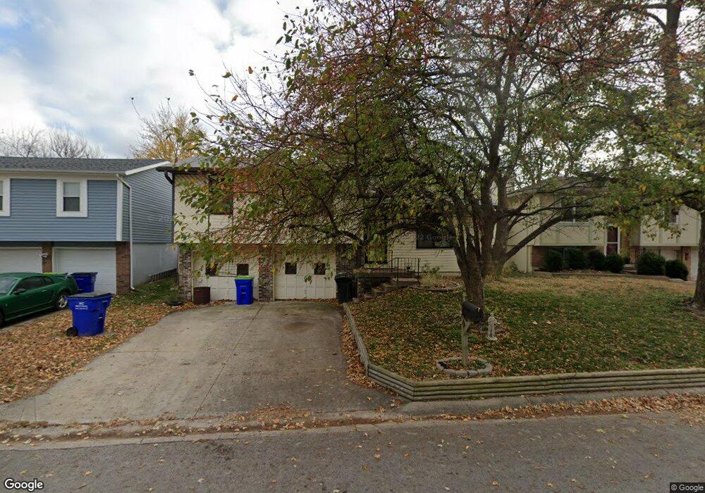
620 Trant St Kansas City, KS 66111
Estimated Value: $239,000 - $263,000
3
Beds
2
Baths
1,006
Sq Ft
$253/Sq Ft
Est. Value
About This Home
This home is located at 620 Trant St, Kansas City, KS 66111 and is currently estimated at $254,526, approximately $253 per square foot. 620 Trant St is a home located in Wyandotte County with nearby schools including Robert E Clark Middle School and Bonner Springs High School.
Ownership History
Date
Name
Owned For
Owner Type
Purchase Details
Closed on
Jun 24, 2015
Sold by
Tsen Karl and Tsen Kristen M
Bought by
Green Megan and Tsen Megan
Current Estimated Value
Purchase Details
Closed on
Jun 18, 2015
Sold by
Tsen Karl
Bought by
Green Megan
Purchase Details
Closed on
Jan 20, 2005
Sold by
Ballou Timothy A and Ballou Rhonda L
Bought by
Tsen Karl and Tsen Megan
Home Financials for this Owner
Home Financials are based on the most recent Mortgage that was taken out on this home.
Original Mortgage
$89,960
Interest Rate
5.25%
Mortgage Type
New Conventional
Create a Home Valuation Report for This Property
The Home Valuation Report is an in-depth analysis detailing your home's value as well as a comparison with similar homes in the area
Home Values in the Area
Average Home Value in this Area
Purchase History
| Date | Buyer | Sale Price | Title Company |
|---|---|---|---|
| Green Megan | -- | Secured Title Of Kansas City | |
| Green Megan | -- | None Available | |
| Tsen Karl | -- | Old Republic Title Company O |
Source: Public Records
Mortgage History
| Date | Status | Borrower | Loan Amount |
|---|---|---|---|
| Previous Owner | Tsen Karl | $89,960 |
Source: Public Records
Tax History Compared to Growth
Tax History
| Year | Tax Paid | Tax Assessment Tax Assessment Total Assessment is a certain percentage of the fair market value that is determined by local assessors to be the total taxable value of land and additions on the property. | Land | Improvement |
|---|---|---|---|---|
| 2024 | $3,816 | $25,461 | $4,161 | $21,300 |
| 2023 | $3,593 | $22,379 | $3,326 | $19,053 |
| 2022 | $3,044 | $18,871 | $3,092 | $15,779 |
| 2021 | $2,907 | $16,994 | $2,865 | $14,129 |
| 2020 | $2,764 | $15,734 | $2,740 | $12,994 |
| 2019 | $2,691 | $14,984 | $2,740 | $12,244 |
| 2018 | $2,584 | $14,547 | $2,341 | $12,206 |
| 2017 | $2,376 | $13,269 | $2,341 | $10,928 |
| 2016 | $2,298 | $12,759 | $2,341 | $10,418 |
| 2015 | $2,300 | $12,759 | $2,341 | $10,418 |
| 2014 | $2,166 | $12,508 | $2,341 | $10,167 |
Source: Public Records
Map
Nearby Homes
- 738 S 9th St
- 507 Newton St
- 240 White St Unit LOT 240
- 603 Newton St
- 507 High St
- 781 Highland Dr
- 824 Highland Dr
- 828 Highland Dr
- 789 Highland Dr
- 800 Highland Dr
- 20823 W 45th Terrace
- 4531 Woodstock St
- 1803 S 98th St
- 10506 Shelton Ave
- 1630 S 105th Terrace
- 1548 S 105th Ct
- 21222 W 48th St
- 98th Metropolitan Ave
- 9687 Metropolitan Ave
- 4817 Marion St