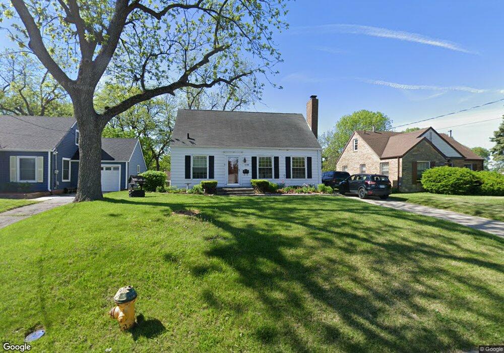
6200 Rollins Ave Des Moines, IA 50312
Waterbury NeighborhoodEstimated Value: $219,000 - $274,000
2
Beds
1
Bath
1,008
Sq Ft
$245/Sq Ft
Est. Value
About This Home
This home is located at 6200 Rollins Ave, Des Moines, IA 50312 and is currently estimated at $247,360, approximately $245 per square foot. 6200 Rollins Ave is a home located in Polk County with nearby schools including Windsor Elementary School, Merrill Middle School, and Roosevelt High School.
Ownership History
Date
Name
Owned For
Owner Type
Purchase Details
Closed on
Oct 15, 2004
Sold by
Shelbury Daniel and Shelburg Kimberly A
Bought by
Shelburg Daniel E and Shelburg Kimberly A
Current Estimated Value
Home Financials for this Owner
Home Financials are based on the most recent Mortgage that was taken out on this home.
Original Mortgage
$117,600
Outstanding Balance
$69,228
Interest Rate
8.7%
Mortgage Type
New Conventional
Estimated Equity
$178,132
Purchase Details
Closed on
Mar 10, 1998
Sold by
Rottinghaus Mark E and Rottinghaus Kathryn D
Bought by
Shelburg Daniel and Shelburg Daniel E
Home Financials for this Owner
Home Financials are based on the most recent Mortgage that was taken out on this home.
Original Mortgage
$85,787
Interest Rate
7.23%
Mortgage Type
FHA
Create a Home Valuation Report for This Property
The Home Valuation Report is an in-depth analysis detailing your home's value as well as a comparison with similar homes in the area
Home Values in the Area
Average Home Value in this Area
Purchase History
| Date | Buyer | Sale Price | Title Company |
|---|---|---|---|
| Shelburg Daniel E | -- | Nations Title Agency Inc | |
| Shelburg Daniel | $87,500 | -- |
Source: Public Records
Mortgage History
| Date | Status | Borrower | Loan Amount |
|---|---|---|---|
| Open | Shelburg Daniel E | $117,600 | |
| Closed | Shelburg Daniel | $85,787 |
Source: Public Records
Tax History Compared to Growth
Tax History
| Year | Tax Paid | Tax Assessment Tax Assessment Total Assessment is a certain percentage of the fair market value that is determined by local assessors to be the total taxable value of land and additions on the property. | Land | Improvement |
|---|---|---|---|---|
| 2024 | $3,280 | $185,800 | $48,800 | $137,000 |
| 2023 | $3,412 | $185,800 | $48,800 | $137,000 |
| 2022 | $3,382 | $157,000 | $42,000 | $115,000 |
| 2021 | $3,356 | $157,000 | $42,000 | $115,000 |
| 2020 | $3,480 | $146,400 | $38,900 | $107,500 |
| 2019 | $3,256 | $146,400 | $38,900 | $107,500 |
| 2018 | $3,214 | $132,900 | $34,500 | $98,400 |
| 2017 | $2,862 | $132,900 | $34,500 | $98,400 |
| 2016 | $2,782 | $117,600 | $30,000 | $87,600 |
| 2015 | $2,782 | $117,600 | $30,000 | $87,600 |
| 2014 | $2,484 | $105,900 | $26,400 | $79,500 |
Source: Public Records
Map
Nearby Homes
- 720 63rd St
- 6420 Center St
- 686 63rd St
- 6750 School St Unit 205
- 6750 School St Unit 851
- 6750 School St Unit 206
- 6015 Waterbury Cir
- 731 56th St
- 5723 Waterbury Cir
- 1050 57th St
- 1117 63rd St
- 1010 56th St
- 1003 68th St
- 1064 56th St
- 1036 5th St
- 1142 65th St
- 1129 57th St
- 701 54th St
- 712 Clegg Rd
- 5740 Walnut Hill Ave
- 6204 Rollins Ave
- 6118 Rollins Ave
- 6208 Rollins Ave
- 6114 Rollins Ave
- 6131 Pleasant Dr
- 6137 Pleasant Dr
- 6108 Rollins Ave
- 6127 Pleasant Dr
- 6203 Pleasant Dr
- 6104 Rollins Ave
- 807 63rd St
- 812 62nd Place
- 801 63rd St
- 6211 Pleasant Dr
- 6100 Rollins Ave
- 6115 Pleasant Dr
- 6215 Pleasant Dr
- 6024 Rollins Ave
- 6132 Pleasant Dr
- 716 62nd St