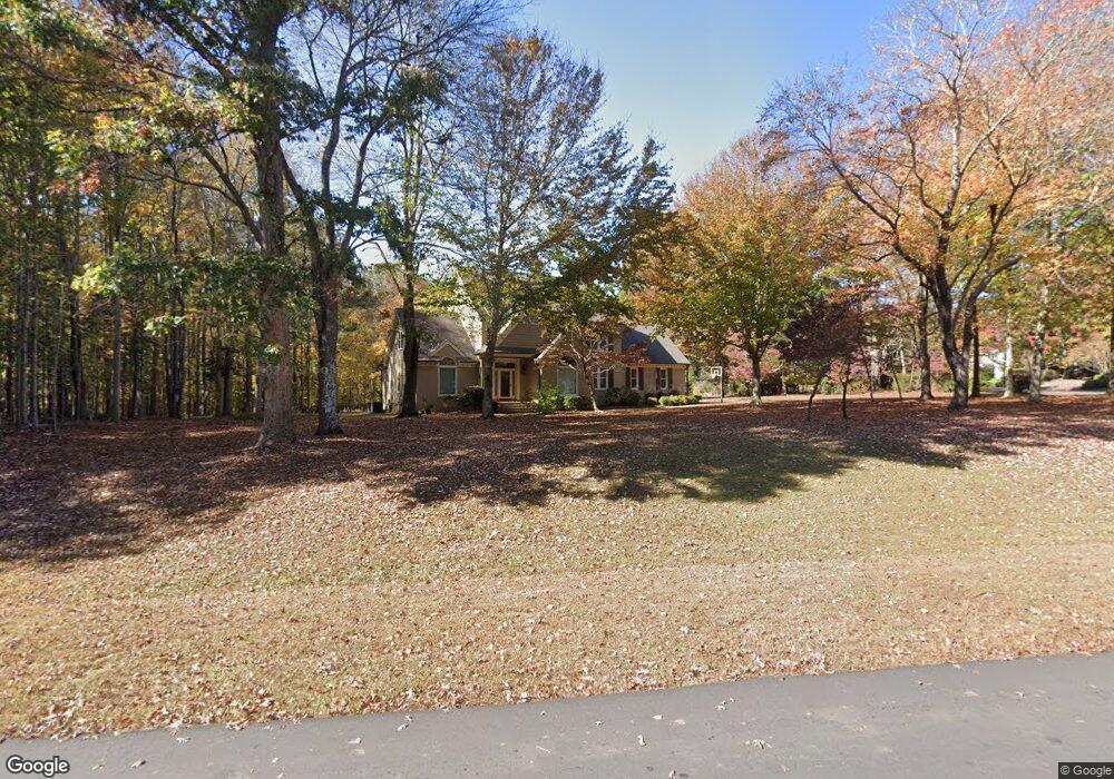
6201 Heacham Ct Raleigh, NC 27614
Falls Lake NeighborhoodEstimated Value: $840,399 - $945,000
4
Beds
3
Baths
3,255
Sq Ft
$272/Sq Ft
Est. Value
About This Home
This home is located at 6201 Heacham Ct, Raleigh, NC 27614 and is currently estimated at $885,100, approximately $271 per square foot. 6201 Heacham Ct is a home located in Wake County with nearby schools including Pleasant Union Elementary School, West Millbrook Middle School, and Millbrook High School.
Ownership History
Date
Name
Owned For
Owner Type
Purchase Details
Closed on
Sep 14, 2020
Sold by
Keamey Gerald T and Keamey Michelle
Bought by
Deshong Amy and Deshong Christopher
Current Estimated Value
Home Financials for this Owner
Home Financials are based on the most recent Mortgage that was taken out on this home.
Original Mortgage
$432,000
Outstanding Balance
$383,371
Interest Rate
2.9%
Mortgage Type
New Conventional
Estimated Equity
$501,729
Purchase Details
Closed on
Sep 30, 2014
Sold by
Funderburk Richard C and Funderburk Denise W
Bought by
Kearney Gerald T and Kearney Michelle
Purchase Details
Closed on
Jun 26, 2003
Sold by
Mehlich Carolyn F and Mehlick Carolyn F
Bought by
Funderburk Richard C and Funderburk Denise W
Home Financials for this Owner
Home Financials are based on the most recent Mortgage that was taken out on this home.
Original Mortgage
$300,000
Interest Rate
5.43%
Mortgage Type
Purchase Money Mortgage
Create a Home Valuation Report for This Property
The Home Valuation Report is an in-depth analysis detailing your home's value as well as a comparison with similar homes in the area
Home Values in the Area
Average Home Value in this Area
Purchase History
| Date | Buyer | Sale Price | Title Company |
|---|---|---|---|
| Deshong Amy | $540,000 | None Available | |
| Kearney Gerald T | $476,000 | Cardinal Title Center Llc | |
| Funderburk Richard C | $399,000 | -- |
Source: Public Records
Mortgage History
| Date | Status | Borrower | Loan Amount |
|---|---|---|---|
| Open | Deshong Amy | $432,000 | |
| Previous Owner | Funderburk Richard C | $300,000 |
Source: Public Records
Tax History Compared to Growth
Tax History
| Year | Tax Paid | Tax Assessment Tax Assessment Total Assessment is a certain percentage of the fair market value that is determined by local assessors to be the total taxable value of land and additions on the property. | Land | Improvement |
|---|---|---|---|---|
| 2025 | $5,152 | $802,384 | $200,000 | $602,384 |
| 2024 | $5,003 | $802,384 | $200,000 | $602,384 |
| 2023 | $4,475 | $571,382 | $165,000 | $406,382 |
| 2022 | $4,147 | $571,382 | $165,000 | $406,382 |
| 2021 | $4,035 | $571,382 | $165,000 | $406,382 |
| 2020 | $3,968 | $571,382 | $165,000 | $406,382 |
| 2019 | $3,973 | $483,980 | $165,000 | $318,980 |
| 2018 | $0 | $483,980 | $165,000 | $318,980 |
| 2017 | $0 | $483,980 | $165,000 | $318,980 |
| 2016 | $3,391 | $483,980 | $165,000 | $318,980 |
| 2015 | -- | $458,729 | $156,000 | $302,729 |
| 2014 | $2,987 | $450,955 | $156,000 | $294,955 |
Source: Public Records
Map
Nearby Homes
- 6804 Brixley Cir
- 6300 Swallow Cove Ln
- 1112 Stone Kirk Dr
- 6033 Over Hadden Ct
- 14124 Norwood Rd
- 6508 Sanctuary Falls Dr
- 1228 Dorleath Ct
- 5808 Cavanaugh Dr
- 6736 Brixley Crest Ct
- 812 Stradella Rd
- 5768 Cavanaugh Dr
- 1105 Longstone Way
- 1208 Hannahs View Dr
- 5808 Norwood Ridge Dr
- 1404 Barony Lake Way
- 1409 Caistor Ln
- 12117 Cliffside Cir
- 1300 Caistor Ln
- 1629 Adams Mountain Rd
- 10909 Raven Rock Dr
- 808 Tadlock Dr
- 6205 Heacham Ct Unit 73
- 6205 Heacham Ct
- 800 Tadlock Dr
- 6200 Heacham Ct
- 6209 Heacham Ct
- 728 Tadlock Dr
- 6208 Heacham Ct
- 6128 Weobley Ln
- 820 Tadlock Dr
- 6129 Weobley Ln
- 725 Tadlock Dr
- 724 Tadlock Dr
- 6120 Weobley Ln
- 1001 Long Barrow Ct
- 6201 Therfield Dr
- 1005 Long Barrow Ct
- 6209 Pentridge Ct
- 6125 Weobley Ln
- 1000 Long Barrow Ct