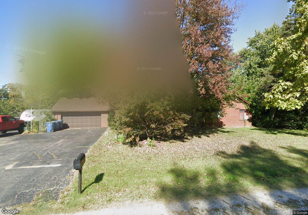
6201 State Route 162 Maryville, IL 62062
Estimated Value: $250,000 - $345,000
2
Beds
2
Baths
1,682
Sq Ft
$165/Sq Ft
Est. Value
About This Home
This home is located at 6201 State Route 162, Maryville, IL 62062 and is currently estimated at $278,161, approximately $165 per square foot. 6201 State Route 162 is a home located in Madison County with nearby schools including Maryville Elementary School, Dorris Intermediate School, and Collinsville Middle School.
Ownership History
Date
Name
Owned For
Owner Type
Purchase Details
Closed on
Feb 22, 2014
Sold by
Meyer Sharon L
Bought by
Boyles Deidre
Current Estimated Value
Home Financials for this Owner
Home Financials are based on the most recent Mortgage that was taken out on this home.
Original Mortgage
$125,356
Outstanding Balance
$94,408
Interest Rate
4.25%
Mortgage Type
FHA
Estimated Equity
$183,753
Purchase Details
Closed on
Apr 5, 2010
Sold by
Meyer Sharon L and Meyer Edward F
Bought by
Meyer Sharon L
Purchase Details
Closed on
Mar 30, 2006
Sold by
Meyer Edward F
Bought by
Meyer Edward F and Meyer Sharon L
Create a Home Valuation Report for This Property
The Home Valuation Report is an in-depth analysis detailing your home's value as well as a comparison with similar homes in the area
Home Values in the Area
Average Home Value in this Area
Purchase History
| Date | Buyer | Sale Price | Title Company |
|---|---|---|---|
| Boyles Deidre | $128,000 | Metro Title & Escrow Company | |
| Meyer Sharon L | -- | None Available | |
| Meyer Edward F | -- | None Available |
Source: Public Records
Mortgage History
| Date | Status | Borrower | Loan Amount |
|---|---|---|---|
| Open | Boyles Deidre | $125,356 |
Source: Public Records
Tax History Compared to Growth
Tax History
| Year | Tax Paid | Tax Assessment Tax Assessment Total Assessment is a certain percentage of the fair market value that is determined by local assessors to be the total taxable value of land and additions on the property. | Land | Improvement |
|---|---|---|---|---|
| 2024 | $5,150 | $81,180 | $18,190 | $62,990 |
| 2023 | $5,150 | $75,140 | $16,840 | $58,300 |
| 2022 | $4,871 | $69,480 | $15,570 | $53,910 |
| 2021 | $4,171 | $62,350 | $13,940 | $48,410 |
| 2020 | $4,015 | $59,490 | $13,300 | $46,190 |
| 2019 | $3,893 | $57,460 | $12,850 | $44,610 |
| 2018 | $3,791 | $54,430 | $12,170 | $42,260 |
| 2017 | $3,236 | $46,680 | $10,320 | $36,360 |
| 2016 | $3,385 | $46,680 | $10,320 | $36,360 |
| 2015 | $3,152 | $45,460 | $10,050 | $35,410 |
| 2014 | $3,152 | $45,460 | $10,050 | $35,410 |
| 2013 | $3,152 | $45,460 | $10,050 | $35,410 |
Source: Public Records
Map
Nearby Homes
- 29 Dogwood Terrace
- 53 Cheshire Dr
- 241 Madison Ave
- 1313 Jacquelyn Ct
- 215 Summit Ave
- 505 Huntington
- 0 Fountains of Sunset
- 14 Lou Juan Dr
- 204 Aspen Point
- 5736 Old Keebler Rd
- 6 Shaderest Ct
- 214 Edwards St
- 126 Kingsbrooke Blvd
- 5 Chariot Ct
- 24 Alta St
- 501 Drost St
- 109 Kingsbrooke Blvd
- 126 Center St
- 71 Hillsborough Ave
- 16 Williamsburg Ln
- 6161 State Route 162
- 6144 State Route 162
- 6119 State Route 162
- 2146 Gun Club Ln
- 6 Dogwood Terrace
- 6140 State Route 162
- 6128 State Route 162
- 6124 State Route 162
- 6120 State Route 162
- 2141 Gun Club Ln
- xxx Log Cabin Ln
- 0 Log Cabin Ln
- 9 Dogwood Terrace
- 2140 Gun Club Ln
- 6132 State Route 162
- 6216 State Route 162
- 24 Dogwood Terrace
- 2212 Log Cabin Ln
- 2211 Log Cabin Ln
- 10 Blossom Lake Ln