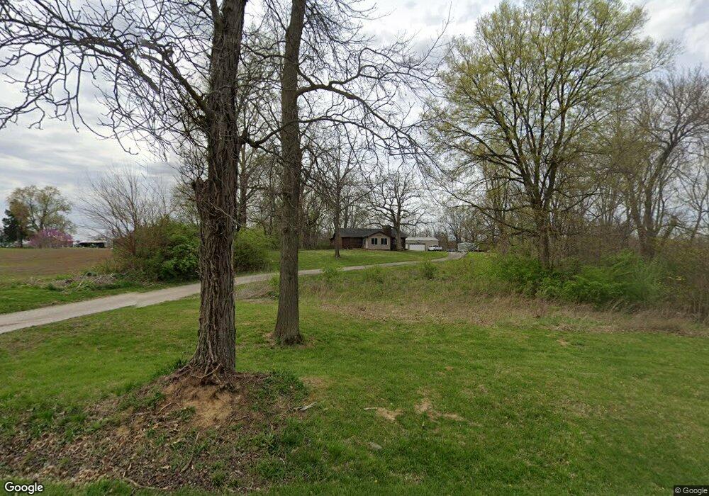
6201 Strode Rd Cantrall, IL 62625
Estimated Value: $294,000 - $325,342
Studio
--
Bath
--
Sq Ft
130,680
Sq Ft
About This Home
This home is located at 6201 Strode Rd, Cantrall, IL 62625 and is currently estimated at $302,336. 6201 Strode Rd is a home with nearby schools including Cantrall Elementary School, Cantrall Intermediate School, and Athens Junior High School.
Ownership History
Date
Name
Owned For
Owner Type
Purchase Details
Closed on
Dec 22, 2020
Sold by
Harris Christopher K and Harris Jennifer C
Bought by
Hankins Amber
Current Estimated Value
Home Financials for this Owner
Home Financials are based on the most recent Mortgage that was taken out on this home.
Original Mortgage
$209,000
Outstanding Balance
$186,404
Interest Rate
2.8%
Mortgage Type
New Conventional
Estimated Equity
$115,932
Create a Home Valuation Report for This Property
The Home Valuation Report is an in-depth analysis detailing your home's value as well as a comparison with similar homes in the area
Purchase History
| Date | Buyer | Sale Price | Title Company |
|---|---|---|---|
| Hankins Amber | $220,000 | Fernandes David A |
Source: Public Records
Mortgage History
| Date | Status | Borrower | Loan Amount |
|---|---|---|---|
| Open | Hankins Amber | $209,000 |
Source: Public Records
Tax History
| Year | Tax Paid | Tax Assessment Tax Assessment Total Assessment is a certain percentage of the fair market value that is determined by local assessors to be the total taxable value of land and additions on the property. | Land | Improvement |
|---|---|---|---|---|
| 2024 | $5,532 | $91,709 | $24,439 | $67,270 |
| 2023 | $5,262 | $84,830 | $22,606 | $62,224 |
| 2022 | $4,945 | $79,014 | $21,056 | $57,958 |
| 2021 | $4,792 | $75,330 | $20,074 | $55,256 |
| 2020 | $4,679 | $73,773 | $19,659 | $54,114 |
| 2019 | $4,535 | $73,217 | $19,511 | $53,706 |
| 2018 | $4,618 | $72,794 | $19,398 | $53,396 |
| 2017 | $4,507 | $71,995 | $19,185 | $52,810 |
| 2016 | $3,869 | $70,273 | $18,726 | $51,547 |
| 2015 | $3,743 | $69,357 | $18,482 | $50,875 |
| 2014 | $3,709 | $66,793 | $17,799 | $48,994 |
| 2013 | $4,091 | $65,890 | $17,558 | $48,332 |
Source: Public Records
Map
Nearby Homes
- 1130 Cantrall Creek Rd
- 6555 Coolidge Dr
- 0 Presidential Lake Estates Unit RMACA1024912
- 61 Thistle Ridge
- 6897 N Cantrall Creek Rd Unit 1
- 24862 Brookwood Hills Rd
- 20 Hickory Ridge Ln Unit 1
- 202 1st St Unit 1
- 1237 Golf Crest Ct
- 1215 Golf Crest Ct
- 3406 Hazlett Rd
- 0 Cabin Smoke Trail
- 520 Vanderbilt Unit 1
- 509 Wingate Dr Unit 1
- 505 Emory Dr Unit 1
- 3945 N Peoria Rd
- 0 S Sherman Blvd
- 1896 Winch Rd
- 2025 Catalina Ln
- 14 Sycamore Row
- 6269 Strode Rd Unit 1
- 6303 Strode Rd
- 6133 Strode Rd
- 6325 Strode Rd
- 6341 Strode Rd
- 6188 Strode Rd Unit 1
- 6134 Strode Rd Unit 1
- 6391 Strode Rd
- 6445 Strode Rd
- 1965 Jeffries Rd Unit 1
- 1866 Cantrall Creek Rd Unit 1
- 1660 Cantrall Creek Rd Unit 1
- 1600 Cantrall Creek Rd
- 1655 Cantrall Creek Rd
- 5925 Muench Rd
- 1454 Jefferies Rd
- 2196 Cantrall Creek Rd
- 5718 Muench Rd
- 1585 Cantrall Creek Rd
- 0 Cantrall Creek Rd Unit RMACA990285
Your Personal Tour Guide
Ask me questions while you tour the home.