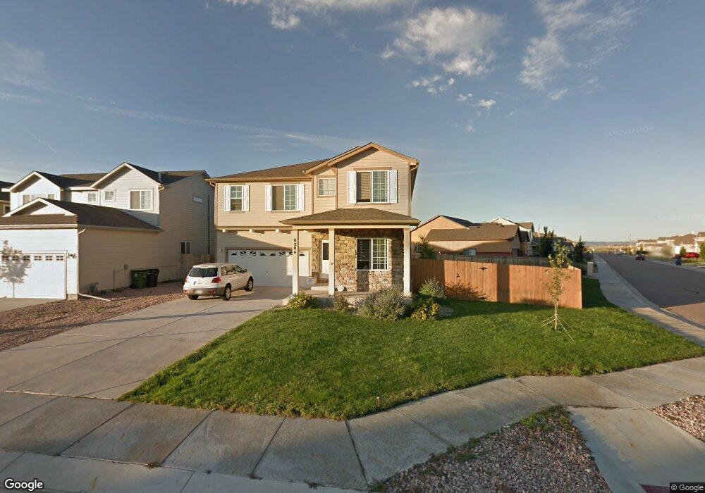
6204 Laurel Grass Range Trail Colorado Springs, CO 80925
Widefield NeighborhoodEstimated Value: $474,318 - $528,000
4
Beds
3
Baths
2,621
Sq Ft
$192/Sq Ft
Est. Value
About This Home
This home is located at 6204 Laurel Grass Range Trail, Colorado Springs, CO 80925 and is currently estimated at $502,080, approximately $191 per square foot. 6204 Laurel Grass Range Trail is a home located in El Paso County with nearby schools including Grand Mountain School, Widefield High School, and Valley Christian Academy.
Ownership History
Date
Name
Owned For
Owner Type
Purchase Details
Closed on
Apr 8, 2011
Sold by
Marshall Eric J and Marshall Donna R
Bought by
Jennings Teri and Jennings Charles
Current Estimated Value
Home Financials for this Owner
Home Financials are based on the most recent Mortgage that was taken out on this home.
Original Mortgage
$214,877
Outstanding Balance
$147,899
Interest Rate
4.75%
Mortgage Type
FHA
Estimated Equity
$354,181
Purchase Details
Closed on
Jul 3, 2008
Sold by
Pannunzio Inc
Bought by
Marshall Eric J and Marshall Donna R
Home Financials for this Owner
Home Financials are based on the most recent Mortgage that was taken out on this home.
Original Mortgage
$289,511
Interest Rate
6.11%
Mortgage Type
FHA
Create a Home Valuation Report for This Property
The Home Valuation Report is an in-depth analysis detailing your home's value as well as a comparison with similar homes in the area
Home Values in the Area
Average Home Value in this Area
Purchase History
| Date | Buyer | Sale Price | Title Company |
|---|---|---|---|
| Jennings Teri | $242,750 | Chicago Title Co | |
| Marshall Eric J | $294,055 | Commonwealth Land Title Ins |
Source: Public Records
Mortgage History
| Date | Status | Borrower | Loan Amount |
|---|---|---|---|
| Open | Jennings Teri | $214,877 | |
| Previous Owner | Marshall Eric J | $289,511 |
Source: Public Records
Tax History Compared to Growth
Tax History
| Year | Tax Paid | Tax Assessment Tax Assessment Total Assessment is a certain percentage of the fair market value that is determined by local assessors to be the total taxable value of land and additions on the property. | Land | Improvement |
|---|---|---|---|---|
| 2025 | $4,784 | $34,380 | -- | -- |
| 2024 | $4,744 | $35,480 | $6,040 | $29,440 |
| 2022 | $3,378 | $24,400 | $4,810 | $19,590 |
| 2021 | $3,517 | $25,100 | $4,950 | $20,150 |
| 2020 | $3,207 | $22,650 | $4,330 | $18,320 |
| 2019 | $3,197 | $22,650 | $4,330 | $18,320 |
| 2018 | $2,712 | $18,920 | $4,360 | $14,560 |
| 2017 | $2,769 | $18,920 | $4,360 | $14,560 |
| 2016 | $2,621 | $20,250 | $4,380 | $15,870 |
| 2015 | $2,761 | $20,250 | $4,380 | $15,870 |
| 2014 | $2,606 | $19,200 | $4,290 | $14,910 |
Source: Public Records
Map
Nearby Homes
- 6225 Laurel Grass Range Trail
- 6035 White Wolf Point
- 10188 Winter Gem Grove
- 10732 Deer Meadow Cir
- 6071 Old Glory Dr
- 6231 Old Glory Dr
- 6241 Old Glory Dr
- 6441 Old Glory Dr
- 6431 Old Glory Dr
- 10868 Deer Meadow Cir
- 6282 Pilgrimage Rd
- 6210 Pilgrimage Rd
- 10208 Abrams Dr
- 10202 Abrams Dr
- 10420 Deer Meadow Cir
- 6127 Journey Dr
- 10463 Desert Bloom Way
- 6152 Water Trough Trail
- 6184 Wood Bison Trail
- 10158 Silver Stirrup Dr
- 6214 Laurel Grass Range Trail
- 6269 Roundup Butte St
- 6224 Laurel Grass Range Trail
- 6252 Roundup Butte St
- 6260 Roundup Butte St
- 6277 Roundup Butte St
- 6254 Laurel Grass Range Trail
- 6268 Roundup Butte St
- 6205 Laurel Grass Range Trail
- 6285 Roundup Butte St
- 6236 Roundup Butte St
- 6276 Roundup Butte St
- 10781 Deer Meadow Cir
- 10757 Deer Meadow Cir
- 10789 Deer Meadow Cir
- 10773 Deer Meadow Cir
- 6228 Roundup Butte St
- 10205 Deer Meadow Cir
- 10765 Deer Meadow Cir
- 6293 Roundup Butte St