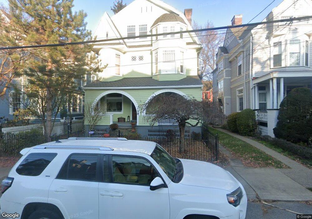
6205 Howe St Pittsburgh, PA 15206
Estimated Value: $1,194,169 - $1,337,000
5
Beds
3
Baths
4,165
Sq Ft
$311/Sq Ft
Est. Value
About This Home
This home is located at 6205 Howe St, Pittsburgh, PA 15206 and is currently estimated at $1,293,792, approximately $310 per square foot. 6205 Howe St is a home located in Allegheny County with nearby schools including Colfax K-8, Pittsburgh Allderdice High School, and Sacred Heart Elementary School.
Ownership History
Date
Name
Owned For
Owner Type
Purchase Details
Closed on
May 24, 2007
Sold by
Sussman Andrew D
Bought by
Conley Sean
Current Estimated Value
Home Financials for this Owner
Home Financials are based on the most recent Mortgage that was taken out on this home.
Original Mortgage
$345,000
Outstanding Balance
$209,509
Interest Rate
6.14%
Mortgage Type
New Conventional
Estimated Equity
$1,084,283
Purchase Details
Closed on
Aug 31, 2001
Sold by
Carr Lois Marshalek and Carr Patrick
Bought by
Sussman Andrew D and Sussman Caroline M
Create a Home Valuation Report for This Property
The Home Valuation Report is an in-depth analysis detailing your home's value as well as a comparison with similar homes in the area
Home Values in the Area
Average Home Value in this Area
Purchase History
| Date | Buyer | Sale Price | Title Company |
|---|---|---|---|
| Conley Sean | $570,000 | -- | |
| Sussman Andrew D | $300,000 | -- |
Source: Public Records
Mortgage History
| Date | Status | Borrower | Loan Amount |
|---|---|---|---|
| Open | Conley Sean | $345,000 |
Source: Public Records
Tax History Compared to Growth
Tax History
| Year | Tax Paid | Tax Assessment Tax Assessment Total Assessment is a certain percentage of the fair market value that is determined by local assessors to be the total taxable value of land and additions on the property. | Land | Improvement |
|---|---|---|---|---|
| 2025 | $12,257 | $532,000 | $200,000 | $332,000 |
| 2024 | $12,257 | $532,000 | $200,000 | $332,000 |
| 2023 | $12,257 | $532,000 | $200,000 | $332,000 |
| 2022 | $12,098 | $532,000 | $200,000 | $332,000 |
| 2021 | $12,134 | $532,000 | $200,000 | $332,000 |
| 2020 | $12,039 | $532,000 | $200,000 | $332,000 |
| 2019 | $12,039 | $532,000 | $200,000 | $332,000 |
| 2018 | $9,563 | $532,000 | $200,000 | $332,000 |
| 2017 | $12,039 | $532,000 | $200,000 | $332,000 |
| 2016 | $2,516 | $532,000 | $200,000 | $332,000 |
| 2015 | $2,516 | $532,000 | $200,000 | $332,000 |
| 2014 | $11,773 | $532,000 | $200,000 | $332,000 |
Source: Public Records
Map
Nearby Homes
- 465 Emerson St
- 418 Emerson St
- 6014 Walnut St
- 6214 Kentucky Ave
- 6109 Fifth Ave Unit 2
- 372 S Highland Ave Unit 103
- 140 N Woodland Rd
- 420 Denniston Ave
- 138 N Woodland Rd
- 5935 Fifth Ave
- 116 N Woodland Rd
- 6324 Marchand St
- 332 Hailman St
- 347 Spahr St
- 5825 Fifth Ave Unit A1
- 5825 Fifth Ave Unit 109
- 5903 5th Ave Unit 105
- 675 College St Unit A
- 90 E Woodland Rd
- 100 Denniston Ave Unit 101