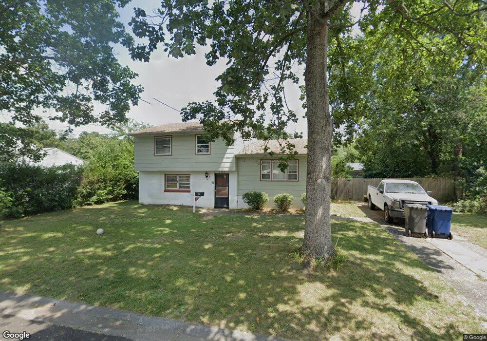
6206 Quinn Ave Mays Landing, NJ 08330
Estimated Value: $286,840 - $311,000
4
Beds
2
Baths
1,340
Sq Ft
$220/Sq Ft
Est. Value
About This Home
This home is located at 6206 Quinn Ave, Mays Landing, NJ 08330 and is currently estimated at $294,710, approximately $219 per square foot. 6206 Quinn Ave is a home located in Atlantic County with nearby schools including Joseph Shaner School, George L. Hess Educational Complex, and William Davies Middle School.
Ownership History
Date
Name
Owned For
Owner Type
Purchase Details
Closed on
Jul 27, 2017
Sold by
Scheibien Vickie
Bought by
Brown William
Current Estimated Value
Home Financials for this Owner
Home Financials are based on the most recent Mortgage that was taken out on this home.
Original Mortgage
$16,000
Outstanding Balance
$13,322
Interest Rate
3.88%
Mortgage Type
Stand Alone Second
Estimated Equity
$281,388
Purchase Details
Closed on
Mar 7, 2001
Sold by
Sondhi Anoop and Sondhi Parveen
Bought by
Scheibein Vickie
Purchase Details
Closed on
Oct 8, 1997
Sold by
Vanscoy Gail A and Buchmann William A
Bought by
Sondhi Anoop
Home Financials for this Owner
Home Financials are based on the most recent Mortgage that was taken out on this home.
Original Mortgage
$76,000
Interest Rate
7.52%
Create a Home Valuation Report for This Property
The Home Valuation Report is an in-depth analysis detailing your home's value as well as a comparison with similar homes in the area
Home Values in the Area
Average Home Value in this Area
Purchase History
| Date | Buyer | Sale Price | Title Company |
|---|---|---|---|
| Brown William | $140,000 | None Available | |
| Scheibein Vickie | $93,000 | Fidelity National Title Ins | |
| Sondhi Anoop | $8,000 | -- |
Source: Public Records
Mortgage History
| Date | Status | Borrower | Loan Amount |
|---|---|---|---|
| Open | Brown William | $16,000 | |
| Open | Brown William | $129,222 | |
| Previous Owner | Sondhi Anoop | $76,000 |
Source: Public Records
Tax History Compared to Growth
Tax History
| Year | Tax Paid | Tax Assessment Tax Assessment Total Assessment is a certain percentage of the fair market value that is determined by local assessors to be the total taxable value of land and additions on the property. | Land | Improvement |
|---|---|---|---|---|
| 2025 | $4,608 | $134,300 | $39,000 | $95,300 |
| 2024 | $4,608 | $134,300 | $39,000 | $95,300 |
| 2023 | $4,333 | $134,300 | $39,000 | $95,300 |
| 2022 | $4,333 | $134,300 | $39,000 | $95,300 |
| 2021 | $4,323 | $134,300 | $39,000 | $95,300 |
| 2020 | $4,323 | $134,300 | $39,000 | $95,300 |
| 2019 | $4,334 | $134,300 | $39,000 | $95,300 |
| 2018 | $4,182 | $134,300 | $39,000 | $95,300 |
| 2017 | $4,116 | $134,300 | $39,000 | $95,300 |
| 2016 | $4,001 | $134,300 | $39,000 | $95,300 |
| 2015 | $3,865 | $134,300 | $39,000 | $95,300 |
| 2014 | $4,169 | $158,700 | $47,000 | $111,700 |
Source: Public Records
Map
Nearby Homes
- 6206 Roberts Ave
- 6301 Roberts Ave
- 0 Harding Hwy Unit NJAC2019438
- 0 Harding Hwy Unit 597638
- 6314 Lance Ave
- 6301 Knight Ave
- 6310 Phillips Ave
- 6140 Robin Dr
- 37 Delancy Ct
- 80 Mill St
- 5 Camac Ave
- 6062 Main St
- 565 Park Rd
- 535 Park Rd
- 6015 Main St
- 715 Park Rd
- 850 Morningside Dr
- 526 Bainbridge Ave
- 955 McGeary Place
- 0 3rd St
- 6204 Quinn Ave
- 6208 Quinn Ave
- 6207 Roberts Ave
- 6209 Roberts Ave
- 6205 Roberts Ave
- 6211 Roberts Ave
- 6205 Quinn Ave
- 6207 Quinn Ave
- 6203 Quinn Ave
- 6203 Roberts Ave
- 6202 Quinn Ave
- 6209 Quinn Ave
- 6201 Roberts Ave
- 6201 Quinn Ave
- 6212 Quinn Ave
- 6208 Roberts Ave
- 6206 Palmer Ave
- 6210 Roberts Ave
- 6215 Roberts Ave
- 6208 Palmer Ave