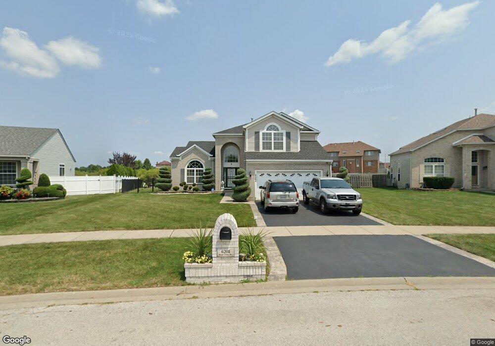
6208 Pond View Dr Matteson, IL 60443
West Matteson NeighborhoodEstimated Value: $361,000 - $391,000
4
Beds
3
Baths
2,468
Sq Ft
$152/Sq Ft
Est. Value
About This Home
This home is located at 6208 Pond View Dr, Matteson, IL 60443 and is currently estimated at $374,099, approximately $151 per square foot. 6208 Pond View Dr is a home located in Cook County with nearby schools including Colin Powell Middle School.
Ownership History
Date
Name
Owned For
Owner Type
Purchase Details
Closed on
Jun 13, 2007
Sold by
Lasalle Bank Na
Bought by
Bonds Robert and Bonds Lavetta
Current Estimated Value
Home Financials for this Owner
Home Financials are based on the most recent Mortgage that was taken out on this home.
Original Mortgage
$237,500
Outstanding Balance
$145,946
Interest Rate
6.54%
Mortgage Type
Unknown
Estimated Equity
$228,153
Purchase Details
Closed on
Oct 31, 2006
Sold by
Andrews Lawrence A
Bought by
Lasalle Bank Na
Purchase Details
Closed on
Oct 28, 2004
Sold by
Montalbano Builders Inc
Bought by
Neal Andrews Katina Y
Home Financials for this Owner
Home Financials are based on the most recent Mortgage that was taken out on this home.
Original Mortgage
$272,470
Interest Rate
5.8%
Mortgage Type
Unknown
Create a Home Valuation Report for This Property
The Home Valuation Report is an in-depth analysis detailing your home's value as well as a comparison with similar homes in the area
Home Values in the Area
Average Home Value in this Area
Purchase History
| Date | Buyer | Sale Price | Title Company |
|---|---|---|---|
| Bonds Robert | $250,000 | Fatic | |
| Lasalle Bank Na | -- | None Available | |
| Neal Andrews Katina Y | $272,500 | Cti |
Source: Public Records
Mortgage History
| Date | Status | Borrower | Loan Amount |
|---|---|---|---|
| Open | Bonds Robert | $237,500 | |
| Previous Owner | Neal Andrews Katina Y | $272,470 |
Source: Public Records
Tax History
| Year | Tax Paid | Tax Assessment Tax Assessment Total Assessment is a certain percentage of the fair market value that is determined by local assessors to be the total taxable value of land and additions on the property. | Land | Improvement |
|---|---|---|---|---|
| 2025 | $11,345 | $34,000 | $5,473 | $28,527 |
| 2024 | $11,345 | $34,000 | $5,473 | $28,527 |
| 2023 | $6,165 | $34,000 | $5,473 | $28,527 |
| 2022 | $6,165 | $20,292 | $4,727 | $15,565 |
| 2021 | $6,059 | $20,291 | $4,726 | $15,565 |
| 2020 | $5,454 | $20,291 | $4,726 | $15,565 |
| 2019 | $5,933 | $18,403 | $4,229 | $14,174 |
| 2018 | $7,689 | $18,403 | $4,229 | $14,174 |
| 2017 | $9,453 | $22,107 | $4,229 | $17,878 |
| 2016 | $7,579 | $17,856 | $3,731 | $14,125 |
| 2015 | $7,360 | $17,856 | $3,731 | $14,125 |
| 2014 | $6,288 | $17,856 | $3,731 | $14,125 |
| 2013 | $8,437 | $21,721 | $3,731 | $17,990 |
Source: Public Records
Map
Nearby Homes
- 6216 Pond View Dr
- 21131 Vivienne Dr
- 6158 White Birch Ln
- 6125 Sunflower Dr
- 21156 Christina Dr
- 21143 Gray Hawk Dr Unit 2554
- 21206 Sophia Dr
- 6037 Spring Ln
- 21218 Shannon Ave
- 6021 Spring Ln
- 1010 Regent Dr
- 970 Regent Dr
- 6306 Beaver Dam Rd
- 6503 Blue Sky Ln Unit 2502
- 997 Regent Dr
- 6500 Pasture Side Trail
- 0 Ridgeland Ave
- 912 Princeton Ave
- 829 Princeton Ave
- 443 Danielle Rd
- 6204 Pond View Dr
- 6212 Pond View Dr
- 6200 Pond View Dr
- 908 Donnington Dr
- 6207 Pond View Dr
- 904 Donnington Dr
- 912 Donnington Dr
- 900 Donnington Dr
- 6215 Pond View Dr
- 916 Donnington Dr
- 6220 Pond View Dr
- 910 Great Plains Ave
- 905 Eagle Point Dr
- 6223 Pond View Dr
- 913 Great Plains Ave
- 6224 Pond View Dr
- 909 Eagle Point Dr
- 909 Donnington Dr
- 909 Donnington Dr
- 905 Donnington Dr
Your Personal Tour Guide
Ask me questions while you tour the home.