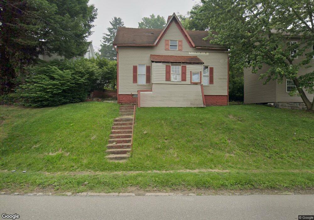
621 Bond Ave Barnesville, OH 43713
Estimated Value: $90,864 - $170,000
Studio
1
Bath
1,184
Sq Ft
$96/Sq Ft
Est. Value
About This Home
This home is located at 621 Bond Ave, Barnesville, OH 43713 and is currently estimated at $113,966, approximately $96 per square foot. 621 Bond Ave is a home located in Belmont County with nearby schools including Barnesville Elementary School, Barnesville Middle School, and Barnesville High School.
Ownership History
Date
Name
Owned For
Owner Type
Purchase Details
Closed on
May 15, 2013
Sold by
Milhoan Carolyn
Bought by
Dlesk Charles E
Current Estimated Value
Home Financials for this Owner
Home Financials are based on the most recent Mortgage that was taken out on this home.
Original Mortgage
$13,750
Outstanding Balance
$9,569
Interest Rate
3.39%
Mortgage Type
Seller Take Back
Estimated Equity
$104,397
Purchase Details
Closed on
Nov 8, 2002
Sold by
Milhoan Carolyn
Bought by
Milhoan Carolyn
Purchase Details
Closed on
Sep 10, 2001
Sold by
Dlesk Dennis J
Bought by
Dlesk Dennis J
Purchase Details
Closed on
Jan 1, 1986
Sold by
Bohandy Homer
Bought by
Bohandy Homer
Create a Home Valuation Report for This Property
The Home Valuation Report is an in-depth analysis detailing your home's value as well as a comparison with similar homes in the area
Home Values in the Area
Average Home Value in this Area
Purchase History
| Date | Buyer | Sale Price | Title Company |
|---|---|---|---|
| Dlesk Charles E | -- | Attorney | |
| Milhoan Carolyn | $17,000 | -- | |
| Dlesk Dennis J | $9,000 | -- | |
| Bohandy Homer | -- | -- |
Source: Public Records
Mortgage History
| Date | Status | Borrower | Loan Amount |
|---|---|---|---|
| Open | Dlesk Charles E | $13,750 |
Source: Public Records
Tax History
| Year | Tax Paid | Tax Assessment Tax Assessment Total Assessment is a certain percentage of the fair market value that is determined by local assessors to be the total taxable value of land and additions on the property. | Land | Improvement |
|---|---|---|---|---|
| 2025 | $585 | $17,370 | $3,000 | $14,370 |
| 2024 | $577 | $17,370 | $3,000 | $14,370 |
| 2023 | $680 | $19,660 | $2,500 | $17,160 |
| 2022 | $680 | $19,653 | $2,496 | $17,157 |
| 2021 | $682 | $19,653 | $2,496 | $17,157 |
| 2020 | $594 | $16,380 | $2,080 | $14,300 |
| 2019 | $612 | $16,380 | $2,080 | $14,300 |
| 2018 | $594 | $16,380 | $2,080 | $14,300 |
| 2017 | $718 | $19,400 | $3,300 | $16,100 |
| 2016 | $675 | $19,400 | $3,300 | $16,100 |
| 2015 | $707 | $19,400 | $3,300 | $16,100 |
| 2014 | $659 | $18,780 | $3,000 | $15,780 |
| 2013 | $675 | $18,780 | $3,000 | $15,780 |
Source: Public Records
Map
Nearby Homes
- 202 Walton Ave
- 617 Park St
- 618 Park St
- 136 E Walnut St
- 152 E Main St
- 62239 Hillcrest Rd
- 613 E Main St
- TBD W Main St
- 329 S Chestnut St
- 105 Bethesda St
- 118 Pine Ln
- 0 County Road 114
- 61900 Fairview Rd
- 164 Pine Ln
- 0 Fairmont Ave Unit 5163774
- 0 Fairmont Ave Unit 5163784
- Lot 1 Cattle Dr
- 0 Nevada Rd
- 57128 Somerton Hwy
- 471 Fair Ave
- 623 Bond Ave
- 627 Bond Ave
- 617 Bond Ave
- 622 Bond Ave
- 624 Bond Ave
- 626 Bond Ave
- 711 Bond Ave
- 117 Greenmount Ave
- 611 Bond Ave
- 611 & 613 Bond Ave
- 715 Bond Ave
- 640 Bond Ave
- 717 N Chestnut St
- 618 N Chestnut St
- 127 Greenmount Ave
- 719 Bond Ave
- 708 N Chestnut St
- 718 N Chestnut St
- 700 Bond Ave
- 721 N Chestnut St
Your Personal Tour Guide
Ask me questions while you tour the home.