Estimated Value: $342,000 - $449,000
1
Bed
1
Bath
772
Sq Ft
$478/Sq Ft
Est. Value
About This Home
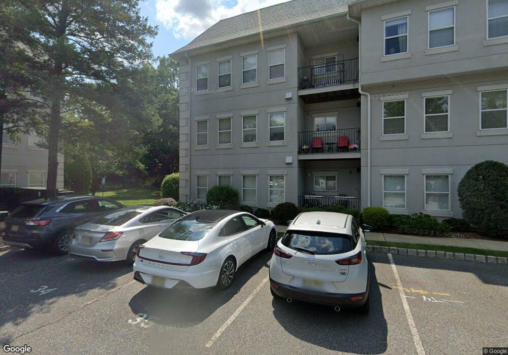
This home is located at 621 Brittany Dr, Wayne, NJ 07470 and is currently estimated at $368,751, approximately $477 per square foot. 621 Brittany Dr is a home located in Passaic County with nearby schools including Albert P. Terhune Elementary School, Schuyler-Colfax Middle School, and Wayne Hills High School.
Ownership History
Date
Name
Owned For
Owner Type
Purchase Details
Closed on
May 1, 2023
Sold by
Cavill Joann M
Bought by
Cummings William
Current Estimated Value
Purchase Details
Closed on
Nov 6, 2014
Sold by
Cavill Keith and Sanagorski Lisa
Bought by
Cavill Joann M
Home Financials for this Owner
Home Financials are based on the most recent Mortgage that was taken out on this home.
Original Mortgage
$85,000
Interest Rate
4.17%
Mortgage Type
New Conventional
Purchase Details
Closed on
Jul 31, 2006
Sold by
Admir Lorraine Mucci
Bought by
Sanagorski Lisa
Home Financials for this Owner
Home Financials are based on the most recent Mortgage that was taken out on this home.
Original Mortgage
$232,000
Interest Rate
7.87%
Mortgage Type
Adjustable Rate Mortgage/ARM
Create a Home Valuation Report for This Property
The Home Valuation Report is an in-depth analysis detailing your home's value as well as a comparison with similar homes in the area
Home Values in the Area
Average Home Value in this Area
Purchase History
| Date | Buyer | Sale Price | Title Company |
|---|---|---|---|
| Cummings William | $230,000 | None Listed On Document | |
| Cummings William | $230,000 | None Listed On Document | |
| Cavill Joann M | $113,400 | Agent For Westcor Land Title | |
| Sanagorski Lisa | -- | -- |
Source: Public Records
Mortgage History
| Date | Status | Borrower | Loan Amount |
|---|---|---|---|
| Previous Owner | Cavill Joann M | $85,000 | |
| Previous Owner | Sanagorski Lisa | $232,000 |
Source: Public Records
Tax History Compared to Growth
Tax History
| Year | Tax Paid | Tax Assessment Tax Assessment Total Assessment is a certain percentage of the fair market value that is determined by local assessors to be the total taxable value of land and additions on the property. | Land | Improvement |
|---|---|---|---|---|
| 2025 | $5,928 | $99,700 | $45,700 | $54,000 |
| 2024 | $5,701 | $99,700 | $45,700 | $54,000 |
| 2022 | $5,637 | $99,700 | $45,700 | $54,000 |
| 2021 | $5,631 | $99,700 | $45,700 | $54,000 |
| 2020 | $5,606 | $99,700 | $45,700 | $54,000 |
| 2019 | $5,497 | $99,700 | $45,700 | $54,000 |
| 2018 | $5,449 | $99,700 | $45,700 | $54,000 |
| 2017 | $5,399 | $99,700 | $45,700 | $54,000 |
| 2016 | $5,323 | $99,700 | $45,700 | $54,000 |
| 2015 | $5,259 | $99,700 | $45,700 | $54,000 |
| 2014 | $5,111 | $99,700 | $45,700 | $54,000 |
Source: Public Records
Map
Nearby Homes
- 710 Brittany Dr Unit 10
- 1002 Brittany Dr Unit 1002
- 8619 Brittany Dr
- 8710 Brittany Dr
- 1017 Brittany Dr
- 8312 Brittany Dr
- 3 Brandywine Rd
- 9 Gates Place
- 89 Pancake Hollow Dr
- 1360 Hamburg Turnpike Unit 708
- 1553 Alps Rd
- 267 Church Ln
- 25 Sunrise Dr
- 27 Grandview Dr
- 106 Pancake Hollow Dr
- 200 Levinberg Ln
- 85 Mountain Ridge Dr
- 33 Gates Place
- 285 Levinberg Ln
- 622 Brittany Dr
- 623 Brittany Dr
- 617 Brittany Dr
- 618 Brittany Dr
- 619 Brittany Dr
- 624 Brittany Dr Unit 624
- 620 Brittany Dr Unit C0620
- 701 Brittany Dr
- 613 Brittany Dr
- 614 Brittany Dr
- 702 Brittany Dr
- 615 Brittany Dr
- 616 Brittany Dr
- 703 Brittany Dr
- 706 Brittany Dr Unit C0706
- 609 Brittany Dr
- 610 Brittany Dr
- 704 Brittany Dr
- 707 Brittany Dr
- 709 Brittany Dr