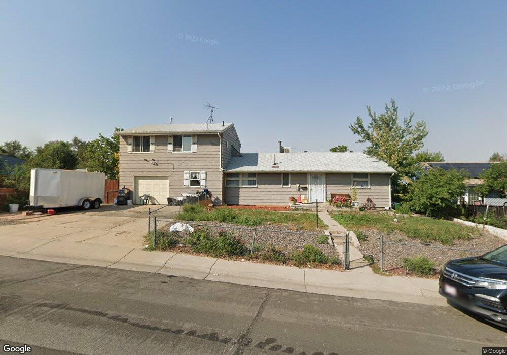
621 Bronco Rd Denver, CO 80221
Sherrelwood NeighborhoodEstimated Value: $387,901 - $499,000
5
Beds
2
Baths
1,707
Sq Ft
$258/Sq Ft
Est. Value
About This Home
This home is located at 621 Bronco Rd, Denver, CO 80221 and is currently estimated at $440,975, approximately $258 per square foot. 621 Bronco Rd is a home located in Adams County with nearby schools including Trailside Academy, The Pinnacle Charter School Elementary, and The Pinnacle Charter School Middle.
Ownership History
Date
Name
Owned For
Owner Type
Purchase Details
Closed on
Mar 19, 2015
Sold by
Medina Angelica
Bought by
Herrera Valdez Luis M and Medina Angelica
Current Estimated Value
Purchase Details
Closed on
Feb 24, 2014
Sold by
Herrera Valdez Luis M
Bought by
Medina Angelica
Purchase Details
Closed on
Oct 6, 2010
Sold by
Medina Angelica
Bought by
Medina Angelica and Valdez Luis Martin Herrera
Purchase Details
Closed on
Feb 4, 2010
Sold by
Bank Of America Na
Bought by
Medina Angelica
Purchase Details
Closed on
Sep 14, 2009
Sold by
Mefford Elery H
Bought by
Bank Of America Na
Create a Home Valuation Report for This Property
The Home Valuation Report is an in-depth analysis detailing your home's value as well as a comparison with similar homes in the area
Home Values in the Area
Average Home Value in this Area
Purchase History
| Date | Buyer | Sale Price | Title Company |
|---|---|---|---|
| Herrera Valdez Luis M | -- | None Available | |
| Medina Angelica | -- | None Available | |
| Medina Angelica | -- | None Available | |
| Medina Angelica | $73,000 | Assured Title | |
| Bank Of America Na | -- | None Available |
Source: Public Records
Tax History Compared to Growth
Tax History
| Year | Tax Paid | Tax Assessment Tax Assessment Total Assessment is a certain percentage of the fair market value that is determined by local assessors to be the total taxable value of land and additions on the property. | Land | Improvement |
|---|---|---|---|---|
| 2024 | $2,573 | $24,570 | $4,940 | $19,630 |
| 2023 | $2,568 | $28,410 | $5,070 | $23,340 |
| 2022 | $2,357 | $22,020 | $4,870 | $17,150 |
| 2021 | $2,217 | $22,020 | $4,870 | $17,150 |
| 2020 | $2,142 | $21,520 | $5,010 | $16,510 |
| 2019 | $2,151 | $21,520 | $5,010 | $16,510 |
| 2018 | $1,903 | $17,980 | $5,400 | $12,580 |
| 2017 | $1,869 | $17,980 | $5,400 | $12,580 |
| 2016 | $1,075 | $10,140 | $2,390 | $7,750 |
| 2015 | $949 | $10,140 | $2,390 | $7,750 |
| 2014 | $1,061 | $11,000 | $1,990 | $9,010 |
Source: Public Records
Map
Nearby Homes
- 600 Bronco Rd
- 941 Bronco Rd
- 7081 Fox St
- 7172 Kalamath St
- 481 Cragmore St
- 480 W 70th Place
- 7371 Bronco Rd
- 920 Delta St
- 1195 W 70th Ave
- 921 Dakin St
- 1161 Dakin St
- 7600 Acoma Ct
- 700 Elbert St
- 6905 Mariposa St Unit B
- 7715 Durango St
- 521 W 78th Place
- 7488 Quivas St
- 7815 Conifer Rd
- 7663 Navajo St
- 7800 Greenwood Blvd
- 601 Bronco Rd
- 640 Bountiful Ct
- 620 Bountiful Ct
- 660 Bountiful Ct
- 600 Bountiful Ct
- 581 Bronco Rd
- 580 Bountiful Ct
- 640 Bronco Rd
- 580 Bronco Rd
- 660 Bronco Rd
- 560 Bountiful Ct
- 561 Bronco Rd
- 560 Bronco Rd
- 680 Bronco Rd
- 721 Bronco Rd
- 541 Bronco Rd
- 540 Bountiful Ct
- 691 Bountiful Ct
- 661 Bountiful Ct
- 641 Bountiful Ct