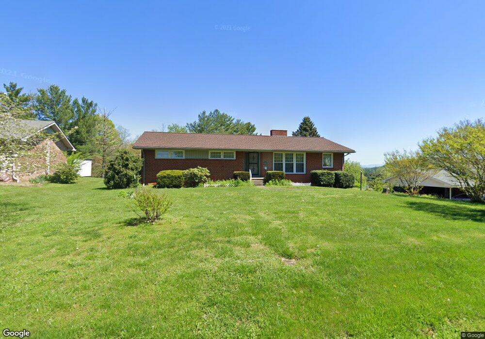
621 Hollis St Kingsport, TN 37660
Estimated Value: $218,678 - $280,000
--
Bed
2
Baths
1,701
Sq Ft
$147/Sq Ft
Est. Value
About This Home
This home is located at 621 Hollis St, Kingsport, TN 37660 and is currently estimated at $250,420, approximately $147 per square foot. 621 Hollis St is a home located in Sullivan County with nearby schools including George Washington Elementary School, John Sevier Middle School, and Ross N. Robinson Middle School.
Ownership History
Date
Name
Owned For
Owner Type
Purchase Details
Closed on
May 3, 2020
Sold by
Pairgin Sandra K and Meade Randy K
Bought by
Meade Benjamin D and Meade Brynna
Current Estimated Value
Home Financials for this Owner
Home Financials are based on the most recent Mortgage that was taken out on this home.
Original Mortgage
$129,200
Outstanding Balance
$115,126
Interest Rate
3.6%
Mortgage Type
New Conventional
Estimated Equity
$135,294
Purchase Details
Closed on
Feb 12, 2019
Sold by
Meade Jeffery W and Skelton Verna Ruth
Bought by
Pairgin Sandra K and Meade Randy B
Create a Home Valuation Report for This Property
The Home Valuation Report is an in-depth analysis detailing your home's value as well as a comparison with similar homes in the area
Home Values in the Area
Average Home Value in this Area
Purchase History
| Date | Buyer | Sale Price | Title Company |
|---|---|---|---|
| Meade Benjamin D | $130,000 | Ecu Title And Escrow | |
| Pairgin Sandra K | -- | Heritage Title & Closing Svc |
Source: Public Records
Mortgage History
| Date | Status | Borrower | Loan Amount |
|---|---|---|---|
| Open | Meade Benjamin D | $129,200 |
Source: Public Records
Tax History Compared to Growth
Tax History
| Year | Tax Paid | Tax Assessment Tax Assessment Total Assessment is a certain percentage of the fair market value that is determined by local assessors to be the total taxable value of land and additions on the property. | Land | Improvement |
|---|---|---|---|---|
| 2024 | -- | $33,100 | $2,150 | $30,950 |
| 2023 | $1,457 | $33,100 | $2,150 | $30,950 |
| 2022 | $1,457 | $33,100 | $2,150 | $30,950 |
| 2021 | $1,418 | $33,100 | $2,150 | $30,950 |
| 2020 | $800 | $33,100 | $2,150 | $30,950 |
| 2019 | $1,443 | $31,125 | $2,150 | $28,975 |
| 2018 | $1,409 | $31,125 | $2,150 | $28,975 |
| 2017 | $1,409 | $31,125 | $2,150 | $28,975 |
| 2016 | $1,410 | $30,350 | $2,150 | $28,200 |
| 2014 | $1,328 | $30,362 | $0 | $0 |
Source: Public Records
Map
Nearby Homes
- 606 Hollis St
- 905 Afton St
- 2001 Sand St
- 1950 W Stone Dr
- 2228 Hall St
- 1929 Greenway St
- 2137 Hiara Dr
- 2324 Louita Ave
- 252 River Edge Dr
- 200 River Edge Dr
- 0 Granby Rd Unit 9960138
- 1461 Gress Mag Mountain
- 2424 Rivermont Dr
- 305 Pleasley Rd
- 2046 Lowell Dr
- 1244 Stamp Lodge Rd
- 1824&1828 Netherland Inn Rd
- 1237 Stamp Lodge Rd
- 1249 Stamp Lodge Rd
- 375 Sky S
- 617 Hollis St
- 625 Hollis St
- 2112 Alamo Place
- 2108 Alamo Place
- 613 Hollis St
- 623 Hollis St
- 614 Hollis St
- 618 Hollis St
- 2109 Azalea Place
- 2109 Alamo Place
- 609 Hollis St
- 622 Hollis St
- 2104 Alamo Place
- 2112 Azalea Place
- 2105 Azalea Place
- 2105 Alamo Place
- 626 Hollis St
- 637 Hollis St
- 2100 Alamo Place
- 608 Afton St