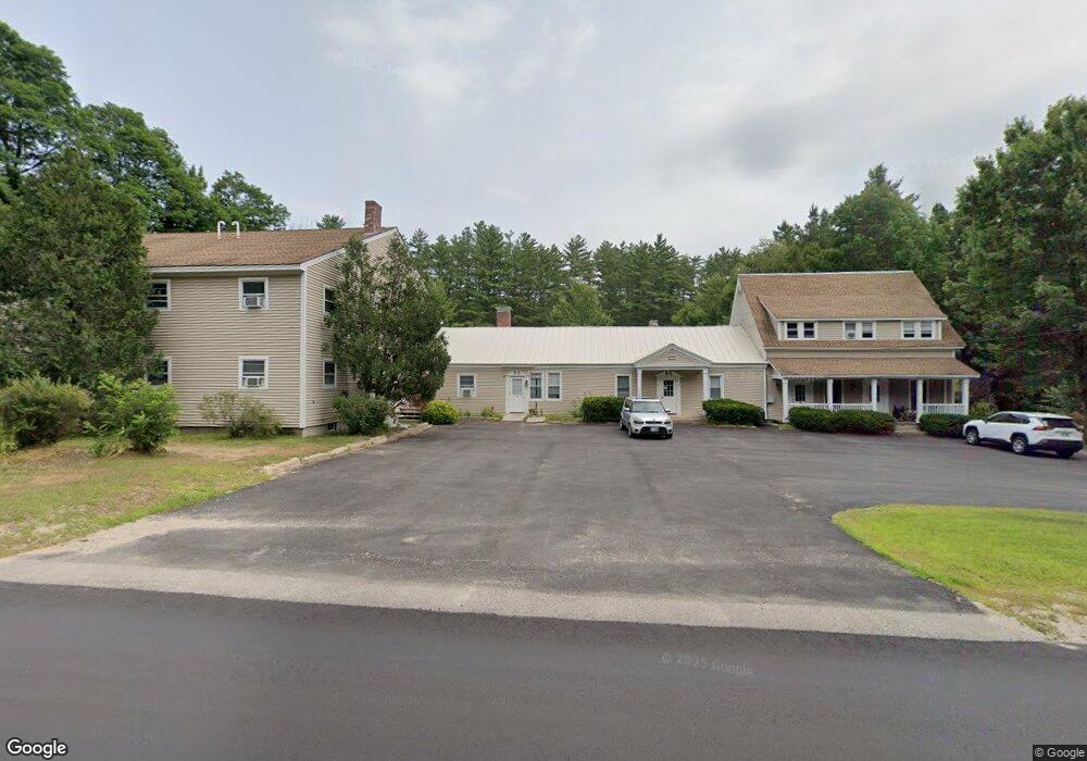
621 Kearsarge Rd Conway, NH 03860
Estimated Value: $1,568,387
--
Bed
--
Bath
9,248
Sq Ft
$170/Sq Ft
Est. Value
About This Home
This home is located at 621 Kearsarge Rd, Conway, NH 03860 and is currently estimated at $1,568,387, approximately $169 per square foot. 621 Kearsarge Rd is a home located in Carroll County with nearby schools including A. Crosby Kennett Middle School, Kennett High School, and The Lilliputian School.
Ownership History
Date
Name
Owned For
Owner Type
Purchase Details
Closed on
Feb 24, 2003
Sold by
Mbjk Lp
Bought by
T & J Arms Llc
Current Estimated Value
Home Financials for this Owner
Home Financials are based on the most recent Mortgage that was taken out on this home.
Original Mortgage
$504,000
Outstanding Balance
$218,250
Interest Rate
5.98%
Mortgage Type
Commercial
Estimated Equity
$1,350,137
Create a Home Valuation Report for This Property
The Home Valuation Report is an in-depth analysis detailing your home's value as well as a comparison with similar homes in the area
Home Values in the Area
Average Home Value in this Area
Purchase History
| Date | Buyer | Sale Price | Title Company |
|---|---|---|---|
| T & J Arms Llc | $504,000 | -- | |
| T & J Arms Llc | $504,000 | -- |
Source: Public Records
Mortgage History
| Date | Status | Borrower | Loan Amount |
|---|---|---|---|
| Open | T & J Arms Llc | $504,000 | |
| Closed | T & J Arms Llc | $504,000 |
Source: Public Records
Tax History Compared to Growth
Tax History
| Year | Tax Paid | Tax Assessment Tax Assessment Total Assessment is a certain percentage of the fair market value that is determined by local assessors to be the total taxable value of land and additions on the property. | Land | Improvement |
|---|---|---|---|---|
| 2024 | $8,204 | $715,300 | $174,500 | $540,800 |
| 2023 | $8,355 | $715,300 | $174,500 | $540,800 |
| 2022 | $11,092 | $565,900 | $138,500 | $427,400 |
| 2021 | $9,247 | $565,900 | $138,500 | $427,400 |
| 2020 | $7,043 | $417,000 | $138,500 | $278,500 |
| 2019 | $7,222 | $417,000 | $138,500 | $278,500 |
| 2018 | $8,804 | $387,000 | $108,500 | $278,500 |
| 2017 | $7,732 | $387,000 | $108,500 | $278,500 |
| 2016 | $7,473 | $387,000 | $108,500 | $278,500 |
| 2015 | $7,388 | $387,000 | $108,500 | $278,500 |
| 2014 | $7,299 | $387,000 | $108,500 | $278,500 |
| 2013 | $6,919 | $387,400 | $108,500 | $278,900 |
Source: Public Records
Map
Nearby Homes
- 679 Kearsarge Rd
- 72 Cranmore Woods Ln Unit 2
- 72 Cranmore Woods Ln Unit 4
- 50 Drachenfels Rd
- 168 Old Bartlett Rd Unit A
- 243 Skimobile Rd Unit 352
- 243 Skimobile Rd Unit 252
- 243 Skimobile Rd Unit 355
- 243 Skimobile Rd Unit 255
- 235 Skimobile Rd Unit 1404
- 239 Skimobile Rd Unit 314
- 239 Skimobile Rd Unit 305
- 239 Skimobile Rd Unit 304
- 970 Kearsarge Rd
- 137 Skimobile Rd Unit 3
- 15 Black Diamond Rd Unit 4
- 11 Black Diamond Rd Unit 3
- 7 Black Diamond Rd Unit 2
- 45 Wildflower Trail Unit 9
- 2955 White Mountain Hwy Unit 106 (W5)
- 609 Kearsarge Rd
- 00 Kearsarge Rd
- 0 Kearsarge Rd
- 0 Kearsarge Rd Unit 4044681
- 639 Kearsarge Rd
- 13 Dixey Ct
- 26 Dixey Ct
- 26 Dixey Ct
- 10 Dixey Ct
- 642 Kearsarge Rd
- 645 Kearsarge Rd
- 648 Kearsarge Rd
- 13 Dixey Ct
- 655 Kearsarge Rd Unit 1
- 655 Kearsarge Rd
- 44 Dixey Ct
- 592 Kearsarge Rd
- 620 Kearsarge Rd
- 340 Old Bartlett Rd
- 555 Kearsarge Rd