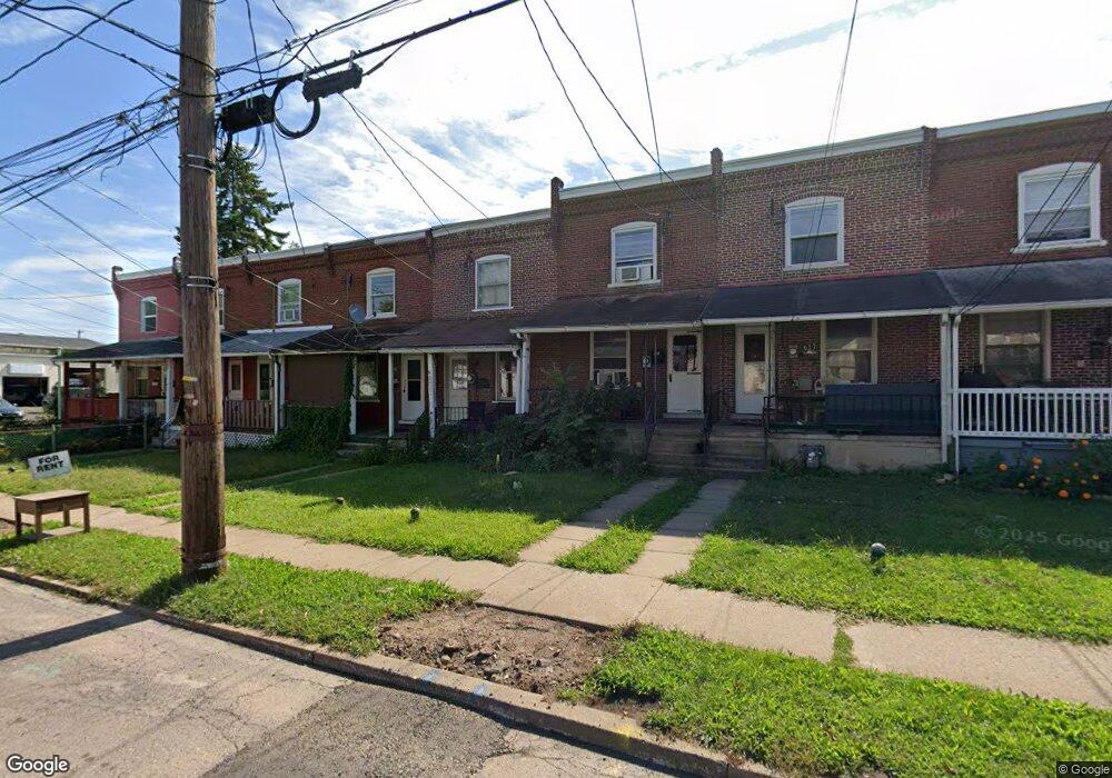
621 N Cannon Ave Lansdale, PA 19446
Estimated Value: $213,000 - $241,429
3
Beds
1
Bath
936
Sq Ft
$247/Sq Ft
Est. Value
About This Home
This home is located at 621 N Cannon Ave, Lansdale, PA 19446 and is currently estimated at $231,107, approximately $246 per square foot. 621 N Cannon Ave is a home located in Montgomery County with nearby schools including Knapp Elementary School, Penndale Middle School, and North Penn Senior High School.
Ownership History
Date
Name
Owned For
Owner Type
Purchase Details
Closed on
Jan 14, 2020
Sold by
Laird David E
Bought by
Laird David E
Current Estimated Value
Purchase Details
Closed on
Apr 23, 2009
Sold by
Clark Ashleigh and Clark Jordan C
Bought by
Laird David E and Laird Laberta E
Home Financials for this Owner
Home Financials are based on the most recent Mortgage that was taken out on this home.
Original Mortgage
$105,000
Interest Rate
4.9%
Purchase Details
Closed on
Jun 8, 2007
Sold by
Schwager Benjamin R
Bought by
Clark Ashleigh and Clark Jordan C
Home Financials for this Owner
Home Financials are based on the most recent Mortgage that was taken out on this home.
Original Mortgage
$133,929
Interest Rate
6.14%
Purchase Details
Closed on
Apr 15, 2003
Sold by
Cressman Robert R
Bought by
Schwager Benjamin R
Create a Home Valuation Report for This Property
The Home Valuation Report is an in-depth analysis detailing your home's value as well as a comparison with similar homes in the area
Home Values in the Area
Average Home Value in this Area
Purchase History
| Date | Buyer | Sale Price | Title Company |
|---|---|---|---|
| Laird David E | -- | None Available | |
| Laird David E | $140,000 | None Available | |
| Clark Ashleigh | $135,000 | None Available | |
| Schwager Benjamin R | $56,000 | -- |
Source: Public Records
Mortgage History
| Date | Status | Borrower | Loan Amount |
|---|---|---|---|
| Previous Owner | Laird David E | $105,000 | |
| Previous Owner | Clark Ashleigh | $133,929 |
Source: Public Records
Tax History Compared to Growth
Tax History
| Year | Tax Paid | Tax Assessment Tax Assessment Total Assessment is a certain percentage of the fair market value that is determined by local assessors to be the total taxable value of land and additions on the property. | Land | Improvement |
|---|---|---|---|---|
| 2025 | $3,135 | $74,520 | $39,620 | $34,900 |
| 2024 | $3,135 | $74,520 | $39,620 | $34,900 |
| 2023 | $2,933 | $74,520 | $39,620 | $34,900 |
| 2022 | $2,839 | $74,520 | $39,620 | $34,900 |
| 2021 | $2,723 | $74,520 | $39,620 | $34,900 |
| 2020 | $2,641 | $74,520 | $39,620 | $34,900 |
| 2019 | $72 | $74,520 | $39,620 | $34,900 |
| 2018 | $697 | $74,520 | $39,620 | $34,900 |
| 2017 | $2,425 | $74,520 | $39,620 | $34,900 |
| 2016 | $2,396 | $74,520 | $39,620 | $34,900 |
| 2015 | $2,353 | $74,520 | $39,620 | $34,900 |
| 2014 | $2,224 | $74,520 | $39,620 | $34,900 |
Source: Public Records
Map
Nearby Homes
- 302 W 8th St Unit 21
- 816 Kenilworth Ave
- 833 W 4th St
- 129 W Fifth St
- 1025 Birch St
- 1028 Poplar St Unit 75
- 204 N Valley Forge Rd Unit 7B
- 831 W Main St
- 625 Derstine Ave
- 405 Derstine Ave
- 108 Allison Ct Unit 8
- 21 S Valley Forge Rd Unit 213
- 13 W End Dr
- 39 E 5th St
- 529 N Chestnut St
- 1035 Forest Ave
- 124 E 5th St
- 130 E 5th St
- 200 E 5th St
- 135 Third
- 619 N Cannon Ave
- 623 N Cannon Ave
- 617 N Cannon Ave
- 627 N Cannon Ave
- 615 N Cannon Ave
- 613 N Cannon Ave
- 629 N Cannon Ave
- 611 N Cannon Ave
- 607 N Cannon Ave
- 605 N Cannon Ave
- 406 Acorn St Unit 410
- 406 410 Acorn St
- 603 N Cannon Ave
- 530 W 6th St
- 601 N Cannon Ave
- 639 N Cannon Ave
- 618 N Cannon Ave
- 421 W 6th St
- 421 Acorn St
- 419 W 6th St