Estimated Value: $268,415 - $330,000
3
Beds
3
Baths
1,826
Sq Ft
$163/Sq Ft
Est. Value
About This Home
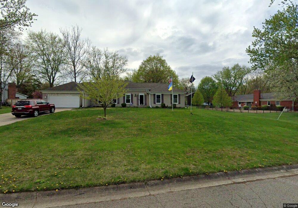
This home is located at 6210 Bedford Ave, Flint, MI 48507 and is currently estimated at $297,854, approximately $163 per square foot. 6210 Bedford Ave is a home located in Genesee County with nearby schools including Anderson Elementary School, McGrath Elementary School, and Grand Blanc West Middle School.
Ownership History
Date
Name
Owned For
Owner Type
Purchase Details
Closed on
Jan 5, 2011
Sold by
Alfaro Michael R and Alfaro Helen M
Bought by
Hill Timothy and Hill Barbara
Current Estimated Value
Purchase Details
Closed on
Apr 19, 2001
Sold by
Alfaro Michael R and Alfaro Helen M
Bought by
Alfaro Michael R and Alfaro Helen M
Home Financials for this Owner
Home Financials are based on the most recent Mortgage that was taken out on this home.
Original Mortgage
$114,000
Interest Rate
7.03%
Create a Home Valuation Report for This Property
The Home Valuation Report is an in-depth analysis detailing your home's value as well as a comparison with similar homes in the area
Home Values in the Area
Average Home Value in this Area
Purchase History
| Date | Buyer | Sale Price | Title Company |
|---|---|---|---|
| Hill Timothy | $116,500 | Sargents Title Company | |
| Alfaro Michael R | -- | Greco Title |
Source: Public Records
Mortgage History
| Date | Status | Borrower | Loan Amount |
|---|---|---|---|
| Previous Owner | Alfaro Michael R | $114,000 |
Source: Public Records
Tax History
| Year | Tax Paid | Tax Assessment Tax Assessment Total Assessment is a certain percentage of the fair market value that is determined by local assessors to be the total taxable value of land and additions on the property. | Land | Improvement |
|---|---|---|---|---|
| 2025 | $2,796 | $123,100 | $0 | $0 |
| 2024 | $1,674 | $116,600 | $0 | $0 |
| 2023 | $1,597 | $100,400 | $0 | $0 |
| 2022 | $2,467 | $92,300 | $0 | $0 |
| 2021 | $2,428 | $86,500 | $0 | $0 |
| 2020 | $1,473 | $82,800 | $0 | $0 |
| 2019 | $1,451 | $77,700 | $0 | $0 |
| 2018 | $169 | $0 | $0 | $0 |
| 2017 | $2,156 | $67,200 | $0 | $0 |
| 2016 | $2,116 | $64,400 | $0 | $0 |
| 2015 | $1,852 | $61,900 | $0 | $0 |
| 2014 | $1,266 | $56,100 | $0 | $0 |
| 2012 | -- | $51,100 | $51,100 | $0 |
Source: Public Records
Map
Nearby Homes
- 1283 Woodnoll Dr
- 1195 Alton Ave
- 1075 E Hill Rd
- 0 Taylor Dr Unit 50159493
- 1642 Wagon Wheel Ln
- 1329 Arrowwood Ln
- 1380 Sunset Blvd
- 0 Jefferson Blvd
- 0 Harding Dr Unit 20251056693
- 6557 Rustic Ridge Trail
- 1142 Leisure Dr
- 1045 Leisure Dr Unit 7
- 0000 Mckinley Blvd
- 00 Coolidge Dr
- 000 Coolidge Dr
- 0000 Coolidge Dr
- 1226 Harding Dr
- 00 Mckinley Blvd
- 000 Mckinley Blvd
- 0 E Hill Rd Unit 20261004433
- 6228 Bedford Ave
- 1205 Lawnview Ct
- 1217 Lawnview Ct
- 6209 Bedford Ave
- 6199 Bedford Ave
- 1222 Woodnoll Dr
- 6219 Bedford Ave
- 6227 Bedford Ave
- 1177 Woodview Dr
- 1225 Lawnview Ct
- 1240 Woodnoll Dr
- 6237 Bedford Ave
- 1222 Lawnview Ct
- 6247 Bedford Ave
- 1161 Woodview Dr
- 1252 Woodnoll Dr
- 1135 Woodview Dr
- 1235 Lawnview Ct
- 1069 Woodview Dr
- 1061 Woodview Dr