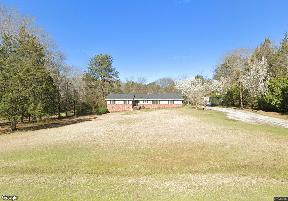
6210 Ga Highway 220 W Lincolnton, GA 30817
Estimated Value: $211,000 - $365,000
3
Beds
2
Baths
1,647
Sq Ft
$168/Sq Ft
Est. Value
About This Home
This home is located at 6210 Ga Highway 220 W, Lincolnton, GA 30817 and is currently estimated at $276,327, approximately $167 per square foot. 6210 Ga Highway 220 W is a home located in Lincoln County with nearby schools including Lincoln County Elementary School, Lincoln County Middle School, and Lincoln County High School.
Ownership History
Date
Name
Owned For
Owner Type
Purchase Details
Closed on
Apr 12, 1990
Sold by
Henderson William L
Bought by
Elam Carl
Current Estimated Value
Purchase Details
Closed on
Jan 9, 1987
Sold by
Dawkins Michael B and Dawkins Catherine G
Bought by
Henderson William L
Purchase Details
Closed on
Aug 1, 1984
Sold by
Feltz Jay W
Bought by
Dawkins Michael B and Dawkins Catherine G
Purchase Details
Closed on
Apr 1, 1982
Bought by
Feltz Jay W
Create a Home Valuation Report for This Property
The Home Valuation Report is an in-depth analysis detailing your home's value as well as a comparison with similar homes in the area
Home Values in the Area
Average Home Value in this Area
Purchase History
| Date | Buyer | Sale Price | Title Company |
|---|---|---|---|
| Elam Carl | $66,200 | -- | |
| Henderson William L | $57,500 | -- | |
| Dawkins Michael B | $51,500 | -- | |
| Feltz Jay W | $48,500 | -- |
Source: Public Records
Tax History Compared to Growth
Tax History
| Year | Tax Paid | Tax Assessment Tax Assessment Total Assessment is a certain percentage of the fair market value that is determined by local assessors to be the total taxable value of land and additions on the property. | Land | Improvement |
|---|---|---|---|---|
| 2025 | $1,808 | $65,500 | $3,800 | $61,700 |
| 2024 | $1,765 | $60,420 | $3,600 | $56,820 |
| 2023 | $1,381 | $52,512 | $2,880 | $49,632 |
| 2022 | $1,432 | $50,432 | $2,880 | $47,552 |
| 2021 | $1,428 | $45,676 | $2,480 | $43,196 |
| 2020 | $1,341 | $36,756 | $2,480 | $34,276 |
| 2019 | $1,345 | $36,756 | $2,480 | $34,276 |
| 2018 | $1,155 | $36,756 | $2,480 | $34,276 |
| 2017 | $1,202 | $38,248 | $2,840 | $35,408 |
| 2016 | $1,313 | $38,248 | $2,840 | $35,408 |
| 2015 | -- | $38,248 | $2,840 | $35,408 |
| 2014 | -- | $38,248 | $2,840 | $35,408 |
| 2013 | -- | $38,248 | $2,840 | $35,408 |
Source: Public Records
Map
Nearby Homes
- 0 Backway Rd
- 00 Bonner Rd
- Lot 6 Lighthouse Point
- 0 Hwy 220 Unit 538782
- Lot 14 Wisteria Dr
- 1960 White Rock Rd
- LOT 22 Plantation Point Rd
- 0 Maiden Cane Way Unit 10610441
- 0 Mariners Way Unit Lot 39
- 0 Mariners Way Unit Lot 41
- 0 Mariners Way Unit 10539877
- 1102 Dogwood Dr
- 0 Hwy 220 Tract B
- 9-3 Long Cove
- 1025 Plantation Ln
- 1203 Price Reese Rd
- 7-3 Long Cove
- 1791 Augusta Hwy
- 1-3 Long Cove Dr
- 6-3 Long Cove Dr
- 6236 Ga Highway 220 W
- 6217 Ga Highway 220 W
- 6241 W Ga Highway 220 W
- 6184 Ga Highway 220 W
- 6193 Ga Highway 220 W
- 6160 Ga Highway 220 W
- 6723 Georgia 220
- 6421 W Hwy 220
- 3753 Augusta Hwy
- 3849 Augusta Hwy
- 3863 Augusta Hwy
- 6114 Ga Highway 220 W
- 3883 Augusta Hwy
- 3661 Augusta Hwy
- 3889 Augusta Hwy
- 6.33 Ac Augusta Hwy
- 1066 Sullivan Rd
- 3660 Augusta Hwy
- 6049 Ga Highway 220 W
- 3919 Augusta Hwy