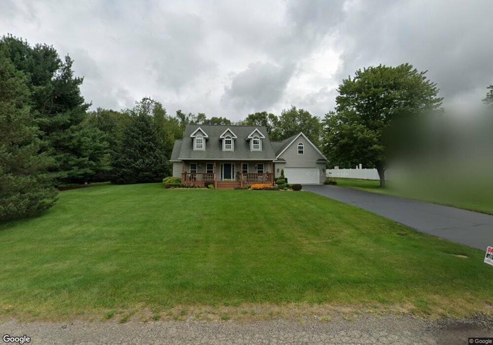
6211 Red Maple Rd Battle Creek, MI 49014
Estimated Value: $408,398 - $603,000
4
Beds
3
Baths
2,280
Sq Ft
$223/Sq Ft
Est. Value
About This Home
This home is located at 6211 Red Maple Rd, Battle Creek, MI 49014 and is currently estimated at $507,466, approximately $222 per square foot. 6211 Red Maple Rd is a home located in Calhoun County with nearby schools including Harper Creek Middle School, Harper Creek High School, and Family Altar Christian School.
Ownership History
Date
Name
Owned For
Owner Type
Purchase Details
Closed on
Sep 30, 2004
Sold by
Bellia Mark and Bellia Towania
Bought by
Pollack Dennis A and Pollack Aletha M
Current Estimated Value
Home Financials for this Owner
Home Financials are based on the most recent Mortgage that was taken out on this home.
Original Mortgage
$140,000
Outstanding Balance
$70,077
Interest Rate
5.93%
Mortgage Type
Purchase Money Mortgage
Estimated Equity
$437,389
Purchase Details
Closed on
Feb 13, 2004
Sold by
Thayer David A and Thayer Tammy
Bought by
Bellia Mark and Bellia Towania
Home Financials for this Owner
Home Financials are based on the most recent Mortgage that was taken out on this home.
Original Mortgage
$218,000
Interest Rate
4.75%
Mortgage Type
Purchase Money Mortgage
Create a Home Valuation Report for This Property
The Home Valuation Report is an in-depth analysis detailing your home's value as well as a comparison with similar homes in the area
Home Values in the Area
Average Home Value in this Area
Purchase History
| Date | Buyer | Sale Price | Title Company |
|---|---|---|---|
| Pollack Dennis A | $270,000 | Chicago Title Of Michigan | |
| Bellia Mark | $273,000 | Chicago Title |
Source: Public Records
Mortgage History
| Date | Status | Borrower | Loan Amount |
|---|---|---|---|
| Open | Pollack Dennis A | $140,000 | |
| Previous Owner | Bellia Mark | $218,000 | |
| Closed | Bellia Mark | $40,950 |
Source: Public Records
Tax History Compared to Growth
Tax History
| Year | Tax Paid | Tax Assessment Tax Assessment Total Assessment is a certain percentage of the fair market value that is determined by local assessors to be the total taxable value of land and additions on the property. | Land | Improvement |
|---|---|---|---|---|
| 2025 | $5,268 | $191,000 | $0 | $0 |
| 2024 | $3,311 | $193,400 | $0 | $0 |
| 2023 | $4,266 | $181,900 | $0 | $0 |
| 2022 | $4,266 | $169,400 | $0 | $0 |
| 2021 | $4,209 | $161,700 | $0 | $0 |
| 2020 | $4,149 | $155,600 | $0 | $0 |
| 2019 | $0 | $140,800 | $0 | $0 |
| 2018 | $0 | $143,100 | $10,000 | $133,100 |
| 2017 | $0 | $126,300 | $0 | $0 |
| 2016 | $0 | $112,800 | $0 | $0 |
| 2015 | -- | $116,400 | $10,480 | $105,920 |
| 2014 | -- | $129,400 | $10,480 | $118,920 |
Source: Public Records
Map
Nearby Homes
- 6185 Willow Run Dr
- 14 Blue Stone Ridge
- 11349 6 Mile Rd
- 6660 B Dr N
- 12460 Beadle Lake Rd
- 13233 6 1 2 Mile Rd
- 13028 Harper Crossing
- 509 E Hamilton Ln
- 13661 6 1 2 Mile Rd
- 15 Birch Hill Dr
- 215 Beckwith Dr
- 12800 Minges Rd S
- 29 Langley Rd E
- VL Beadle Lake Rd
- 2851 Kistler Rd
- 231 Embury Dr
- 5555 Capital Ave SW
- 12790 Perry Rd
- 215 W Hamilton Ln
- 1375 Woodland Beach
- 6301 Woodland Ct
- 6200 Willow Run Dr
- 6285 Woodland Ct
- 6197 Willow Run Dr
- 6300 Woodland Ct
- 6275 Woodland Ct
- 6191 Willow Run Dr
- 6187 Red Maple Rd
- 6290 Woodland Ct
- 6282 Woodland Ct
- 12005 6 1/2 Mile Rd
- 12005 6 1 2 Mile Rd
- 12 Red Maple Rd
- 4 Red Maple Rd
- 8 Red Maple Rd
- 1 Red Maple Rd
- 14 Red Maple Rd
- 2 Red Maple Rd
- 15 Red Maple Rd
- 7 Red Maple Rd