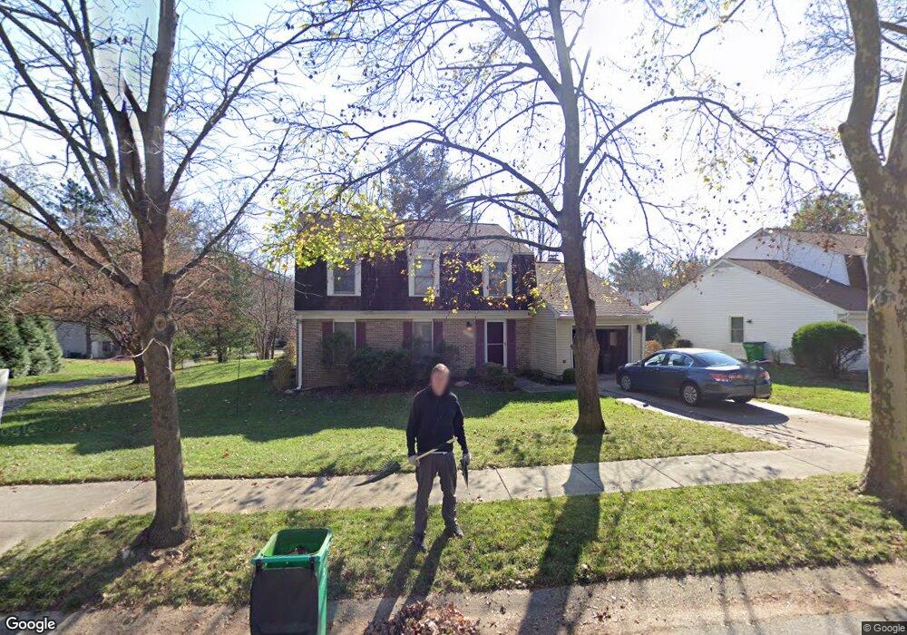
6214 Slender Sky Columbia, MD 21044
Hickory Ridge NeighborhoodEstimated Value: $559,830 - $622,000
--
Bed
3
Baths
1,817
Sq Ft
$326/Sq Ft
Est. Value
About This Home
This home is located at 6214 Slender Sky, Columbia, MD 21044 and is currently estimated at $592,208, approximately $325 per square foot. 6214 Slender Sky is a home located in Howard County with nearby schools including Swansfield Elementary School, Wilde Lake Middle, and Atholton High School.
Ownership History
Date
Name
Owned For
Owner Type
Purchase Details
Closed on
Oct 8, 2002
Sold by
Anzalone George D
Bought by
Classon Christopher E and Classon Rukmini
Current Estimated Value
Purchase Details
Closed on
Jan 16, 1985
Sold by
Carter Stephen B and Carter Wf
Bought by
Anzalone George D
Home Financials for this Owner
Home Financials are based on the most recent Mortgage that was taken out on this home.
Original Mortgage
$104,500
Interest Rate
13.12%
Create a Home Valuation Report for This Property
The Home Valuation Report is an in-depth analysis detailing your home's value as well as a comparison with similar homes in the area
Home Values in the Area
Average Home Value in this Area
Purchase History
| Date | Buyer | Sale Price | Title Company |
|---|---|---|---|
| Classon Christopher E | $250,000 | -- | |
| Anzalone George D | $110,000 | -- |
Source: Public Records
Mortgage History
| Date | Status | Borrower | Loan Amount |
|---|---|---|---|
| Previous Owner | Anzalone George D | $104,500 | |
| Closed | Classon Christopher E | -- |
Source: Public Records
Tax History Compared to Growth
Tax History
| Year | Tax Paid | Tax Assessment Tax Assessment Total Assessment is a certain percentage of the fair market value that is determined by local assessors to be the total taxable value of land and additions on the property. | Land | Improvement |
|---|---|---|---|---|
| 2025 | $7,042 | $469,900 | $0 | $0 |
| 2024 | $7,042 | $454,900 | $245,400 | $209,500 |
| 2023 | $6,651 | $434,567 | $0 | $0 |
| 2022 | $6,314 | $414,233 | $0 | $0 |
| 2021 | $5,794 | $393,900 | $222,300 | $171,600 |
| 2020 | $5,794 | $377,467 | $0 | $0 |
| 2019 | $5,558 | $361,033 | $0 | $0 |
| 2018 | $5,032 | $344,600 | $166,000 | $178,600 |
| 2017 | $4,966 | $344,600 | $0 | $0 |
| 2016 | $904 | $337,533 | $0 | $0 |
| 2015 | $904 | $334,000 | $0 | $0 |
| 2014 | $882 | $334,000 | $0 | $0 |
Source: Public Records
Map
Nearby Homes
- 10522 E Wind Way
- 10637 High Beam Ct
- 6365 Bright Plume
- 10330 College Square
- 10722 Hidden Ridge Dr
- 6009 Wild Ginger Ct
- 5920 Watch Chain Way
- 11238 Crystal Run Unit A
- 5832 Wyndham Cir
- 5814 Wyndham Cir
- 11450 Little Patuxent Pkwy Unit 605
- 11421 Little Patuxent Pkwy Unit 306
- 5964 Watch Chain Way
- 10966 Shadow Ln
- 10195 Owen Brown Rd
- 10822 Warfield Place
- 10426 Fair Oaks
- 10457 Sternwheel Place
- 11630 Sun Circle Way
- 11796 Lone Tree Ct
- 6210 Slender Sky
- 6227 Plaited Reed
- 6218 Slender Sky
- 6206 Slender Sky
- 6213 Slender Sky
- 6209 Slender Sky
- 6219 Plaited Reed
- 6231 Plaited Reed
- 6222 Slender Sky
- 6205 Slender Sky
- 6235 Plaited Reed
- 6221 Slender Sky
- 27475 Covered Bridge Trail
- 6226 Slender Sky
- 6228 Plaited Reed
- 6224 Plaited Reed
- 6214 Resting Sea
- 6220 Plaited Reed
- 6240 Plaited Reed
- 6239 Plaited Reed