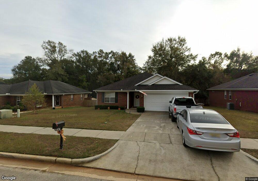
6215 Donham Ct Unit 2 Mobile, AL 36618
Colonial Heights NeighborhoodEstimated Value: $168,000 - $222,000
4
Beds
2
Baths
1,893
Sq Ft
$105/Sq Ft
Est. Value
About This Home
This home is located at 6215 Donham Ct Unit 2, Mobile, AL 36618 and is currently estimated at $198,391, approximately $104 per square foot. 6215 Donham Ct Unit 2 is a home located in Mobile County with nearby schools including Orchard Elementary School, CL Scarborough Middle School, and Mattie T Blount High School.
Ownership History
Date
Name
Owned For
Owner Type
Purchase Details
Closed on
Sep 21, 2011
Sold by
Federal National Mortgage Association
Bought by
Shelby Shaketa Rashae
Current Estimated Value
Home Financials for this Owner
Home Financials are based on the most recent Mortgage that was taken out on this home.
Original Mortgage
$106,236
Outstanding Balance
$72,788
Interest Rate
4.5%
Mortgage Type
FHA
Estimated Equity
$125,603
Purchase Details
Closed on
Apr 28, 2011
Sold by
Suntrust Mortgage Inc
Bought by
Federal National Mortgage Association
Purchase Details
Closed on
Jun 12, 2008
Sold by
Hamilton Paul R and Hamilton Charlene R
Bought by
Suntrust Mortgage Inc
Home Financials for this Owner
Home Financials are based on the most recent Mortgage that was taken out on this home.
Original Mortgage
$151,120
Interest Rate
6.02%
Mortgage Type
Unknown
Create a Home Valuation Report for This Property
The Home Valuation Report is an in-depth analysis detailing your home's value as well as a comparison with similar homes in the area
Home Values in the Area
Average Home Value in this Area
Purchase History
| Date | Buyer | Sale Price | Title Company |
|---|---|---|---|
| Shelby Shaketa Rashae | $109,000 | None Available | |
| Federal National Mortgage Association | -- | None Available | |
| Suntrust Mortgage Inc | $156,114 | None Available | |
| Hamilton Paul R | -- | Slt |
Source: Public Records
Mortgage History
| Date | Status | Borrower | Loan Amount |
|---|---|---|---|
| Open | Shelby Shaketa Rashae | $106,236 | |
| Previous Owner | Hamilton Paul R | $151,120 |
Source: Public Records
Tax History
| Year | Tax Paid | Tax Assessment Tax Assessment Total Assessment is a certain percentage of the fair market value that is determined by local assessors to be the total taxable value of land and additions on the property. | Land | Improvement |
|---|---|---|---|---|
| 2025 | $1,031 | $17,130 | $2,000 | $15,130 |
| 2024 | $1,031 | $16,660 | $2,000 | $14,660 |
| 2023 | $855 | $14,360 | $2,000 | $12,360 |
| 2022 | $851 | $14,450 | $2,000 | $12,450 |
| 2021 | $872 | $14,780 | $2,000 | $12,780 |
| 2020 | $893 | $15,110 | $2,000 | $13,110 |
| 2019 | $794 | $13,560 | $0 | $0 |
| 2018 | $813 | $13,860 | $0 | $0 |
| 2017 | $831 | $14,140 | $0 | $0 |
| 2016 | $854 | $14,500 | $0 | $0 |
| 2013 | $713 | $12,160 | $0 | $0 |
Source: Public Records
Map
Nearby Homes
- 6270 Lausanne Dr N
- 6513 Grace St
- 1644 Princess Helen Rd W
- 0 Barker Dr E
- 1512 Withers Ave
- 6233 Summer Place Dr N
- 6558 Athey Ct
- 0 Hall Rd Unit 7635847
- 1122 Fribourg St
- 1313 Innsbruck Dr
- 5859 Chalet Dr N
- 6759 Overlook Rd
- 6158 Saint Gallen Ave N
- 5755 Colonial Ln N
- 0 Williamstowne Curve Unit 7687107
- 6655 Devander Dr
- 6756 Victor Rd
- 1583 Dover St
- 1108 Rhett Dr
- 1600 Decatur St
Your Personal Tour Guide
Ask me questions while you tour the home.