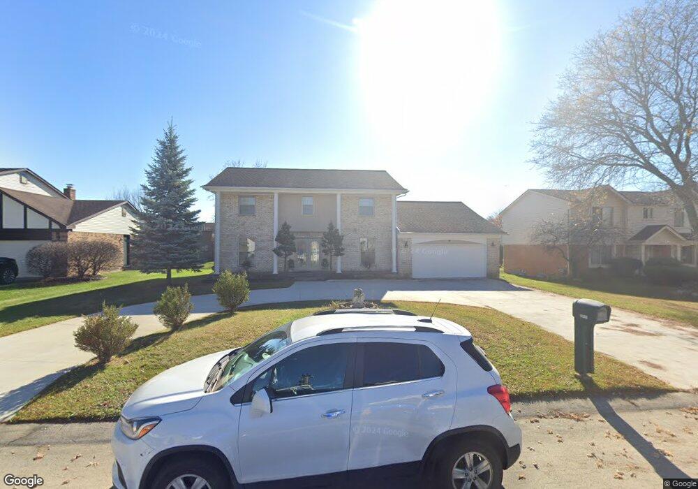
6217 Anne Dr West Bloomfield, MI 48322
Estimated Value: $432,880 - $496,000
4
Beds
3
Baths
2,636
Sq Ft
$179/Sq Ft
Est. Value
About This Home
This home is located at 6217 Anne Dr, West Bloomfield, MI 48322 and is currently estimated at $471,970, approximately $179 per square foot. 6217 Anne Dr is a home located in Oakland County with nearby schools including Walled Lake Central High School, Maria Montessori Center, and Montessori Academy Of Farmington Hills.
Ownership History
Date
Name
Owned For
Owner Type
Purchase Details
Closed on
Oct 22, 2021
Sold by
Ameen Sabah Pitros and Bony Ghaida Ibrahim
Bought by
Ameen Sabah Pitros and Bony Ghaida Ibrahim
Current Estimated Value
Purchase Details
Closed on
Dec 14, 2006
Sold by
Shabilla Kasian and Shabilla Nada
Bought by
Shabilla Kasian and Shabilla Nada
Home Financials for this Owner
Home Financials are based on the most recent Mortgage that was taken out on this home.
Original Mortgage
$288,000
Interest Rate
6.24%
Mortgage Type
New Conventional
Purchase Details
Closed on
Dec 8, 2003
Sold by
Dabish Adel D and Dabish Faiza
Bought by
Shabilla Kasian
Home Financials for this Owner
Home Financials are based on the most recent Mortgage that was taken out on this home.
Original Mortgage
$228,000
Interest Rate
1.95%
Mortgage Type
Purchase Money Mortgage
Create a Home Valuation Report for This Property
The Home Valuation Report is an in-depth analysis detailing your home's value as well as a comparison with similar homes in the area
Home Values in the Area
Average Home Value in this Area
Purchase History
| Date | Buyer | Sale Price | Title Company |
|---|---|---|---|
| Ameen Sabah Pitros | -- | None Available | |
| Shabilla Kasian | -- | Multiple | |
| Shabilla Kasian | $285,000 | The Title Co Of Michigan |
Source: Public Records
Mortgage History
| Date | Status | Borrower | Loan Amount |
|---|---|---|---|
| Previous Owner | Shabilla Kasian | $288,000 | |
| Previous Owner | Shabilla Kasian | $228,000 |
Source: Public Records
Tax History
| Year | Tax Paid | Tax Assessment Tax Assessment Total Assessment is a certain percentage of the fair market value that is determined by local assessors to be the total taxable value of land and additions on the property. | Land | Improvement |
|---|---|---|---|---|
| 2025 | $3,786 | $193,340 | $19,250 | $174,090 |
| 2024 | $2,189 | $168,830 | $0 | $0 |
| 2022 | $2,064 | $158,200 | $19,250 | $138,950 |
| 2021 | $3,394 | $155,330 | $0 | $0 |
| 2020 | $2,040 | $157,070 | $19,250 | $137,820 |
| 2018 | $3,304 | $132,990 | $17,300 | $115,690 |
| 2015 | -- | $104,490 | $0 | $0 |
| 2014 | -- | $98,250 | $0 | $0 |
| 2011 | -- | $87,840 | $0 | $0 |
Source: Public Records
Map
Nearby Homes
- 31114 N Park Dr
- 6621 Glenshaw Ct
- 36758 Valley Ridge Dr
- 6680 Ridgefield Cir
- 34630 Old Timber Rd
- 7345 Verona Dr
- 6700 Ridgefield Cir Unit 201
- 6540 Ridgefield Cir Unit 204
- 6715 Maple Lakes Dr Unit 70
- 6693 Maple Lakes Dr Unit 62
- 6677 Maple Lakes Dr
- 6505 Maple Lakes Ct
- 6886 E Nashway
- 6580 Ridgefield Cir Unit 202
- 37019 Driftwood Unit 5
- 29942 Deer Run Ct
- 6901 Reed Ct
- 5835 Drake Rd
- 30935 Perrys Crossing
- 7276 Somerby
- 6239 Anne Dr
- 6197 Anne Dr
- 6226 Laurain Ct
- 6265 Anne Dr
- 6248 Laurain Ct
- 6179 Anne Dr Unit Bldg-Unit
- 6179 Anne Dr
- 6204 Laurain Ct
- 6216 Anne Dr
- 6238 Anne Dr
- 6182 Laurain Ct
- 6194 Anne Dr
- 6270 Laurain Ct Unit Bldg-Unit
- 6270 Laurain Ct
- 6157 Anne Dr
- 6264 Anne Dr
- 6172 Anne Dr
- 6150 Laurain Ct
- 7401 Oak Tree Dr
- 7397 Oak Tree Dr
Your Personal Tour Guide
Ask me questions while you tour the home.