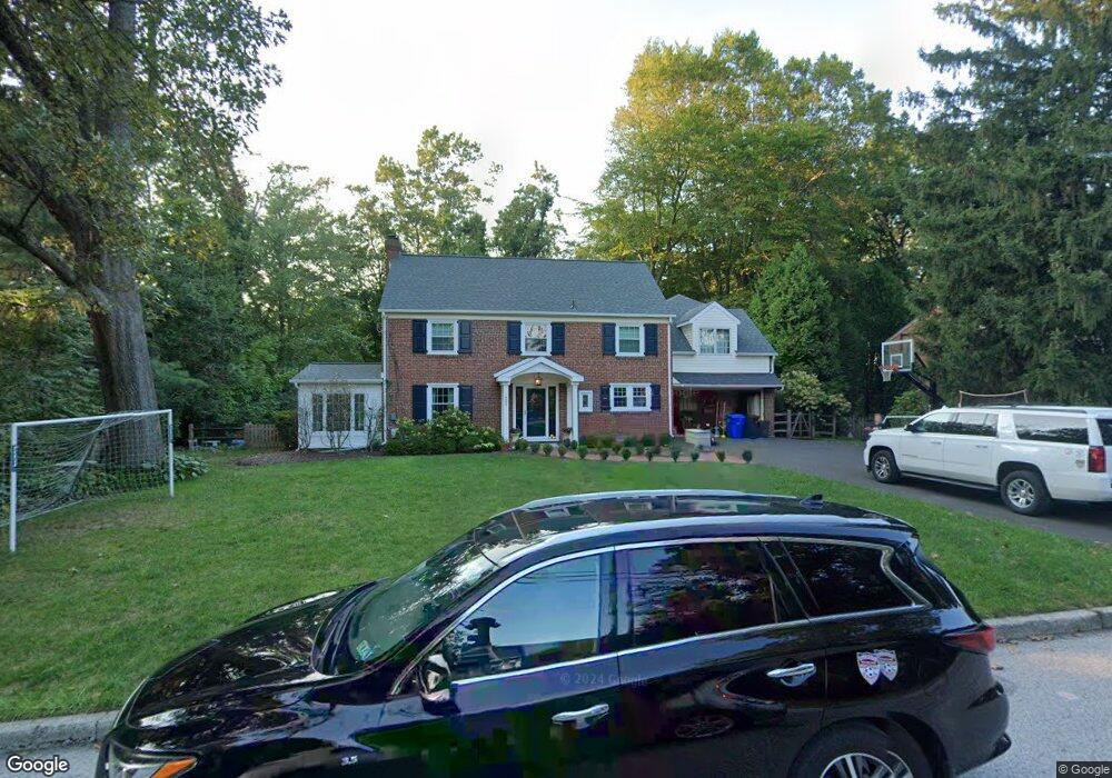
622 Custis Rd Glenside, PA 19038
Estimated Value: $687,000 - $737,000
4
Beds
3
Baths
1,944
Sq Ft
$366/Sq Ft
Est. Value
About This Home
This home is located at 622 Custis Rd, Glenside, PA 19038 and is currently estimated at $712,090, approximately $366 per square foot. 622 Custis Rd is a home located in Montgomery County with nearby schools including Elkins Park School, Cedarbrook Middle School, and Cheltenham High School.
Ownership History
Date
Name
Owned For
Owner Type
Purchase Details
Closed on
Oct 29, 2008
Sold by
Gress Walker Debra P and Walker Robert C
Bought by
Silver Carrie and Silver David
Current Estimated Value
Home Financials for this Owner
Home Financials are based on the most recent Mortgage that was taken out on this home.
Original Mortgage
$370,500
Outstanding Balance
$243,805
Interest Rate
6.13%
Estimated Equity
$468,285
Purchase Details
Closed on
Aug 28, 1998
Sold by
Centeno Joseph J and Centeno Candace A
Bought by
Walker Robert C and Grese Walker Debra P
Purchase Details
Closed on
Jun 21, 1995
Sold by
Skeans Donald W and Skeans Lois M
Bought by
Centeno Joseph J and Mueller Candace A
Create a Home Valuation Report for This Property
The Home Valuation Report is an in-depth analysis detailing your home's value as well as a comparison with similar homes in the area
Home Values in the Area
Average Home Value in this Area
Purchase History
| Date | Buyer | Sale Price | Title Company |
|---|---|---|---|
| Silver Carrie | $390,000 | None Available | |
| Walker Robert C | $250,000 | Germantown Title Company | |
| Centeno Joseph J | $208,250 | -- |
Source: Public Records
Mortgage History
| Date | Status | Borrower | Loan Amount |
|---|---|---|---|
| Open | Silver Carrie | $370,500 |
Source: Public Records
Tax History Compared to Growth
Tax History
| Year | Tax Paid | Tax Assessment Tax Assessment Total Assessment is a certain percentage of the fair market value that is determined by local assessors to be the total taxable value of land and additions on the property. | Land | Improvement |
|---|---|---|---|---|
| 2025 | $13,528 | $202,550 | -- | -- |
| 2024 | $13,528 | $202,550 | -- | -- |
| 2023 | $13,375 | $202,550 | $0 | $0 |
| 2022 | $13,146 | $202,550 | $0 | $0 |
| 2021 | $12,786 | $202,550 | $0 | $0 |
| 2020 | $12,417 | $202,550 | $0 | $0 |
| 2019 | $12,169 | $202,550 | $0 | $0 |
| 2018 | $3,377 | $202,550 | $0 | $0 |
| 2017 | $11,618 | $202,550 | $0 | $0 |
| 2016 | $11,540 | $202,550 | $0 | $0 |
| 2015 | $10,106 | $186,050 | $63,550 | $122,500 |
| 2014 | $10,106 | $186,050 | $63,550 | $122,500 |
Source: Public Records
Map
Nearby Homes
- 711 Custis Rd
- 446 Twickenham Rd
- 516 Beaver Rd
- 1943 Fawn Dr
- 504 Plymouth Rd
- 65 Limekiln Pike
- 1003 Church Rd
- 2541 Church Rd
- 407 W Waverly Rd
- 0 Logan Ave Unit PAMC2112680
- 120 Linden Ave
- 220 Garth Rd
- 140 Linden Ave
- 1641 Chattin Rd
- 221 Central Ave
- 222 Ruscombe Ave
- 230 Harrison Ave
- 162 Logan Ave
- 200 Redford Rd
- 229 Edge Hill Rd
- 612 Custis Rd
- 630 Custis Rd
- 621 Bridle Rd
- 606 Custis Rd
- 636 Custis Rd
- 619 Custis Rd
- 617 Bridle Rd
- 613 Custis Rd
- 631 Custis Rd
- 613 Bridle Rd
- 607 Custis Rd
- 600 Custis Rd
- 642 Custis Rd
- 637 Custis Rd
- 601 Custis Rd
- 609 Bridle Rd
- 552 Custis Rd
- 618 Willow Grove Ave
- 618 Willow Grove Ave
- 624 Willow Grove Ave