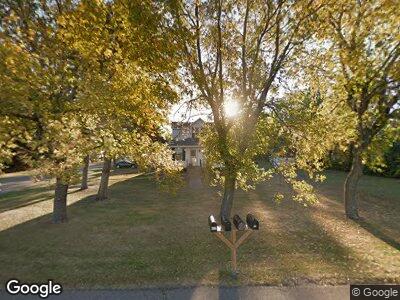
622 Greely St Buxton, ND 58218
Estimated Value: $115,000 - $161,000
--
Bed
--
Bath
--
Sq Ft
--
Built
About This Home
This home is located at 622 Greely St, Buxton, ND 58218 and is currently estimated at $145,070. 622 Greely St is a home with nearby schools including Central Valley Elementary School and Central Valley High School.
Ownership History
Date
Name
Owned For
Owner Type
Purchase Details
Closed on
Aug 5, 2021
Sold by
Duckstad Heather M and Lofquist Heather M
Bought by
Lofquist Joseph and Lofquist Heather M
Current Estimated Value
Home Financials for this Owner
Home Financials are based on the most recent Mortgage that was taken out on this home.
Original Mortgage
$85,000
Interest Rate
5%
Mortgage Type
New Conventional
Purchase Details
Closed on
Sep 9, 2009
Sold by
Dutton Skyler J and Dutton Clarissa M
Bought by
Duckstad Heather M
Home Financials for this Owner
Home Financials are based on the most recent Mortgage that was taken out on this home.
Original Mortgage
$74,350
Interest Rate
5.27%
Mortgage Type
New Conventional
Create a Home Valuation Report for This Property
The Home Valuation Report is an in-depth analysis detailing your home's value as well as a comparison with similar homes in the area
Home Values in the Area
Average Home Value in this Area
Purchase History
| Date | Buyer | Sale Price | Title Company |
|---|---|---|---|
| Lofquist Joseph | -- | New Title Company Name | |
| Duckstad Heather M | $72,900 | Grand Forks Abstract And Tit |
Source: Public Records
Mortgage History
| Date | Status | Borrower | Loan Amount |
|---|---|---|---|
| Previous Owner | Lofquist Joseph | $85,000 | |
| Previous Owner | Duckstad Heather M | $74,350 |
Source: Public Records
Tax History Compared to Growth
Tax History
| Year | Tax Paid | Tax Assessment Tax Assessment Total Assessment is a certain percentage of the fair market value that is determined by local assessors to be the total taxable value of land and additions on the property. | Land | Improvement |
|---|---|---|---|---|
| 2024 | $1,294 | $68,850 | $8,750 | $60,100 |
| 2023 | $1,040 | $51,500 | $3,500 | $48,000 |
| 2022 | $1,315 | $50,000 | $3,500 | $46,500 |
| 2021 | $1,423 | $48,500 | $3,500 | $45,000 |
| 2020 | $1,486 | $48,500 | $3,500 | $45,000 |
| 2019 | $1,116 | $47,196 | $3,450 | $43,746 |
| 2018 | $1,190 | $46,888 | $3,465 | $43,423 |
| 2017 | $1,184 | $46,888 | $0 | $0 |
| 2016 | $805 | $0 | $0 | $0 |
| 2015 | $805 | $0 | $0 | $0 |
| 2014 | $805 | $0 | $0 | $0 |
| 2013 | -- | $0 | $0 | $0 |
Source: Public Records
Map
Nearby Homes
- 705 Neill St
- 616 Neill St
- Lot 9-12 Broadway
- LOTS 9-12 Broadway
- 0 160th Ave NE
- RR 160th Ave NE
- 210 Russel St
- LOTS 9-12 Block 32
- LOTS 5-8 Block 32
- 418 7th Ave
- LOTS 17-20 Block 25
- 1251 Eagle Ave
- 899 Eagle Ave
- TBD Highway 81
- 224 Front St
- 1495 168th Ave NE
- 17052 15th St NE
- 414 Cole Creek Way
- 1223 151st Ave NE
- 522 Maplewood Dr
