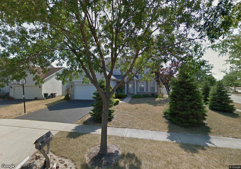
622 Maple Dr Streamwood, IL 60107
Estimated Value: $435,000 - $505,000
4
Beds
3
Baths
2,224
Sq Ft
$207/Sq Ft
Est. Value
About This Home
This home is located at 622 Maple Dr, Streamwood, IL 60107 and is currently estimated at $461,175, approximately $207 per square foot. 622 Maple Dr is a home located in Cook County with nearby schools including Heritage Elementary School, Tefft Middle School, and Streamwood High School.
Ownership History
Date
Name
Owned For
Owner Type
Purchase Details
Closed on
Apr 12, 2018
Sold by
Mielke Mark P
Bought by
Mielke Mark P and Living Trust For Mark P Mielke
Current Estimated Value
Purchase Details
Closed on
Mar 8, 2004
Sold by
Solis Jaime R and Solis Malgorzata S
Bought by
Mielke Mark P
Home Financials for this Owner
Home Financials are based on the most recent Mortgage that was taken out on this home.
Original Mortgage
$240,000
Interest Rate
5.78%
Mortgage Type
Unknown
Purchase Details
Closed on
Aug 13, 1997
Sold by
Lakewood Streams Ltd Partnership
Bought by
Solis Jaime and Solis Malgorzata
Home Financials for this Owner
Home Financials are based on the most recent Mortgage that was taken out on this home.
Original Mortgage
$144,600
Interest Rate
7.44%
Create a Home Valuation Report for This Property
The Home Valuation Report is an in-depth analysis detailing your home's value as well as a comparison with similar homes in the area
Home Values in the Area
Average Home Value in this Area
Purchase History
| Date | Buyer | Sale Price | Title Company |
|---|---|---|---|
| Mielke Mark P | -- | Attorney | |
| Mielke Mark P | $300,000 | Atgf Inc | |
| Solis Jaime | $135,333 | -- |
Source: Public Records
Mortgage History
| Date | Status | Borrower | Loan Amount |
|---|---|---|---|
| Closed | Mielke Mark P | $240,000 | |
| Previous Owner | Solis Jaime | $144,600 |
Source: Public Records
Tax History Compared to Growth
Tax History
| Year | Tax Paid | Tax Assessment Tax Assessment Total Assessment is a certain percentage of the fair market value that is determined by local assessors to be the total taxable value of land and additions on the property. | Land | Improvement |
|---|---|---|---|---|
| 2024 | $9,214 | $33,000 | $6,552 | $26,448 |
| 2023 | $8,939 | $33,000 | $6,552 | $26,448 |
| 2022 | $8,939 | $33,000 | $6,552 | $26,448 |
| 2021 | $7,155 | $22,831 | $4,446 | $18,385 |
| 2020 | $7,114 | $22,831 | $4,446 | $18,385 |
| 2019 | $7,125 | $25,653 | $4,446 | $21,207 |
| 2018 | $7,883 | $25,751 | $3,978 | $21,773 |
| 2017 | $7,795 | $25,751 | $3,978 | $21,773 |
| 2016 | $7,552 | $25,751 | $3,978 | $21,773 |
| 2015 | $8,016 | $25,162 | $3,510 | $21,652 |
| 2014 | $7,912 | $25,162 | $3,510 | $21,652 |
| 2013 | $7,647 | $25,162 | $3,510 | $21,652 |
Source: Public Records
Map
Nearby Homes
- 128 Sycamore Ave
- 719 Lacy Ave
- 804 Bussey Ct
- 6988 Plumtree Ln
- 511 Freeman Ave
- 819 Robinson Ave
- 617 Arnold Ave
- 105 N Chase Ave
- 2110 Cherry Ave
- 110 N Chase Ave
- 406 Library Ln
- 7411 Astor Ave
- 7170 East Ave
- 4077 Club Tree Dr
- 4018 Oxford Ct
- 6551 Center Ave
- 434 Locksley Dr
- 748 Sterling Ct Unit A1
- 406 Locksley Dr
- 759 Sterling Ct Unit A2