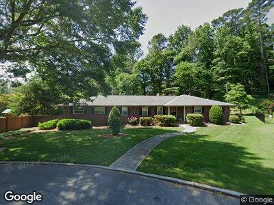
622 Mcfarland Ave Dalton, GA 30720
Estimated Value: $381,751 - $526,000
--
Bed
3
Baths
2,694
Sq Ft
$164/Sq Ft
Est. Value
About This Home
This home is located at 622 Mcfarland Ave, Dalton, GA 30720 and is currently estimated at $442,688, approximately $164 per square foot. 622 Mcfarland Ave is a home located in Whitfield County with nearby schools including City Park Elementary School, Dalton Middle School, and Dalton High School.
Ownership History
Date
Name
Owned For
Owner Type
Purchase Details
Closed on
Jun 24, 2021
Sold by
Williams Diane F
Bought by
Def Platinum Properties Llc
Current Estimated Value
Purchase Details
Closed on
Jun 3, 2019
Sold by
Farrow Scott Allen
Bought by
Williams Diane F
Purchase Details
Closed on
Nov 17, 2003
Sold by
City Of Dalton
Bought by
Farrow Anne F
Purchase Details
Closed on
Nov 1, 1998
Bought by
Farrow Anne F
Create a Home Valuation Report for This Property
The Home Valuation Report is an in-depth analysis detailing your home's value as well as a comparison with similar homes in the area
Home Values in the Area
Average Home Value in this Area
Purchase History
| Date | Buyer | Sale Price | Title Company |
|---|---|---|---|
| Def Platinum Properties Llc | -- | None Listed On Document | |
| Williams Diane F | -- | -- | |
| Williams Diane F | -- | -- | |
| Williams Diane F | -- | -- | |
| Farrow Anne F | -- | -- | |
| Farrow Anne F | $158,000 | -- |
Source: Public Records
Mortgage History
| Date | Status | Borrower | Loan Amount |
|---|---|---|---|
| Previous Owner | Williams Diane | $198,500 |
Source: Public Records
Tax History Compared to Growth
Tax History
| Year | Tax Paid | Tax Assessment Tax Assessment Total Assessment is a certain percentage of the fair market value that is determined by local assessors to be the total taxable value of land and additions on the property. | Land | Improvement |
|---|---|---|---|---|
| 2024 | $3,887 | $121,387 | $21,760 | $99,627 |
| 2023 | $3,887 | $111,232 | $21,600 | $89,632 |
| 2022 | $2,777 | $80,634 | $13,400 | $67,234 |
| 2021 | $2,781 | $80,634 | $13,400 | $67,234 |
| 2020 | $2,889 | $80,634 | $13,400 | $67,234 |
| 2019 | $2,979 | $80,634 | $13,400 | $67,234 |
| 2018 | $842 | $72,533 | $13,400 | $59,133 |
| 2017 | $826 | $72,533 | $13,400 | $59,133 |
| 2016 | $767 | $70,582 | $16,800 | $53,782 |
| 2014 | $598 | $70,582 | $16,800 | $53,782 |
| 2013 | -- | $70,582 | $16,800 | $53,782 |
Source: Public Records
Map
Nearby Homes
- 622 Mcfarland Ave
- 620 Mcfarland Ave
- 701 Ridgewood Ln
- 618 Mcfarland Ave
- 619 Mcfarland Ave
- 707 Greenwood Dr
- 618 Miller St
- 711 Ridgewood Ln
- 616 Mcfarland Ave
- 700 Miller St
- 616 Miller St
- 702 Miller St
- 703 Greenwood Dr
- 614 Mcfarland Ave
- 613 Mcfarland Ave
- 704 Miller St
- 612 Miller St
- 621 Miller St
- 701 Greenwood Dr
- 615 Miller St