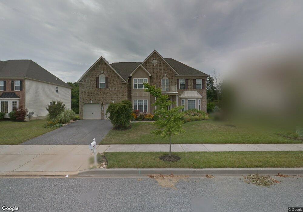
622 Nesting Ln Middletown, DE 19709
Estimated Value: $723,000 - $792,000
4
Beds
4
Baths
4,135
Sq Ft
$180/Sq Ft
Est. Value
About This Home
This home is located at 622 Nesting Ln, Middletown, DE 19709 and is currently estimated at $744,855, approximately $180 per square foot. 622 Nesting Ln is a home located in New Castle County with nearby schools including Brick Mill Elementary School, Louis L. Redding Middle School, and Middletown High School.
Ownership History
Date
Name
Owned For
Owner Type
Purchase Details
Closed on
Nov 18, 2005
Sold by
Foulk Road Associates Llc
Bought by
Brown Douglas R and Brown Ann M
Current Estimated Value
Home Financials for this Owner
Home Financials are based on the most recent Mortgage that was taken out on this home.
Original Mortgage
$190,000
Outstanding Balance
$104,930
Interest Rate
6.17%
Mortgage Type
Fannie Mae Freddie Mac
Estimated Equity
$639,925
Create a Home Valuation Report for This Property
The Home Valuation Report is an in-depth analysis detailing your home's value as well as a comparison with similar homes in the area
Home Values in the Area
Average Home Value in this Area
Purchase History
| Date | Buyer | Sale Price | Title Company |
|---|---|---|---|
| Brown Douglas R | $479,575 | -- |
Source: Public Records
Mortgage History
| Date | Status | Borrower | Loan Amount |
|---|---|---|---|
| Open | Brown Douglas R | $190,000 |
Source: Public Records
Tax History
| Year | Tax Paid | Tax Assessment Tax Assessment Total Assessment is a certain percentage of the fair market value that is determined by local assessors to be the total taxable value of land and additions on the property. | Land | Improvement |
|---|---|---|---|---|
| 2024 | $446 | $148,500 | $15,100 | $133,400 |
| 2023 | $446 | $148,500 | $15,100 | $133,400 |
| 2022 | $4,566 | $148,500 | $15,100 | $133,400 |
| 2021 | $4,466 | $148,500 | $15,100 | $133,400 |
| 2020 | $4,413 | $148,500 | $15,100 | $133,400 |
| 2019 | $4,535 | $148,500 | $15,100 | $133,400 |
| 2018 | $3,914 | $148,500 | $15,100 | $133,400 |
| 2017 | $3,768 | $148,500 | $15,100 | $133,400 |
| 2016 | $3,385 | $148,500 | $15,100 | $133,400 |
| 2015 | $3,719 | $148,500 | $15,100 | $133,400 |
| 2014 | $3,711 | $148,500 | $15,100 | $133,400 |
Source: Public Records
Map
Nearby Homes
- 624 Nesting Ln
- 836 Sweet Birch Dr
- 29 W Reybold Dr
- 795 Idlewyld Dr
- 610 Spring Hollow Dr
- 815 Sweet Birch Dr
- 870 Sweet Birch Dr
- 895 Marl Pit Rd
- 513 Spring Hollow Dr
- 444 Spring Hollow Dr
- 403 New St
- 448 Spring Hollow Dr
- 241 Wickerberry Dr
- 6 Bradley Cir
- 321 Ellenwood Dr
- 434 Spring Hollow Dr
- 119 Tuscany Dr
- 40 S Cummings Dr
- 659 Warren Dr
- 308 Ellenwood Dr
- 620 Nesting Ln
- 618 Nesting Ln
- 626 Nesting Ln
- 201 Snow Goose Dr
- 900 Benalli Dr
- 616 Nesting Ln
- 628 Nesting Ln
- 202 Snow Goose Dr
- 203 Snow Goose Dr
- 627 Nesting Ln
- 902 Benalli Dr
- 901 Benalli Dr
- 614 Nesting Ln
- 630 Nesting Ln
- 205 Snow Goose Dr
- 631 Nesting Ln
- 204 Snow Goose Dr
- 904 Benalli Dr
- 613 Nesting Ln
- 903 Benalli Dr
Your Personal Tour Guide
Ask me questions while you tour the home.