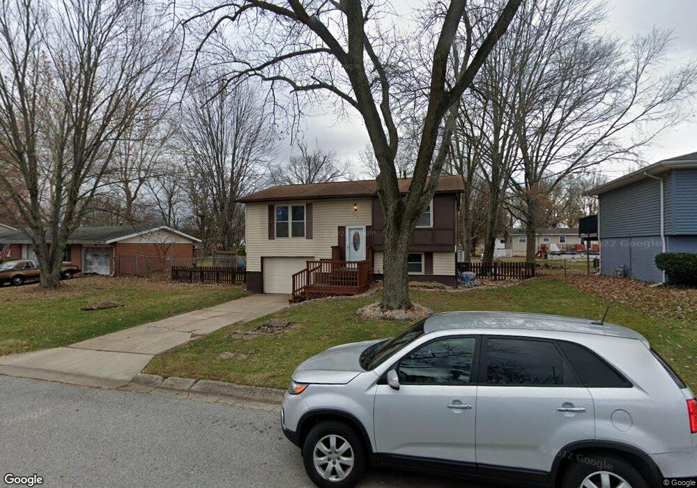
622 Saint Peter Dr Godfrey, IL 62035
Estimated Value: $124,000 - $155,000
4
Beds
1
Bath
816
Sq Ft
$177/Sq Ft
Est. Value
About This Home
This home is located at 622 Saint Peter Dr, Godfrey, IL 62035 and is currently estimated at $144,680, approximately $177 per square foot. 622 Saint Peter Dr is a home located in Madison County with nearby schools including Lewis & Clark Elementary School, Alton Middle School, and Alton High School.
Ownership History
Date
Name
Owned For
Owner Type
Purchase Details
Closed on
May 20, 2008
Sold by
Smith Randall E and Smith Mary C
Bought by
Mouser Rodney G and Mouser Julie A
Current Estimated Value
Home Financials for this Owner
Home Financials are based on the most recent Mortgage that was taken out on this home.
Original Mortgage
$76,000
Outstanding Balance
$48,105
Interest Rate
5.87%
Mortgage Type
Purchase Money Mortgage
Estimated Equity
$96,575
Create a Home Valuation Report for This Property
The Home Valuation Report is an in-depth analysis detailing your home's value as well as a comparison with similar homes in the area
Home Values in the Area
Average Home Value in this Area
Purchase History
| Date | Buyer | Sale Price | Title Company |
|---|---|---|---|
| Mouser Rodney G | $80,000 | Serenity Title & Escrow Ltd |
Source: Public Records
Mortgage History
| Date | Status | Borrower | Loan Amount |
|---|---|---|---|
| Open | Mouser Rodney G | $76,000 |
Source: Public Records
Tax History Compared to Growth
Tax History
| Year | Tax Paid | Tax Assessment Tax Assessment Total Assessment is a certain percentage of the fair market value that is determined by local assessors to be the total taxable value of land and additions on the property. | Land | Improvement |
|---|---|---|---|---|
| 2024 | $2,136 | $42,680 | $4,950 | $37,730 |
| 2023 | $2,136 | $39,400 | $4,570 | $34,830 |
| 2022 | $2,330 | $36,030 | $4,180 | $31,850 |
| 2021 | $1,883 | $31,290 | $3,910 | $27,380 |
| 2020 | $1,840 | $30,620 | $3,830 | $26,790 |
| 2019 | $1,873 | $29,820 | $3,730 | $26,090 |
| 2018 | $1,838 | $28,550 | $3,570 | $24,980 |
| 2017 | $1,746 | $28,550 | $3,570 | $24,980 |
| 2016 | $1,696 | $28,550 | $3,570 | $24,980 |
| 2015 | $1,364 | $27,650 | $3,460 | $24,190 |
| 2014 | $1,364 | $27,650 | $3,460 | $24,190 |
| 2013 | $1,364 | $27,650 | $3,460 | $24,190 |
Source: Public Records
Map
Nearby Homes
- 223 Bachman Ln
- 421 Saint John Dr
- 410 Chelsea Ct
- 5707 Humbert Rd
- 123 Tolle Ln
- 5775 Roach Rd
- 5667 Humbert Rd
- 5661 Humbert Rd
- 504 Elm St
- 0 Humbert Rd Unit MIS25052876
- 607 Mulberry St
- 00 Pine Ridge Lot#52 Dr
- 212 Pine Ridge Dr
- 4805 Wick Mor Dr
- 709 Stamper Ln
- 709 Pardee Rd
- 4814 Azalea Place Unit 2
- 5510 Lamotte Ln
- 4824 Azalea Place Unit 2
- 6002 Wenzel Rd
- 620 Saint Peter Dr
- 624 Saint Peter Dr
- 623 Saint Paul Dr
- 621 Saint Paul Dr
- 618 Saint Peter Dr
- 626 Saint Peter Dr
- 625 Saint Paul Dr
- 623 Saint Peter Dr
- 621 Saint Peter Dr
- 619 Saint Paul Dr
- 625 Saint Peter Dr
- 616 Saint Peter Dr
- 619 Saint Peter Dr
- 707 Saint Anthony Dr
- 627 Saint Paul Dr
- 617 Saint Paul Dr
- 307 Saint Charles Dr
- 617 Saint Peter Dr
- 614 Saint Peter Dr
- 622 Saint Rose Dr