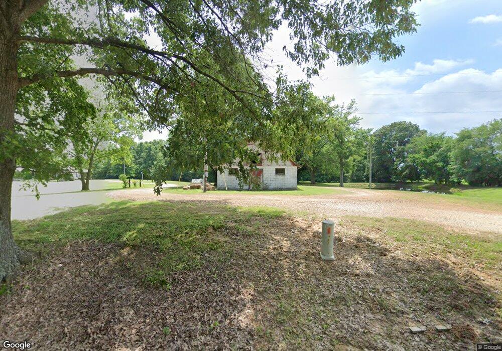
622 Vaughn Rd Martin, TN 38237
Estimated Value: $274,000 - $394,000
--
Bed
2
Baths
2,052
Sq Ft
$166/Sq Ft
Est. Value
About This Home
This home is located at 622 Vaughn Rd, Martin, TN 38237 and is currently estimated at $340,413, approximately $165 per square foot. 622 Vaughn Rd is a home located in Weakley County.
Ownership History
Date
Name
Owned For
Owner Type
Purchase Details
Closed on
Jun 17, 2022
Sold by
Morris Tyler E and Morris Samantha J
Bought by
Maddox Cory A and Maddox Holley
Current Estimated Value
Home Financials for this Owner
Home Financials are based on the most recent Mortgage that was taken out on this home.
Original Mortgage
$310,000
Outstanding Balance
$294,966
Interest Rate
5.27%
Mortgage Type
VA
Estimated Equity
$45,447
Purchase Details
Closed on
Jun 20, 2018
Sold by
Stevens Michael Keith and Stevens Emily Beth
Bought by
Davidson Billy J and Davidson Lynnette
Home Financials for this Owner
Home Financials are based on the most recent Mortgage that was taken out on this home.
Original Mortgage
$165,000
Interest Rate
4.5%
Mortgage Type
Credit Line Revolving
Purchase Details
Closed on
Apr 17, 1999
Bought by
Dublin Jason Dara
Create a Home Valuation Report for This Property
The Home Valuation Report is an in-depth analysis detailing your home's value as well as a comparison with similar homes in the area
Home Values in the Area
Average Home Value in this Area
Purchase History
| Date | Buyer | Sale Price | Title Company |
|---|---|---|---|
| Maddox Cory A | $352,500 | -- | |
| Davidson Billy J | $155,000 | None Available | |
| Dublin Jason Dara | $20,000 | -- |
Source: Public Records
Mortgage History
| Date | Status | Borrower | Loan Amount |
|---|---|---|---|
| Open | Maddox Cory A | $310,000 | |
| Previous Owner | Davidson Billy J | $165,000 |
Source: Public Records
Tax History Compared to Growth
Tax History
| Year | Tax Paid | Tax Assessment Tax Assessment Total Assessment is a certain percentage of the fair market value that is determined by local assessors to be the total taxable value of land and additions on the property. | Land | Improvement |
|---|---|---|---|---|
| 2024 | $909 | $66,350 | $10,000 | $56,350 |
| 2023 | $909 | $66,350 | $10,000 | $56,350 |
| 2022 | $865 | $43,850 | $5,925 | $37,925 |
| 2021 | $865 | $43,850 | $5,925 | $37,925 |
| 2020 | $865 | $43,850 | $5,925 | $37,925 |
| 2019 | $865 | $43,850 | $5,925 | $37,925 |
| 2018 | $65 | $43,850 | $5,925 | $37,925 |
| 2017 | $61 | $41,250 | $2,850 | $38,400 |
| 2016 | $879 | $41,250 | $0 | $0 |
| 2015 | $878 | $41,232 | $0 | $0 |
| 2014 | $878 | $41,232 | $0 | $0 |
Source: Public Records
Map
Nearby Homes
- 0 Buck Mason Rd Unit Map 015, Parcel 007.
- 2540 Ralston Rd
- 471 Pierce Rd
- 5064 Tennessee 118
- 380 State Line Rd
- 2021 Hyndsver Rd
- 297 Stover Rd
- 9627 E State Line
- 137 Haygood Rd
- 7991 Tennessee 118
- 2096 Lee Rd
- 12276 Highway 45
- 413 Honey Locust Dr
- 3060 Bible Union Rd
- 141 Oak St
- 507 Vancil St
- 508 Vancil St
- 16 Oakfield Dr
- 4988 Milltown Rd
- 828 N Lindell St
- 310 Vaughn Rd
- 653 Vaughn Rd
- 213 Vaughn Rd
- 206 Vaughn Rd
- 191 Vaughn Rd
- 730 Vaughn Rd
- 412 Sandy Branch Rd
- 206 Sandy Branch Rd
- 4530 Ralston Rd
- 4690 Ralston Rd
- 4644 Ralston Rd
- 4398 Ralston Rd
- 4685 Ralston Rd
- 4732 Ralston Rd
- 4561 Ralston Rd
- 4589 Ralston Rd
- 817 Sandy Branch Rd
- 651 Grissom Rd
- 660 Sandy Branch Rd
- 989 Vaughn Rd
