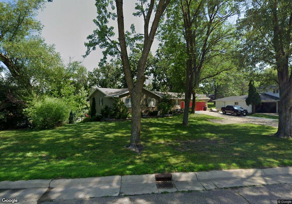
622 W Richway Dr Albert Lea, MN 56007
Estimated Value: $381,805 - $402,000
5
Beds
3
Baths
2,882
Sq Ft
$137/Sq Ft
Est. Value
About This Home
This home is located at 622 W Richway Dr, Albert Lea, MN 56007 and is currently estimated at $394,951, approximately $137 per square foot. 622 W Richway Dr is a home located in Freeborn County with nearby schools including Lakeview Elementary School, Southwest Middle School, and Albert Lea Senior High School.
Ownership History
Date
Name
Owned For
Owner Type
Purchase Details
Closed on
Jul 24, 2020
Sold by
Drewry Williwm F and Drewry Jeanette M
Bought by
Yaw Robert and Yaw Patricia
Current Estimated Value
Home Financials for this Owner
Home Financials are based on the most recent Mortgage that was taken out on this home.
Original Mortgage
$281,300
Outstanding Balance
$203,050
Interest Rate
3.1%
Mortgage Type
New Conventional
Estimated Equity
$192,629
Create a Home Valuation Report for This Property
The Home Valuation Report is an in-depth analysis detailing your home's value as well as a comparison with similar homes in the area
Home Values in the Area
Average Home Value in this Area
Purchase History
| Date | Buyer | Sale Price | Title Company |
|---|---|---|---|
| Yaw Robert | $290,000 | None Available |
Source: Public Records
Mortgage History
| Date | Status | Borrower | Loan Amount |
|---|---|---|---|
| Open | Yaw Patricia | $281,300 | |
| Closed | Yaw Robert | $281,300 |
Source: Public Records
Tax History Compared to Growth
Tax History
| Year | Tax Paid | Tax Assessment Tax Assessment Total Assessment is a certain percentage of the fair market value that is determined by local assessors to be the total taxable value of land and additions on the property. | Land | Improvement |
|---|---|---|---|---|
| 2025 | $5,480 | $381,600 | $81,800 | $299,800 |
| 2024 | $5,442 | $364,100 | $81,800 | $282,300 |
| 2023 | $4,992 | $364,100 | $81,800 | $282,300 |
| 2022 | $4,742 | $329,500 | $65,500 | $264,000 |
| 2021 | $4,688 | $277,500 | $65,500 | $212,000 |
| 2020 | $4,450 | $260,600 | $65,500 | $195,100 |
| 2019 | $4,092 | $243,600 | $65,500 | $178,100 |
| 2018 | $4,026 | $0 | $0 | $0 |
| 2016 | $3,568 | $0 | $0 | $0 |
| 2015 | $3,486 | $0 | $0 | $0 |
| 2014 | $3,538 | $0 | $0 | $0 |
| 2012 | $4,090 | $0 | $0 | $0 |
Source: Public Records
Map
Nearby Homes
- 417 Ridge Rd
- 1010 W Richway Dr
- 410 Ridge Rd
- 1109 W Richway Dr
- 313 Bancroft Dr
- 319 Garden Rd
- 308 Ridge Rd
- 314 Garden Rd
- 420 Garden Rd
- 303 Crescent Dr
- 1810 Lakewood Ave
- 205 Ridge Rd
- 1428 Edgewater Dr
- 203 South Ln
- 304 E Richway Dr
- 308 Lloyd Place
- 209 Burr Oak Dr
- 109 E Hawthorne St
- 1626 Keystone Dr
- 210 Giles Place
- 618 W Richway Dr
- 1809 Brookside Cir
- 1807 Brookside Cir
- 614 W Richway Dr
- 1811 Brookside Cir
- 1805 Brookside Cir
- 610 W Richway Dr
- 1002 W Richway Dr
- 1813 Brookside Cir
- 1814 Brookside Cir
- 1803 Brookside Cir
- TBD W Richway Dr
- 606 W Richway Dr
- 1001 Martin Rd
- 1806 Brookside Cir
- 1006 Shore Acres Dr
- 1705 Brookside Dr
- 1815 Brookside Cir
- 1816 Brookside Cir
- 1701 Brookside Dr