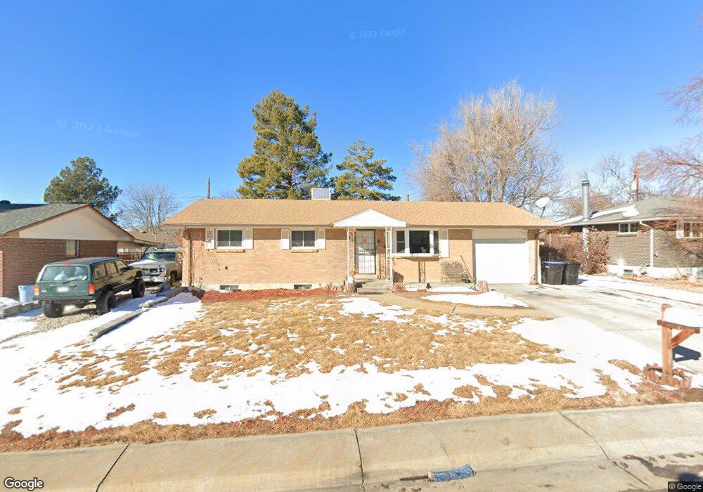
6221 Chase St Arvada, CO 80003
Lamar Heights NeighborhoodEstimated Value: $528,268 - $663,000
6
Beds
3
Baths
2,336
Sq Ft
$249/Sq Ft
Est. Value
About This Home
This home is located at 6221 Chase St, Arvada, CO 80003 and is currently estimated at $582,067, approximately $249 per square foot. 6221 Chase St is a home located in Jefferson County with nearby schools including Swanson Elementary School, North Arvada Middle School, and Arvada High School.
Ownership History
Date
Name
Owned For
Owner Type
Purchase Details
Closed on
Jun 17, 2011
Sold by
Croom Janice K
Bought by
Miller Corine R
Current Estimated Value
Home Financials for this Owner
Home Financials are based on the most recent Mortgage that was taken out on this home.
Original Mortgage
$179,822
Outstanding Balance
$122,442
Interest Rate
4.37%
Mortgage Type
FHA
Estimated Equity
$459,625
Purchase Details
Closed on
Aug 4, 1997
Sold by
Janke Jeffrey E and Janke Christine I
Bought by
Croom Bobby G and Croom Janice K
Home Financials for this Owner
Home Financials are based on the most recent Mortgage that was taken out on this home.
Original Mortgage
$75,450
Interest Rate
7.59%
Mortgage Type
Balloon
Create a Home Valuation Report for This Property
The Home Valuation Report is an in-depth analysis detailing your home's value as well as a comparison with similar homes in the area
Home Values in the Area
Average Home Value in this Area
Purchase History
| Date | Buyer | Sale Price | Title Company |
|---|---|---|---|
| Miller Corine R | $184,500 | Land Title Guarantee Company | |
| Croom Bobby G | $138,450 | -- |
Source: Public Records
Mortgage History
| Date | Status | Borrower | Loan Amount |
|---|---|---|---|
| Open | Miller Corine R | $179,822 | |
| Previous Owner | Croom Bobby G | $75,450 |
Source: Public Records
Tax History Compared to Growth
Tax History
| Year | Tax Paid | Tax Assessment Tax Assessment Total Assessment is a certain percentage of the fair market value that is determined by local assessors to be the total taxable value of land and additions on the property. | Land | Improvement |
|---|---|---|---|---|
| 2024 | $3,166 | $32,639 | $14,169 | $18,470 |
| 2023 | $3,166 | $32,639 | $14,169 | $18,470 |
| 2022 | $2,662 | $27,178 | $12,182 | $14,996 |
| 2021 | $2,706 | $27,960 | $12,533 | $15,427 |
| 2020 | $2,473 | $25,631 | $8,224 | $17,407 |
| 2019 | $2,440 | $25,631 | $8,224 | $17,407 |
| 2018 | $2,161 | $22,072 | $5,554 | $16,518 |
| 2017 | $1,978 | $22,072 | $5,554 | $16,518 |
| 2016 | $1,798 | $18,898 | $5,645 | $13,253 |
| 2015 | $1,501 | $18,898 | $5,645 | $13,253 |
| 2014 | $1,501 | $14,830 | $4,872 | $9,958 |
Source: Public Records
Map
Nearby Homes
- 6185 Sheridan Blvd
- 6373 Depew St
- 6080 Fenton St
- 5375 W 60th Ave
- 5375 W 60th Ave Unit 2
- 5804 W 64th Ave
- 4964 W 61st Dr
- 6365 Xavier Ct
- 6283 Xavier St
- 4904 W 61st Dr
- 6367 Xavier St
- 6349 Ingalls St
- 6503 Gray St
- 5320 W 66th Ave
- 6552 Harlan St
- 6581 Harlan St
- 6639 Depew Ct
- 6650 Depew Ct
- 6656 Benton St
- 6809 Zenobia St Unit 1