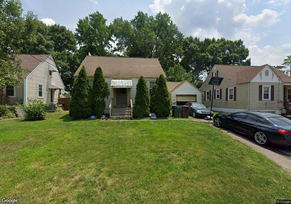
6222 Marie Ave Cincinnati, OH 45224
Finneytown NeighborhoodEstimated Value: $146,164 - $196,000
2
Beds
1
Bath
729
Sq Ft
$240/Sq Ft
Est. Value
About This Home
This home is located at 6222 Marie Ave, Cincinnati, OH 45224 and is currently estimated at $175,291, approximately $240 per square foot. 6222 Marie Ave is a home located in Hamilton County with nearby schools including Finneytown Elementary School, Finneytown Secondary Campus, and St. Vivian School.
Ownership History
Date
Name
Owned For
Owner Type
Purchase Details
Closed on
Aug 25, 1994
Sold by
Desserich Mary Jo
Bought by
Emmons David W and Emmons Elham T
Current Estimated Value
Home Financials for this Owner
Home Financials are based on the most recent Mortgage that was taken out on this home.
Original Mortgage
$33,900
Interest Rate
8.59%
Create a Home Valuation Report for This Property
The Home Valuation Report is an in-depth analysis detailing your home's value as well as a comparison with similar homes in the area
Home Values in the Area
Average Home Value in this Area
Purchase History
| Date | Buyer | Sale Price | Title Company |
|---|---|---|---|
| Emmons David W | -- | -- |
Source: Public Records
Mortgage History
| Date | Status | Borrower | Loan Amount |
|---|---|---|---|
| Closed | Emmons David W | $33,900 |
Source: Public Records
Tax History Compared to Growth
Tax History
| Year | Tax Paid | Tax Assessment Tax Assessment Total Assessment is a certain percentage of the fair market value that is determined by local assessors to be the total taxable value of land and additions on the property. | Land | Improvement |
|---|---|---|---|---|
| 2024 | $2,014 | $27,969 | $7,798 | $20,171 |
| 2023 | $1,946 | $27,969 | $7,798 | $20,171 |
| 2022 | $2,177 | $22,757 | $7,063 | $15,694 |
| 2021 | $2,181 | $22,757 | $7,063 | $15,694 |
| 2020 | $2,160 | $22,757 | $7,063 | $15,694 |
| 2019 | $1,999 | $19,285 | $5,985 | $13,300 |
| 2018 | $1,849 | $19,285 | $5,985 | $13,300 |
| 2017 | $1,790 | $19,285 | $5,985 | $13,300 |
| 2016 | $2,104 | $22,029 | $5,985 | $16,044 |
| 2015 | $2,083 | $22,029 | $5,985 | $16,044 |
| 2014 | $2,081 | $22,029 | $5,985 | $16,044 |
| 2013 | $2,119 | $23,188 | $6,300 | $16,888 |
Source: Public Records
Map
Nearby Homes
- 1090 Elda Ln
- 6014 Argus Rd
- 6085 Capri Dr
- 6000 Capri Dr
- 6029 Waldway Ln
- 1063 Roxie Ln
- 1137 Homeside Ave
- 1147 Homeside Ave
- 1205 Wionna Ave
- 6123 Faircrest Ct
- 5839 Argus Rd
- 1140 Hollywood Ave
- 1148 Hollywood Ave
- 1127 Cedar Ave
- 5974 Sunridge Dr
- 6090 Scarlet Dr
- 1406 Wittekind Terrace
- 1453 Larrywood Ln
- 966 W North Bend Rd
- 6586 S Oak Knoll Dr
- 6220 Marie Ave
- 6224 Marie Ave
- 6226 Marie Ave
- 6228 Marie Ave
- 1086 W North Bend Rd
- 6223 Marie Ave
- 6221 Marie Ave
- 6225 Marie Ave
- 6230 Marie Ave
- 6227 Marie Ave
- 6229 Marie Ave
- 6232 Marie Ave
- 6231 Marie Ave
- 6234 Marie Ave
- 6233 Marie Ave
- 6236 Marie Ave
- 6218 Stella Ave
- 6214 Stella Ave
- 6222 Stella Ave
- 1106 W North Bend Rd