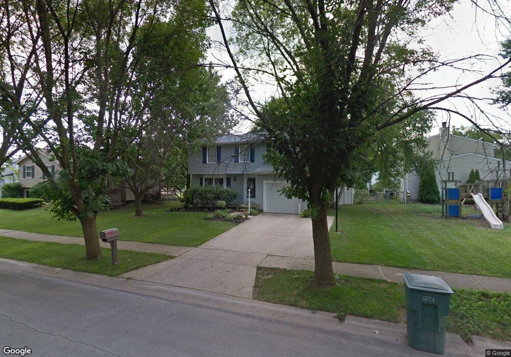
6223 Emberwood Rd Dublin, OH 43017
Riverside NeighborhoodEstimated Value: $327,000 - $408,000
4
Beds
3
Baths
1,560
Sq Ft
$237/Sq Ft
Est. Value
About This Home
This home is located at 6223 Emberwood Rd, Dublin, OH 43017 and is currently estimated at $370,294, approximately $237 per square foot. 6223 Emberwood Rd is a home located in Franklin County with nearby schools including Daniel Wright Elementary School, John Sells Middle School, and Dublin Coffman High School.
Ownership History
Date
Name
Owned For
Owner Type
Purchase Details
Closed on
Mar 21, 2000
Sold by
Johnson Michelle C
Bought by
Doster John D
Current Estimated Value
Purchase Details
Closed on
Jun 3, 1999
Sold by
Dippel James E and Dippel Nina D
Bought by
Doster John D and Johnson Michelle C
Home Financials for this Owner
Home Financials are based on the most recent Mortgage that was taken out on this home.
Original Mortgage
$118,300
Interest Rate
6.94%
Mortgage Type
FHA
Purchase Details
Closed on
Jul 23, 1997
Sold by
Dippel James E and Dippel Nina D
Bought by
Dippel James E and Dippel Nina D
Purchase Details
Closed on
Jul 3, 1990
Bought by
Dippel James E and Dippel Nina D
Purchase Details
Closed on
Jun 1, 1983
Create a Home Valuation Report for This Property
The Home Valuation Report is an in-depth analysis detailing your home's value as well as a comparison with similar homes in the area
Home Values in the Area
Average Home Value in this Area
Purchase History
| Date | Buyer | Sale Price | Title Company |
|---|---|---|---|
| Doster John D | -- | -- | |
| Doster John D | $119,900 | Chicago Title | |
| Dippel James E | -- | -- | |
| Dippel James E | $87,000 | -- | |
| -- | $68,100 | -- |
Source: Public Records
Mortgage History
| Date | Status | Borrower | Loan Amount |
|---|---|---|---|
| Previous Owner | Doster John D | $118,300 |
Source: Public Records
Tax History Compared to Growth
Tax History
| Year | Tax Paid | Tax Assessment Tax Assessment Total Assessment is a certain percentage of the fair market value that is determined by local assessors to be the total taxable value of land and additions on the property. | Land | Improvement |
|---|---|---|---|---|
| 2024 | $6,664 | $110,180 | $37,870 | $72,310 |
| 2023 | $6,570 | $110,180 | $37,870 | $72,310 |
| 2022 | $5,325 | $82,990 | $29,720 | $53,270 |
| 2021 | $5,261 | $80,680 | $29,720 | $50,960 |
| 2020 | $5,229 | $80,680 | $29,720 | $50,960 |
| 2019 | $4,544 | $62,060 | $22,860 | $39,200 |
| 2018 | $4,213 | $62,060 | $22,860 | $39,200 |
| 2017 | $4,018 | $62,060 | $22,860 | $39,200 |
| 2016 | $3,841 | $53,380 | $16,210 | $37,170 |
| 2015 | $3,865 | $53,380 | $16,210 | $37,170 |
| 2014 | $3,869 | $53,380 | $16,210 | $37,170 |
| 2013 | $1,870 | $50,820 | $15,435 | $35,385 |
Source: Public Records
Map
Nearby Homes
- 3087 Strathaven Ct
- 6354 Emberwood Rd
- 3185 Middleboro Way
- 2947 Talbrock Cir
- 6342 Bannister Dr
- 3107 Hamden Ct
- 2951 Cranston Dr Unit 2953
- 2970 Black Kettle Trail
- 6040 Thatcher Dr
- 3263 Scioto Ridge Rd
- 2960 Sawdust Ln Unit 2960
- 2946 Sawdust Ln
- 6241 Buck Ridge Rd
- 5850 Meadowhurst Way
- 5622 Riverside Dr
- 2800 Amana Ct
- 5753 Newgate Rd Unit 5753
- 5735 Newbank Cir Unit 303
- 6802 Chesley Rd
- 5672 Barry Trace Unit 5672
- 6215 Emberwood Rd
- 3037 Essington Dr
- 6207 Emberwood Rd
- 6222 Maryhurst Dr
- 6220 Emberwood Rd
- 6199 Emberwood Rd
- 6214 Maryhurst Dr
- 6212 Emberwood Rd
- 3011 Essington Dr
- 6251 Emberwood Rd
- 6230 Maryhurst Dr
- 6208 Maryhurst Dr
- 6204 Emberwood Rd
- 6191 Emberwood Rd
- 6196 Emberwood Rd
- 6250 Emberwood Rd
- 3054 Essington Dr
- 6257 Emberwood Rd
- 6200 Maryhurst Dr
- 2999 Essington Dr