Estimated Value: $262,000 - $460,000
4
Beds
3
Baths
2,366
Sq Ft
$151/Sq Ft
Est. Value
About This Home
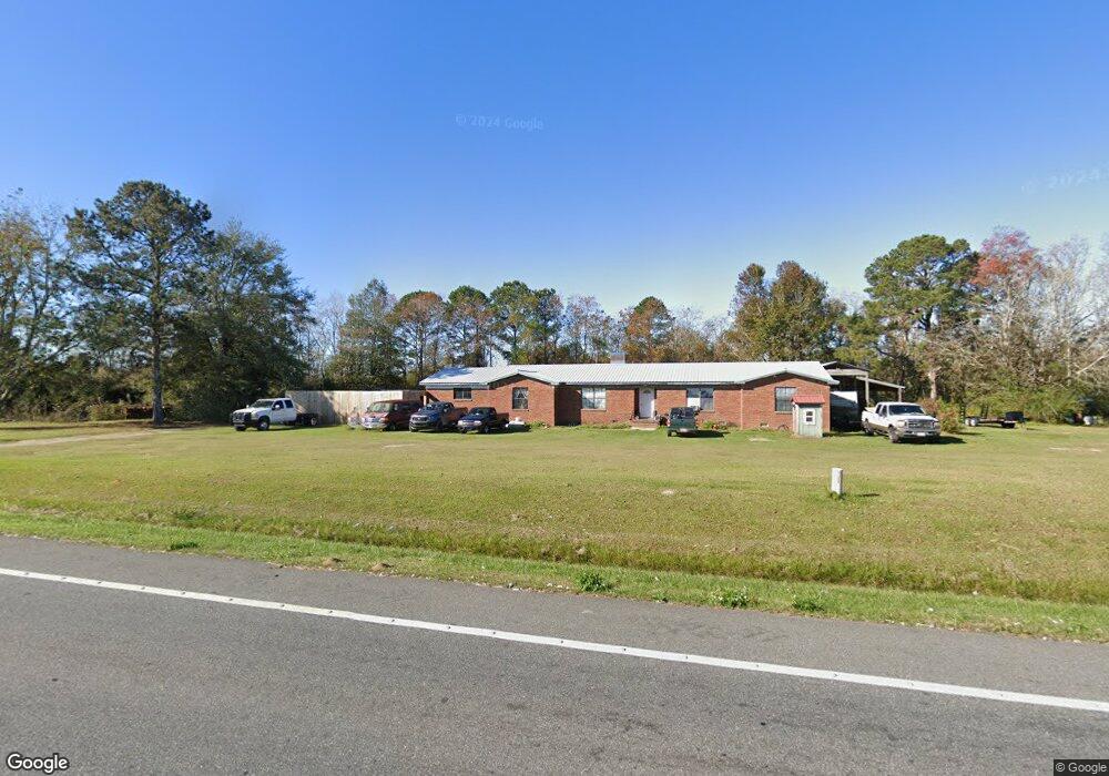
This home is located at 6224 Highway 189 N, Baker, FL 32531 and is currently estimated at $358,382, approximately $151 per square foot. 6224 Highway 189 N is a home located in Okaloosa County with nearby schools including Baker School.
Ownership History
Date
Name
Owned For
Owner Type
Purchase Details
Closed on
Jun 18, 2002
Sold by
Lee Barry and Lee Meri L
Bought by
Rhoads Randy A and Rhoads Karen L
Current Estimated Value
Home Financials for this Owner
Home Financials are based on the most recent Mortgage that was taken out on this home.
Original Mortgage
$64,000
Outstanding Balance
$31,396
Interest Rate
9.12%
Estimated Equity
$326,986
Purchase Details
Closed on
Jun 12, 2002
Sold by
Golden Daniel Edward
Bought by
Lee Barry and Lee Meri L
Home Financials for this Owner
Home Financials are based on the most recent Mortgage that was taken out on this home.
Original Mortgage
$64,000
Outstanding Balance
$31,396
Interest Rate
9.12%
Estimated Equity
$326,986
Create a Home Valuation Report for This Property
The Home Valuation Report is an in-depth analysis detailing your home's value as well as a comparison with similar homes in the area
Home Values in the Area
Average Home Value in this Area
Purchase History
| Date | Buyer | Sale Price | Title Company |
|---|---|---|---|
| Rhoads Randy A | $80,000 | First Natl Land Title Co Inc | |
| Lee Barry | -- | First Natl Land Title Co Inc |
Source: Public Records
Mortgage History
| Date | Status | Borrower | Loan Amount |
|---|---|---|---|
| Open | Rhoads Randy A | $64,000 | |
| Closed | Rhoads Randy A | $16,000 |
Source: Public Records
Tax History Compared to Growth
Tax History
| Year | Tax Paid | Tax Assessment Tax Assessment Total Assessment is a certain percentage of the fair market value that is determined by local assessors to be the total taxable value of land and additions on the property. | Land | Improvement |
|---|---|---|---|---|
| 2024 | $1,294 | $164,189 | -- | -- |
| 2023 | $1,294 | $159,407 | $0 | $0 |
| 2022 | $1,263 | $154,764 | $0 | $0 |
| 2021 | $1,259 | $150,256 | $0 | $0 |
| 2020 | $1,228 | $146,526 | $0 | $0 |
| 2019 | $1,205 | $143,232 | $0 | $0 |
| 2018 | $1,196 | $140,561 | $0 | $0 |
| 2017 | $0 | $137,670 | $0 | $0 |
| 2016 | $1,155 | $134,838 | $0 | $0 |
| 2015 | -- | $133,901 | $0 | $0 |
| 2014 | -- | $133,312 | $0 | $0 |
Source: Public Records
Map
Nearby Homes
- 6043 Dairy Rd
- 0 Homestead Rd
- 1704 Cobb Rd
- 1318 John Riley Barnhill Rd
- 1495 Mccauley Rd
- 5811 Monroe St
- 1512 Vinson Ray Rd
- 1354 Georgia Ave
- 0000 N Sherman Kennedy
- F-10 Long Branch Farm Rd
- 16 acres Sherman Kennedy Rd
- 0000 Sherman Kennedy Rd
- F-9 Long Branch Farm Rd
- F-8 Long Branch Farms Rd
- 924 Hwy C4a
- 5994 Highway 4 W
- TBD Will Henry Ln
- 6100 Buck Ward Rd
- 6090 Buck Ward Rd
- F-3 Long Branch Farm Rd
- 6183 Highway 189 N
- 6264 Highway 189 N
- 6161 Highway 189 N
- 6333 Highway 189 N
- XXX Holloway Rd
- 6115 Highway 189 N
- 1510 Messick Rd
- 6345 Highway 189 N
- 6260 Holloway Rd
- 6246 Holloway Rd
- 1533 Messick Rd
- 6254 Holloway Rd
- 6156 Holloway Rd
- 6107 Holloway Rd
- 6119 Holloway Rd
- 6160 Holloway Rd
- 6349 Highway 189 N
- 6349 Fl-189
- 6135 Holloway Rd
- 6231 Holloway Rd