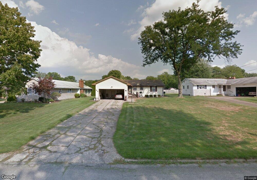
6225 Apache Ln Youngstown, OH 44514
Estimated Value: $233,000 - $237,000
3
Beds
2
Baths
1,320
Sq Ft
$178/Sq Ft
Est. Value
About This Home
This home is located at 6225 Apache Ln, Youngstown, OH 44514 and is currently estimated at $234,859, approximately $177 per square foot. 6225 Apache Ln is a home located in Mahoning County with nearby schools including Poland Union Elementary School, Poland Middle School, and Poland Seminary High School.
Ownership History
Date
Name
Owned For
Owner Type
Purchase Details
Closed on
Apr 16, 2002
Sold by
Petrolla Janet F and Petrolla Janet F
Bought by
Lariccia Robert D and Lariccia Sandra L
Current Estimated Value
Home Financials for this Owner
Home Financials are based on the most recent Mortgage that was taken out on this home.
Original Mortgage
$55,000
Outstanding Balance
$22,383
Interest Rate
7.13%
Estimated Equity
$212,476
Purchase Details
Closed on
Sep 25, 1964
Bought by
Petrolla Janet F
Create a Home Valuation Report for This Property
The Home Valuation Report is an in-depth analysis detailing your home's value as well as a comparison with similar homes in the area
Purchase History
| Date | Buyer | Sale Price | Title Company |
|---|---|---|---|
| Lariccia Robert D | $115,000 | -- | |
| Petrolla Janet F | -- | -- |
Source: Public Records
Mortgage History
| Date | Status | Borrower | Loan Amount |
|---|---|---|---|
| Open | Lariccia Robert D | $55,000 |
Source: Public Records
Tax History
| Year | Tax Paid | Tax Assessment Tax Assessment Total Assessment is a certain percentage of the fair market value that is determined by local assessors to be the total taxable value of land and additions on the property. | Land | Improvement |
|---|---|---|---|---|
| 2025 | $2,444 | $61,470 | $10,600 | $50,870 |
| 2024 | $2,534 | $61,470 | $10,600 | $50,870 |
| 2023 | $2,506 | $61,470 | $10,600 | $50,870 |
| 2022 | $1,843 | $40,890 | $10,600 | $30,290 |
| 2021 | $1,758 | $40,890 | $10,600 | $30,290 |
| 2020 | $1,766 | $40,890 | $10,600 | $30,290 |
| 2019 | $1,507 | $34,260 | $10,600 | $23,660 |
| 2018 | $1,412 | $34,260 | $10,600 | $23,660 |
| 2017 | $1,481 | $34,260 | $10,600 | $23,660 |
| 2016 | $1,552 | $35,450 | $10,600 | $24,850 |
| 2015 | $1,519 | $35,450 | $10,600 | $24,850 |
| 2014 | $1,524 | $35,450 | $10,600 | $24,850 |
| 2013 | $1,505 | $35,450 | $10,600 | $24,850 |
Source: Public Records
Map
Nearby Homes
- 6074 Frontier Dr
- 154 Rocky Ledge Dr
- 6534 Diana Dr
- 6137 Acatello Place
- 0 Clingan Rd Unit 4461196
- 172 Lakeshore Dr
- 2295 Bel Aire Ln
- 232 Edna St
- 2350 Hamilton Ave
- 43 Greystone
- 6695 Clingan Rd Unit 24
- 6695 Clingan Rd Unit 10
- 6695 Clingan Rd Unit 32
- 6695 Clingan Rd Unit 4
- 118 N Main St
- 2370 Lyon Blvd
- 43 Venloe Dr
- 6829 Katahdin Dr
- 2153 Lyon Blvd
- 112 N Lima Rd
- 6241 Apache Ln
- 6209 Apache Ln
- 6255 Apache Ln
- 6193 Apache Ln
- 6230 Pawnee Place
- 6216 Pawnee Place
- 6244 Pawnee Place
- 6226 Apache Ln
- 6271 Apache Ln
- 6179 Apache Ln
- 6210 Apache Ln
- 6240 Apache Ln
- 6200 Pawnee Place
- 6260 Pawnee Place
- 6196 Apache Ln
- 6252 Apache Ln
- 6184 Pawnee Place
- 6285 Apache Ln
- 6184 Apache Ln
- 6270 Apache Ln
Your Personal Tour Guide
Ask me questions while you tour the home.