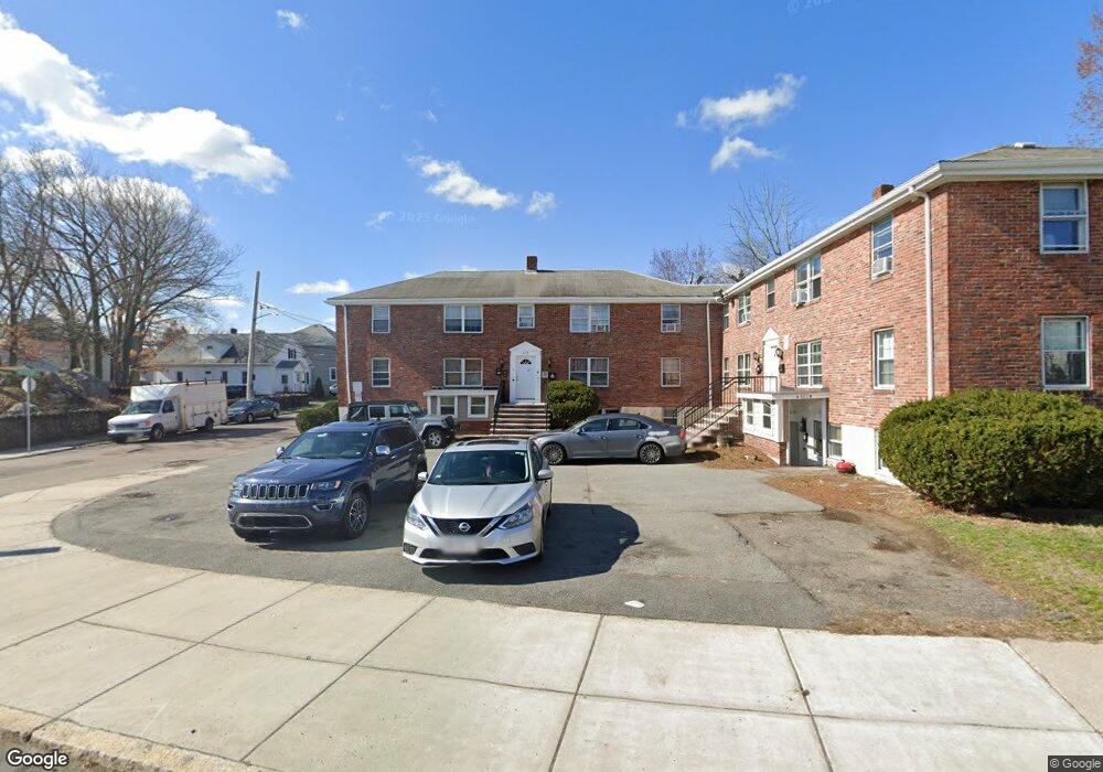
623 Cummins Hwy Unit E Mattapan, MA 02126
Hyde Park NeighborhoodEstimated Value: $261,000 - $326,000
2
Beds
1
Bath
648
Sq Ft
$451/Sq Ft
Est. Value
About This Home
This home is located at 623 Cummins Hwy Unit E, Mattapan, MA 02126 and is currently estimated at $291,939, approximately $450 per square foot. 623 Cummins Hwy Unit E is a home located in Suffolk County with nearby schools including Brooke Charter School Roslindale, Sacred Heart STEM School, and St. Clare High School.
Ownership History
Date
Name
Owned For
Owner Type
Purchase Details
Closed on
Apr 25, 2024
Sold by
Sandler Dar
Bought by
Shebesh Management Llc
Current Estimated Value
Purchase Details
Closed on
Jun 19, 2018
Sold by
Lambert Guerline and Lambert Kesner
Bought by
Kelesidis Sava
Purchase Details
Closed on
Nov 2, 2006
Sold by
Pleasantview Street Rt and Falcucci
Bought by
Lambert Guerline and Lambert Kesner
Home Financials for this Owner
Home Financials are based on the most recent Mortgage that was taken out on this home.
Original Mortgage
$148,000
Interest Rate
7.4%
Mortgage Type
Adjustable Rate Mortgage/ARM
Create a Home Valuation Report for This Property
The Home Valuation Report is an in-depth analysis detailing your home's value as well as a comparison with similar homes in the area
Home Values in the Area
Average Home Value in this Area
Purchase History
| Date | Buyer | Sale Price | Title Company |
|---|---|---|---|
| Shebesh Management Llc | -- | None Available | |
| Shebesh Management Llc | -- | None Available | |
| Kelesidis Sava | $142,000 | -- | |
| Lambert Guerline | $185,000 | -- | |
| Lambert Guerline | $185,000 | -- |
Source: Public Records
Mortgage History
| Date | Status | Borrower | Loan Amount |
|---|---|---|---|
| Previous Owner | Lambert Guerline | $148,000 |
Source: Public Records
Tax History Compared to Growth
Tax History
| Year | Tax Paid | Tax Assessment Tax Assessment Total Assessment is a certain percentage of the fair market value that is determined by local assessors to be the total taxable value of land and additions on the property. | Land | Improvement |
|---|---|---|---|---|
| 2025 | $2,908 | $251,100 | $0 | $251,100 |
| 2024 | $2,958 | $271,400 | $0 | $271,400 |
| 2023 | $2,828 | $263,300 | $0 | $263,300 |
| 2022 | $2,678 | $246,100 | $0 | $246,100 |
| 2021 | $2,478 | $232,200 | $0 | $232,200 |
| 2020 | $1,955 | $185,100 | $0 | $185,100 |
| 2019 | $1,774 | $168,300 | $0 | $168,300 |
| 2018 | $1,764 | $168,300 | $0 | $168,300 |
| 2017 | $1,681 | $158,700 | $0 | $158,700 |
| 2016 | $1,695 | $154,100 | $0 | $154,100 |
| 2015 | $1,560 | $128,800 | $0 | $128,800 |
| 2014 | $1,573 | $125,000 | $0 | $125,000 |
Source: Public Records
Map
Nearby Homes
- 179 Hebron St
- 34 Ridlon Rd
- 265 Hebron St
- 231 Itasca St
- 72 Livermore St
- 839-843 Cummins Hwy
- 0 Tina Ave
- 770 Cummins Hwy Unit 1
- 770 Cummins Hwy Unit 22
- 10 Brockton St
- 100 Itasca St
- 14-14R Kennebec St
- 7 Winborough St
- 90 Hollingsworth St
- 95 Woodhaven St
- 60 and 64 Monterey Ave
- 20 Monterey Ave
- 23 Caton St
- 25 Alpine St Unit 7
- 116 Almont St
- 623 Cummins Hwy Unit F
- 623 Cummins Hwy Unit D
- 623 Cummins Hwy Unit C
- 623 Cummins Hwy Unit B
- 623 Cummins Hwy Unit A
- 621 Cummins Hwy Unit B
- 621 Cummins Hwy Unit C
- 621 Cummins Hwy Unit F
- 621 Cummins Hwy Unit 621-A
- 621 Cummins Hwy Unit A
- 621 Cummins Hwy Unit D
- 621-623 Cummins Hwy Unit D
- 621-623 Cummins Hwy
- 621 Cummins Hwy Unit F
- 621 Cummins Hwy Unit E
- 621 Cummins Hwy Unit D
- 621 Cummins Hwy Unit C
- 621 Cummins Hwy Unit B
- 621 Cummins Hwy Unit A
- 623 Cummins Hwy Unit D