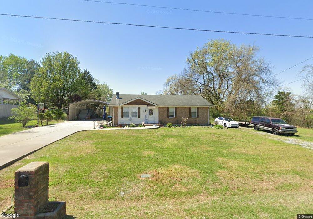
623 Flintlock Dr Smyrna, TN 37167
Estimated Value: $248,515 - $325,000
--
Bed
1
Bath
1,100
Sq Ft
$261/Sq Ft
Est. Value
About This Home
This home is located at 623 Flintlock Dr, Smyrna, TN 37167 and is currently estimated at $287,379, approximately $261 per square foot. 623 Flintlock Dr is a home located in Rutherford County with nearby schools including Stewartsboro Elementary School, Rocky Fork Middle School, and Smyrna High School.
Ownership History
Date
Name
Owned For
Owner Type
Purchase Details
Closed on
Nov 22, 2013
Sold by
Turner Betty K
Bought by
Turner Jodi L
Current Estimated Value
Purchase Details
Closed on
May 3, 2006
Sold by
Butler Family Partnership
Bought by
Turner Betty K
Home Financials for this Owner
Home Financials are based on the most recent Mortgage that was taken out on this home.
Original Mortgage
$98,099
Interest Rate
6.39%
Mortgage Type
Purchase Money Mortgage
Purchase Details
Closed on
May 6, 1996
Sold by
Butler Ronnie E
Bought by
Butler Family Ptn
Create a Home Valuation Report for This Property
The Home Valuation Report is an in-depth analysis detailing your home's value as well as a comparison with similar homes in the area
Home Values in the Area
Average Home Value in this Area
Purchase History
| Date | Buyer | Sale Price | Title Company |
|---|---|---|---|
| Turner Jodi L | -- | -- | |
| Turner Betty K | $98,900 | -- | |
| Butler Family Ptn | -- | -- |
Source: Public Records
Mortgage History
| Date | Status | Borrower | Loan Amount |
|---|---|---|---|
| Open | Butler Family Ptn | $92,150 | |
| Previous Owner | Butler Family Ptn | $98,099 |
Source: Public Records
Tax History Compared to Growth
Tax History
| Year | Tax Paid | Tax Assessment Tax Assessment Total Assessment is a certain percentage of the fair market value that is determined by local assessors to be the total taxable value of land and additions on the property. | Land | Improvement |
|---|---|---|---|---|
| 2025 | $1,271 | $52,938 | $13,750 | $39,188 |
| 2024 | $1,271 | $52,938 | $13,750 | $39,188 |
| 2023 | $1,223 | $50,913 | $13,750 | $37,163 |
| 2022 | $1,091 | $50,913 | $13,750 | $37,163 |
| 2021 | $910 | $31,163 | $7,750 | $23,413 |
| 2020 | $910 | $31,163 | $7,750 | $23,413 |
| 2019 | $910 | $31,163 | $7,750 | $23,413 |
| 2018 | $872 | $31,163 | $0 | $0 |
| 2017 | $811 | $22,775 | $0 | $0 |
| 2016 | $811 | $22,775 | $0 | $0 |
| 2015 | $811 | $22,775 | $0 | $0 |
| 2014 | $566 | $22,775 | $0 | $0 |
| 2013 | -- | $23,050 | $0 | $0 |
Source: Public Records
Map
Nearby Homes
- 308 Custer Ct
- 340 Stewarts Landing Cir
- 211 Stewarts Landing Cir
- 213 Stewarts Landing Cir
- 203 Longfellow Ln
- 109 Longfellow Ln
- 101 Longfellow Ln
- 202 Latimer Dr
- 104 Evanmeade Dr
- 1170 Rimrock Rd
- 1172 Rimrock Rd
- 374 Longhorn Dr
- 640 Ken Pilkerton Dr
- 1026 Rosemont Terrace
- 1176 Rimrock Rd
- 303 Davis Park Dr
- 1175 Rimrock Rd
- 1014 Rosemont Terrace
- 304 Belgian Ln
- 335 Longhorn Dr
- 621 Flintlock Dr
- 422 Pioneer Dr
- 622 Flintlock Dr
- 420 Pioneer Dr
- 619 Flintlock Dr
- 418 Pioneer Dr
- 701 Rodeo Rd
- 617 Flintlock Dr
- 614 Flintlock Dr
- 420 Stockade Dr
- 416 Pioneer Dr
- 703 Rodeo Rd
- 702 Rodeo Rd
- 615 Flintlock Dr
- 419 Pioneer Dr
- 414 Pioneer Dr
- 422 Stockade Dr
- 417 Pioneer Dr
- 705 Rodeo Rd
- 616 Flintlock Dr