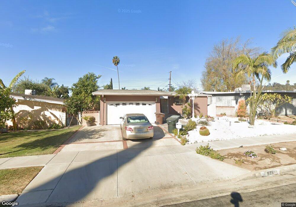
623 Harmsworth Ave La Puente, CA 91744
Estimated Value: $658,000 - $735,000
4
Beds
2
Baths
1,204
Sq Ft
$581/Sq Ft
Est. Value
About This Home
This home is located at 623 Harmsworth Ave, La Puente, CA 91744 and is currently estimated at $699,141, approximately $580 per square foot. 623 Harmsworth Ave is a home located in Los Angeles County with nearby schools including Hurley Elementary School, Giano Intermediate School, and Nogales High School.
Ownership History
Date
Name
Owned For
Owner Type
Purchase Details
Closed on
Nov 6, 2012
Sold by
Diaz Luis J
Bought by
Diaz Luis J and Diaz Javier
Current Estimated Value
Purchase Details
Closed on
Dec 14, 2010
Sold by
Diaz Javier
Bought by
Diaz Luis J
Home Financials for this Owner
Home Financials are based on the most recent Mortgage that was taken out on this home.
Original Mortgage
$119,000
Interest Rate
4.34%
Mortgage Type
New Conventional
Purchase Details
Closed on
Mar 3, 2008
Sold by
Diaz Luis J and Diaz Maria
Bought by
Diaz Luis J
Create a Home Valuation Report for This Property
The Home Valuation Report is an in-depth analysis detailing your home's value as well as a comparison with similar homes in the area
Home Values in the Area
Average Home Value in this Area
Purchase History
| Date | Buyer | Sale Price | Title Company |
|---|---|---|---|
| Diaz Luis J | -- | Provident Title Company | |
| Diaz Luis J | -- | Provident Title Company | |
| Diaz Luis J | -- | None Available |
Source: Public Records
Mortgage History
| Date | Status | Borrower | Loan Amount |
|---|---|---|---|
| Closed | Diaz Luis J | $119,000 |
Source: Public Records
Tax History Compared to Growth
Tax History
| Year | Tax Paid | Tax Assessment Tax Assessment Total Assessment is a certain percentage of the fair market value that is determined by local assessors to be the total taxable value of land and additions on the property. | Land | Improvement |
|---|---|---|---|---|
| 2025 | $3,348 | $236,946 | $142,587 | $94,359 |
| 2024 | $3,348 | $232,301 | $139,792 | $92,509 |
| 2023 | $3,242 | $227,747 | $137,051 | $90,696 |
| 2022 | $3,177 | $223,282 | $134,364 | $88,918 |
| 2021 | $3,125 | $218,905 | $131,730 | $87,175 |
| 2019 | $3,037 | $212,415 | $127,824 | $84,591 |
| 2018 | $2,885 | $208,251 | $125,318 | $82,933 |
| 2016 | $2,774 | $200,165 | $120,452 | $79,713 |
| 2015 | $2,728 | $197,159 | $118,643 | $78,516 |
| 2014 | $2,727 | $193,297 | $116,319 | $76,978 |
Source: Public Records
Map
Nearby Homes
- 656 Radstock Ave
- 16870 Wegman Dr
- 17437 Northam St
- 17406 Renault St
- 17534 Northam St
- 138 Banbridge Ave
- 17772 Hurley St
- 16322 Main St
- 261 Zenith Ave
- 232 N Winton Ave
- 16907 Ridge Park Dr
- 16149 Abbey St
- 1440 Forest Glen Dr
- 1401 Eagle Park Rd Unit 101
- 502 Mangate Ave
- 529 Raminda Ave
- 16115 Central Ave
- 1433 Eagle Park Rd Unit 167
- 1414 Countrywood Ave Unit 91
- 16801 Wing Ln
- 629 Harmsworth Ave
- 617 Harmsworth Ave
- 622 Marston Ave
- 635 Harmsworth Ave
- 628 Marston Ave
- 616 Marston Ave
- 632 Marston Ave
- 622 Harmsworth Ave
- 639 Harmsworth Ave
- 628 Harmsworth Ave
- 616 Harmsworth Ave
- 638 Marston Ave
- 632 Harmsworth Ave
- 645 Harmsworth Ave
- 638 Harmsworth Ave
- 644 Marston Ave
- 623 Marston Ave
- 629 Marston Ave
- 617 Marston Ave
- 644 Harmsworth Ave