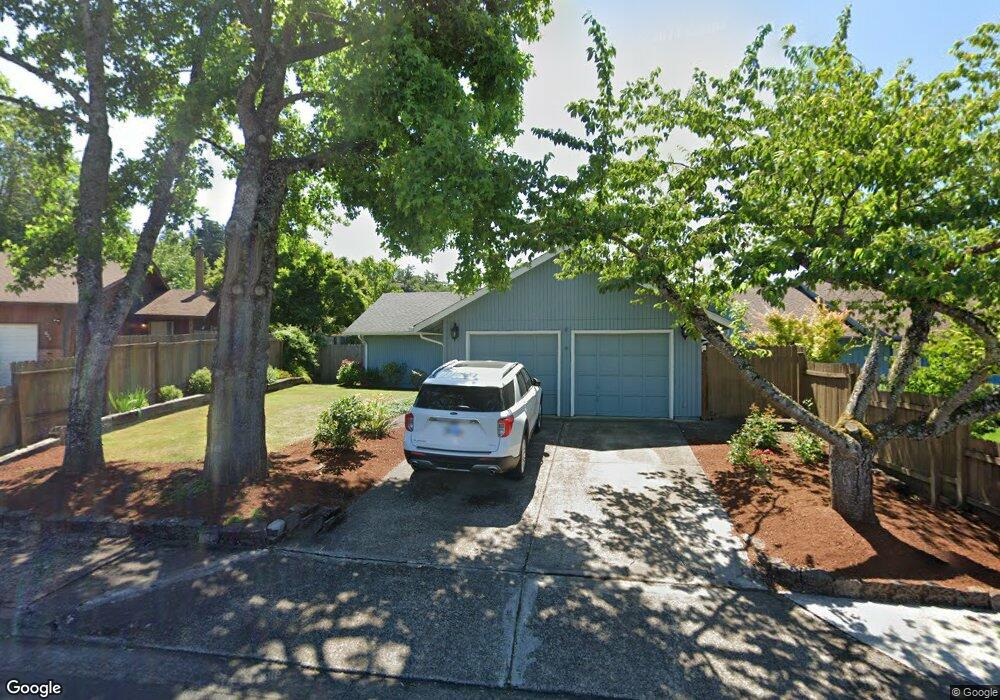
623 Island St Springfield, OR 97477
West Springfield NeighborhoodEstimated Value: $388,493 - $425,000
3
Beds
2
Baths
1,080
Sq Ft
$377/Sq Ft
Est. Value
About This Home
This home is located at 623 Island St, Springfield, OR 97477 and is currently estimated at $406,873, approximately $376 per square foot. 623 Island St is a home located in Lane County with nearby schools including Centennial Elementary School, Hamlin Middle School, and Springfield High School.
Ownership History
Date
Name
Owned For
Owner Type
Purchase Details
Closed on
Jul 21, 1999
Sold by
Renee Noakes Susan and Renee Susan R
Bought by
Floyd David W and Floyd Kandace J
Current Estimated Value
Home Financials for this Owner
Home Financials are based on the most recent Mortgage that was taken out on this home.
Original Mortgage
$117,025
Outstanding Balance
$32,036
Interest Rate
7.51%
Mortgage Type
FHA
Estimated Equity
$374,837
Create a Home Valuation Report for This Property
The Home Valuation Report is an in-depth analysis detailing your home's value as well as a comparison with similar homes in the area
Home Values in the Area
Average Home Value in this Area
Purchase History
| Date | Buyer | Sale Price | Title Company |
|---|---|---|---|
| Floyd David W | $118,000 | Cascade Title Co |
Source: Public Records
Mortgage History
| Date | Status | Borrower | Loan Amount |
|---|---|---|---|
| Open | Floyd David W | $117,025 |
Source: Public Records
Tax History
| Year | Tax Paid | Tax Assessment Tax Assessment Total Assessment is a certain percentage of the fair market value that is determined by local assessors to be the total taxable value of land and additions on the property. | Land | Improvement |
|---|---|---|---|---|
| 2025 | $3,348 | $182,598 | -- | -- |
| 2024 | $3,294 | $177,280 | -- | -- |
| 2023 | $3,294 | $172,117 | $0 | $0 |
| 2022 | $3,051 | $167,104 | $0 | $0 |
| 2021 | $2,996 | $162,237 | $0 | $0 |
| 2020 | $2,909 | $157,512 | $0 | $0 |
| 2019 | $2,821 | $152,925 | $0 | $0 |
| 2018 | $2,659 | $144,147 | $0 | $0 |
| 2017 | $2,557 | $144,147 | $0 | $0 |
| 2016 | $2,504 | $139,949 | $0 | $0 |
| 2015 | $2,432 | $135,873 | $0 | $0 |
| 2014 | $2,395 | $131,916 | $0 | $0 |
Source: Public Records
Map
Nearby Homes
- 930 Prescott Ln
- 992 Sunset Dr
- 952 Summit Blvd
- 0 Summit Blvd Unit 101337462
- 428 W Centennial Blvd
- 1074 Hamilton St
- 552 W D St
- 804 W N St
- 1566 Laura St
- 1424 Wimbledon Place
- 1233 1st St
- 207 W D St
- 1533 Sequoia Ave
- 1505 Canal St
- 835 Anderson Ln
- 1310 W Quinalt St
- 1450 W Quinalt St
- 1130 Anderson Ln
- 239 D St
- 1109 4th St
Your Personal Tour Guide
Ask me questions while you tour the home.