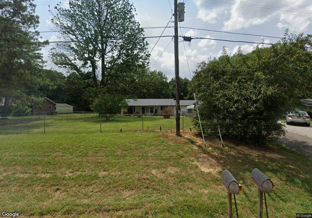
6230 Highway 431 N Springfield, TN 37172
Estimated Value: $321,000 - $406,000
--
Bed
2
Baths
1,994
Sq Ft
$183/Sq Ft
Est. Value
About This Home
This home is located at 6230 Highway 431 N, Springfield, TN 37172 and is currently estimated at $364,475, approximately $182 per square foot. 6230 Highway 431 N is a home located in Robertson County with nearby schools including Krisle Elementary School, Innovation Academy, and Springfield High School.
Ownership History
Date
Name
Owned For
Owner Type
Purchase Details
Closed on
May 23, 2022
Sold by
Dorris Michael D and Dorris Vicky L
Bought by
Reyes Construction Inc
Current Estimated Value
Home Financials for this Owner
Home Financials are based on the most recent Mortgage that was taken out on this home.
Original Mortgage
$297,500
Outstanding Balance
$264,262
Interest Rate
4.43%
Mortgage Type
Credit Line Revolving
Estimated Equity
$100,213
Purchase Details
Closed on
May 25, 1990
Bought by
Dorris Michael D
Purchase Details
Closed on
Jan 25, 1985
Bought by
Morris Bobby G and Morris Martha L
Create a Home Valuation Report for This Property
The Home Valuation Report is an in-depth analysis detailing your home's value as well as a comparison with similar homes in the area
Home Values in the Area
Average Home Value in this Area
Purchase History
| Date | Buyer | Sale Price | Title Company |
|---|---|---|---|
| Reyes Construction Inc | $52,400 | Greater Nashville Title | |
| Dorris Michael D | $52,400 | -- | |
| Morris Bobby G | -- | -- |
Source: Public Records
Mortgage History
| Date | Status | Borrower | Loan Amount |
|---|---|---|---|
| Open | Reyes Construction Inc | $297,500 |
Source: Public Records
Tax History Compared to Growth
Tax History
| Year | Tax Paid | Tax Assessment Tax Assessment Total Assessment is a certain percentage of the fair market value that is determined by local assessors to be the total taxable value of land and additions on the property. | Land | Improvement |
|---|---|---|---|---|
| 2024 | $1,146 | $63,675 | $10,775 | $52,900 |
| 2023 | $1,146 | $63,675 | $10,775 | $52,900 |
| 2022 | $1,137 | $44,150 | $4,450 | $39,700 |
| 2021 | $1,137 | $44,150 | $4,450 | $39,700 |
| 2020 | $1,137 | $44,150 | $4,450 | $39,700 |
| 2019 | $1,748 | $44,150 | $4,450 | $39,700 |
| 2018 | $1,137 | $44,150 | $4,450 | $39,700 |
| 2017 | $1,044 | $33,825 | $3,975 | $29,850 |
| 2016 | $1,044 | $33,825 | $3,975 | $29,850 |
| 2015 | $1,001 | $33,825 | $3,975 | $29,850 |
| 2014 | $1,001 | $33,825 | $3,975 | $29,850 |
Source: Public Records
Map
Nearby Homes
- 5345 Ashburn Rd
- 6538 Highway 431 N
- 5558 Borthick Rd
- 0 Borthick Rd
- 5670 Borthick Rd
- 5561 Borthick Rd
- 5257 Fred Perry Rd
- 943 Smith Grove Rd
- 5345 Roy Holman Rd
- 4466 Gunn Rd
- 509 S High St
- 320 N High St
- 112 Burr Alley
- 408 N High St
- 130 Fugate Ave
- 131 Smith Ave
- 2 Dot Rd
- 1 Dot Rd
- 127 Stratton St
- 0 Dot Rd Unit RTC2971727
- 6224 Highway 431 N
- 6234 Highway 431 N
- 6224 Highway 431n
- 6240 Highway 431 N
- 6229 Highway 431 N
- 6229 Highway 431 N
- 6241 Highway 431 N
- 6148 Highway 431 N
- 6148 Highway 431n
- 6235 Highway 431 N
- 6317 Highway 431 N
- 6137 Highway 431 N
- 435 Powell Ln
- 1095 Powell Ln
- 5329 Ashburn Rd
- 6123 Hwy 431 N
- 5365 Ashburn Rd
- 5337 Ashburn Rd
- 6015 Highway 431 N
- 6009 Highway 431 N