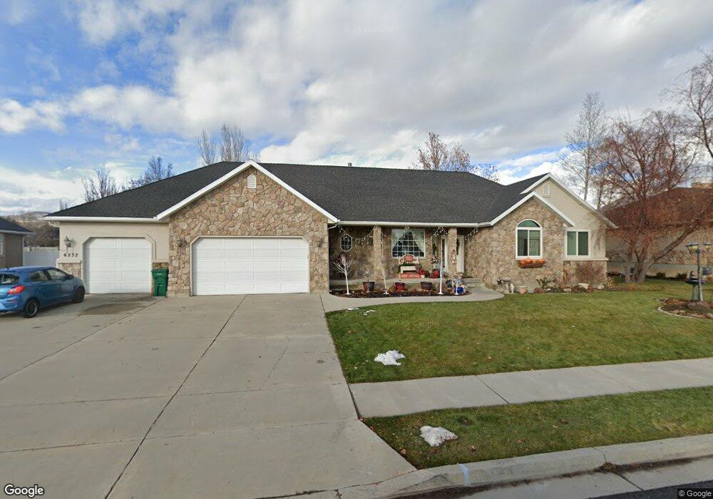
6232 W 10830 N Highland, UT 84003
Estimated Value: $714,000 - $1,073,000
3
Beds
3
Baths
4,276
Sq Ft
$202/Sq Ft
Est. Value
About This Home
This home is located at 6232 W 10830 N, Highland, UT 84003 and is currently estimated at $863,278, approximately $201 per square foot. 6232 W 10830 N is a home located in Utah County with nearby schools including Highland Elementary School, Mountain Ridge Junior High School, and Lone Peak High School.
Ownership History
Date
Name
Owned For
Owner Type
Purchase Details
Closed on
May 18, 2017
Sold by
Cook James Kim and Cook Carolee
Bought by
Cook James Kim and Cook Carolee Bond
Current Estimated Value
Purchase Details
Closed on
Dec 19, 2000
Sold by
Jewett Ronald E
Bought by
Cook James Kim and Cook Carolee
Home Financials for this Owner
Home Financials are based on the most recent Mortgage that was taken out on this home.
Original Mortgage
$75,000
Interest Rate
7.71%
Purchase Details
Closed on
Jun 15, 2000
Sold by
Thompson Mark S and Thompson Debra M
Bought by
Jewett Ronald E
Home Financials for this Owner
Home Financials are based on the most recent Mortgage that was taken out on this home.
Original Mortgage
$216,750
Interest Rate
8.27%
Mortgage Type
Construction
Create a Home Valuation Report for This Property
The Home Valuation Report is an in-depth analysis detailing your home's value as well as a comparison with similar homes in the area
Home Values in the Area
Average Home Value in this Area
Purchase History
| Date | Buyer | Sale Price | Title Company |
|---|---|---|---|
| Cook James Kim | -- | None Available | |
| Cook James Kim | -- | First American Title Co | |
| Jewett Ronald E | -- | First American Title Co | |
| Shilar Investments Lc | -- | Surety Title |
Source: Public Records
Mortgage History
| Date | Status | Borrower | Loan Amount |
|---|---|---|---|
| Closed | Cook James Kim | $75,000 | |
| Previous Owner | Jewett Ronald E | $216,750 | |
| Closed | Jewett Ronald E | $35,000 |
Source: Public Records
Tax History Compared to Growth
Tax History
| Year | Tax Paid | Tax Assessment Tax Assessment Total Assessment is a certain percentage of the fair market value that is determined by local assessors to be the total taxable value of land and additions on the property. | Land | Improvement |
|---|---|---|---|---|
| 2025 | $2,921 | $407,990 | $304,000 | $437,800 |
| 2024 | $2,731 | $360,855 | $0 | $0 |
| 2023 | $2,731 | $363,825 | $0 | $0 |
| 2022 | $2,782 | $359,425 | $0 | $0 |
| 2021 | $2,724 | $524,300 | $212,200 | $312,100 |
| 2020 | $2,583 | $487,500 | $184,500 | $303,000 |
| 2019 | $2,332 | $460,400 | $184,500 | $275,900 |
| 2018 | $2,299 | $431,300 | $176,800 | $254,500 |
| 2017 | $2,039 | $204,215 | $0 | $0 |
| 2016 | $2,226 | $208,340 | $0 | $0 |
| 2015 | $2,348 | $208,340 | $0 | $0 |
| 2014 | $2,168 | $190,630 | $0 | $0 |
Source: Public Records
Map
Nearby Homes
- 6271 W 10830 St N
- 10818 N 6000 W
- 11124 N 6000 W
- 6373 W 10500 N
- 11248 Hawkstone Way Unit 109
- 6024 Hawkstone Way Unit 108
- 11228 Hawkstone Way Unit 110
- 10434 N 6400 W
- 6372 W 10400 N
- 6602 W Normandy Way
- 11337 N 5950 W Unit 7
- 5798 W 11350 N
- 5538 W Naples Dr Unit 125
- 5538 W Turin Ln
- 1610 E Center Pointe Dr
- 1602 E Center Pointe Dr
- 1602 E Center Pointe Dr Unit 1
- 6399 W 10150 N
- 5509 W Sicily Ln
- 10925 N Marsala Dr
- 6214 W 10830 N
- 6248 W 10830 N
- 6248 W 10830 N Unit 4
- 6229 W 10830 N
- 6264 W 10830 N
- 6196 W 10830 N
- 12200 N 6200 St W
- 6247 W 10830 N
- 6213 W 10830 N
- 6267 W 10890 N
- 6263 W 10830 N
- 6272 W 10830 N
- 6182 W 10830 N
- 6242 W 10830 St N Unit 4
- 6286 W 10830 N
- 6206 W Kates Ln
- 6289 W 10890 N
- 6236 W Kate's Ln Unit 1
- 6162 W 10830 N
- 6187 W 10830 N