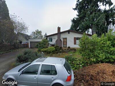
6238 N Bank St Portland, OR 97203
Saint Johns NeighborhoodEstimated Value: $374,000 - $432,470
2
Beds
1
Bath
1,650
Sq Ft
$244/Sq Ft
Est. Value
About This Home
This home is located at 6238 N Bank St, Portland, OR 97203 and is currently estimated at $403,368, approximately $244 per square foot. 6238 N Bank St is a home located in Multnomah County with nearby schools including James John Elementary School, George Middle School, and Roosevelt High School.
Ownership History
Date
Name
Owned For
Owner Type
Purchase Details
Closed on
Oct 27, 2009
Sold by
Smith Dickie Lee
Bought by
Rudolf Jonathan F
Current Estimated Value
Home Financials for this Owner
Home Financials are based on the most recent Mortgage that was taken out on this home.
Original Mortgage
$142,373
Interest Rate
5.02%
Mortgage Type
FHA
Purchase Details
Closed on
May 16, 1997
Sold by
Smith Dickie Lee
Bought by
Smith Dickie Lee and Smith Amy Darlene
Home Financials for this Owner
Home Financials are based on the most recent Mortgage that was taken out on this home.
Original Mortgage
$42,500
Interest Rate
8.14%
Mortgage Type
Purchase Money Mortgage
Create a Home Valuation Report for This Property
The Home Valuation Report is an in-depth analysis detailing your home's value as well as a comparison with similar homes in the area
Home Values in the Area
Average Home Value in this Area
Purchase History
| Date | Buyer | Sale Price | Title Company |
|---|---|---|---|
| Rudolf Jonathan F | $145,000 | Lawyers Title Insurance Corp | |
| Smith Dickie Lee | -- | Oregon Title Insurance Co |
Source: Public Records
Mortgage History
| Date | Status | Borrower | Loan Amount |
|---|---|---|---|
| Open | Rudolf Jonathan F | $50,000 | |
| Open | Rudolf Jonathan F | $170,000 | |
| Closed | Rudolf Jonathan F | $142,373 | |
| Previous Owner | Smith Dickie Lee | $42,500 |
Source: Public Records
Tax History Compared to Growth
Tax History
| Year | Tax Paid | Tax Assessment Tax Assessment Total Assessment is a certain percentage of the fair market value that is determined by local assessors to be the total taxable value of land and additions on the property. | Land | Improvement |
|---|---|---|---|---|
| 2023 | $3,113 | $117,480 | $0 | $0 |
| 2022 | $3,046 | $114,060 | $0 | $0 |
| 2021 | $2,994 | $110,740 | $0 | $0 |
| 2020 | $2,747 | $107,520 | $0 | $0 |
| 2019 | $2,646 | $104,390 | $0 | $0 |
| 2018 | $2,568 | $101,350 | $0 | $0 |
| 2017 | $2,461 | $98,400 | $0 | $0 |
| 2016 | $2,253 | $95,540 | $0 | $0 |
| 2015 | $2,194 | $92,760 | $0 | $0 |
| 2014 | $2,160 | $90,060 | $0 | $0 |
Source: Public Records
Map
Nearby Homes
- 6684 N Bank St
- 6679 N Armour St
- 6905 N Bank St
- 6915 N Bank St
- 6666 N Columbia Way
- 6669 N Fessenden St Unit 25
- 6649 N Fessenden St Unit 11
- 6675 N Fessenden St Unit 14
- 6611 N Fessenden St
- 10006 N Calhoun Ave
- 10035 N Calhoun Ave
- 9525 N Burr Ave
- 9568 N Tioga Ave
- 7535 N Fessenden St
- 10230 N Tyler Ave
- 9585 N Polk Ave
- 10258 N Allegheny Ave
- 9640 N Haven Ave
- 10387 N Mohawk Ave
- 8014 N Johnswood Dr
- 6238 N Bank St
- 6234 N Bank St
- 6268 N Bank St
- 6237 N Astor St Unit 6243
- 6243 N Astor St
- 6263 N Astor St
- 6261 N Bank St
- 0 N Bank St
- 6228 N Bank St
- 10126 N MacRum Ave
- 6275 N Astor St
- 6269 N Bank St
- 6225 N Astor St
- 6275 N Bank St
- 10110 N MacRum Ave
- 6217 N Astor St
- 6281 N Bank St
- 6203 N Astor St
- 6256 N Astor St
- 6244 N Astor St