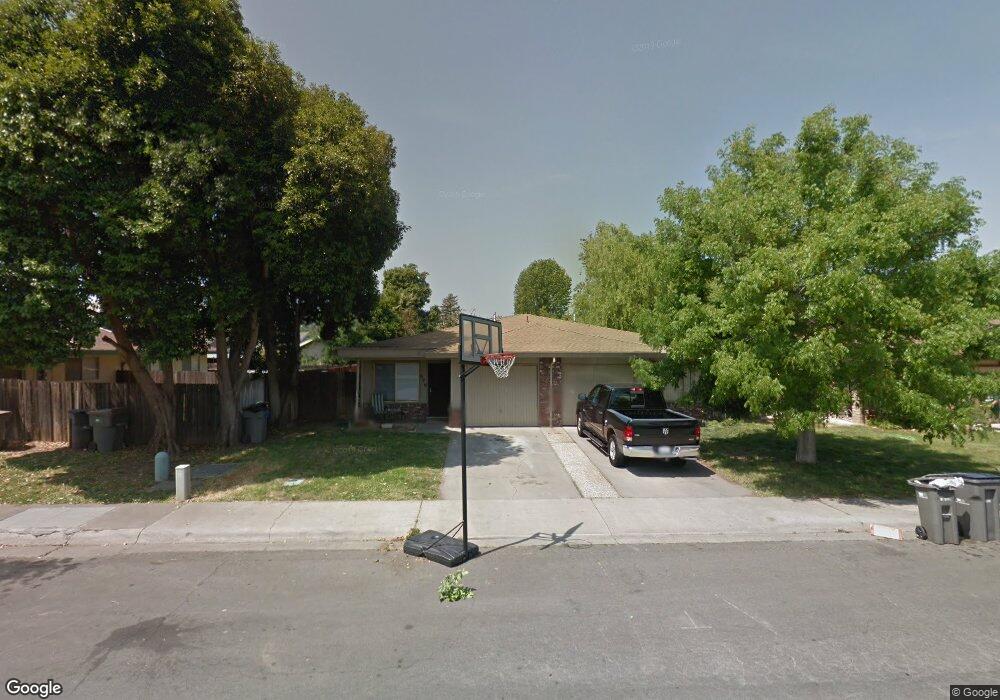
624 Daniels St Woodland, CA 95695
Estimated Value: $385,000 - $524,000
4
Beds
2
Baths
1,800
Sq Ft
$266/Sq Ft
Est. Value
About This Home
This home is located at 624 Daniels St, Woodland, CA 95695 and is currently estimated at $478,300, approximately $265 per square foot. 624 Daniels St is a home located in Yolo County with nearby schools including T.L. Whitehead Elementary School, Lee Middle School, and Woodland Senior High School.
Ownership History
Date
Name
Owned For
Owner Type
Purchase Details
Closed on
Aug 5, 2025
Sold by
Foster Neal
Bought by
Neal Foster Trust and Foster
Current Estimated Value
Purchase Details
Closed on
Jun 6, 2012
Sold by
Stover Shirley M
Bought by
Foster Neal
Purchase Details
Closed on
Jun 5, 2012
Sold by
Krahling Buren W and Krahling Bernice R
Bought by
Foster Neal
Create a Home Valuation Report for This Property
The Home Valuation Report is an in-depth analysis detailing your home's value as well as a comparison with similar homes in the area
Home Values in the Area
Average Home Value in this Area
Purchase History
| Date | Buyer | Sale Price | Title Company |
|---|---|---|---|
| Neal Foster Trust | -- | None Listed On Document | |
| Foster Neal | -- | Fidelity Natl Title Co Of Ca | |
| Foster Neal | $165,000 | Fidelity Natl Title Co Of Ca |
Source: Public Records
Tax History Compared to Growth
Tax History
| Year | Tax Paid | Tax Assessment Tax Assessment Total Assessment is a certain percentage of the fair market value that is determined by local assessors to be the total taxable value of land and additions on the property. | Land | Improvement |
|---|---|---|---|---|
| 2025 | $2,136 | $207,234 | $50,235 | $156,999 |
| 2023 | $2,136 | $199,188 | $48,285 | $150,903 |
| 2022 | $2,053 | $195,284 | $47,339 | $147,945 |
| 2021 | $2,020 | $191,456 | $46,411 | $145,045 |
| 2020 | $1,991 | $189,494 | $45,936 | $143,558 |
| 2019 | $1,954 | $185,780 | $45,036 | $140,744 |
| 2018 | $1,934 | $182,138 | $44,153 | $137,985 |
| 2017 | $1,892 | $178,568 | $43,288 | $135,280 |
| 2016 | $1,860 | $175,068 | $42,440 | $132,628 |
| 2015 | $1,798 | $172,439 | $41,803 | $130,636 |
| 2014 | $1,798 | $169,063 | $40,985 | $128,078 |
Source: Public Records
Map
Nearby Homes
- 737 Heather Ln
- 517 Daniels St
- 725 Fairview Dr
- 805 W Lincoln Ave
- 736 W Lincoln Ave Unit 138
- 956 W Cross St
- 637 Knollwood Dr
- 615 Knollwood Dr
- 633 Poplar Ln
- 420 W Southwood Dr
- 648 California St
- 628 California St
- 801-803 California St
- 1200 Evergreen Ct
- 910 Notre Dame Dr
- 754 Fordham Place
- 116 Imperial St
- 23 Azure Place
- 2 King Place
- 449 West St
- 620 Daniels St
- 726 W Cross St
- 730 W Cross St
- 734 W Cross St
- 621 Connor Ln
- 616 Daniels St Unit 618
- 625 Connor Ln
- 617 Connor Ln
- 738 W Cross St
- 613 Connor Ln
- 612 Daniels St Unit 614
- 609 Connor Ln
- 702 Daniels St
- 729 W Cross St
- 733 W Cross St
- 608 Daniels St Unit 610
- 701 Daniels St
- 640 Cottonwood St
- 737 W Cross St
- 620 Connor Ln