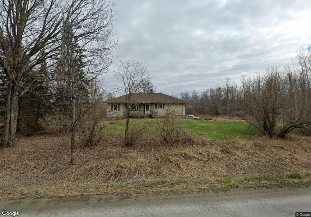
624 Mudgett Rd Levant, ME 04456
Estimated Value: $252,826 - $310,000
2
Beds
1
Bath
1,482
Sq Ft
$192/Sq Ft
Est. Value
About This Home
This home is located at 624 Mudgett Rd, Levant, ME 04456 and is currently estimated at $284,707, approximately $192 per square foot. 624 Mudgett Rd is a home with nearby schools including Suzanne M. Smith Elementary School and Caravel Middle School.
Ownership History
Date
Name
Owned For
Owner Type
Purchase Details
Closed on
Oct 10, 2019
Sold by
Bendure Julia B Est
Bought by
Bendure Richard B and Langley Melissa S
Current Estimated Value
Home Financials for this Owner
Home Financials are based on the most recent Mortgage that was taken out on this home.
Original Mortgage
$180,000
Outstanding Balance
$156,290
Interest Rate
3.5%
Mortgage Type
New Conventional
Estimated Equity
$128,417
Create a Home Valuation Report for This Property
The Home Valuation Report is an in-depth analysis detailing your home's value as well as a comparison with similar homes in the area
Home Values in the Area
Average Home Value in this Area
Purchase History
| Date | Buyer | Sale Price | Title Company |
|---|---|---|---|
| Bendure Richard B | -- | -- |
Source: Public Records
Mortgage History
| Date | Status | Borrower | Loan Amount |
|---|---|---|---|
| Open | Bendure Richard B | $180,000 |
Source: Public Records
Tax History
| Year | Tax Paid | Tax Assessment Tax Assessment Total Assessment is a certain percentage of the fair market value that is determined by local assessors to be the total taxable value of land and additions on the property. | Land | Improvement |
|---|---|---|---|---|
| 2025 | $2,238 | $186,500 | $73,100 | $113,400 |
| 2024 | $2,052 | $186,500 | $73,100 | $113,400 |
| 2023 | $2,069 | $176,100 | $73,100 | $103,000 |
| 2022 | $2,511 | $143,500 | $73,100 | $70,400 |
| 2021 | $2,511 | $143,500 | $73,100 | $70,400 |
| 2020 | $2,511 | $143,500 | $73,100 | $70,400 |
| 2019 | $2,195 | $146,300 | $73,100 | $73,200 |
| 2018 | $2,213 | $158,100 | $73,100 | $85,000 |
| 2017 | $2,030 | $150,400 | $73,100 | $77,300 |
| 2016 | $1,880 | $150,400 | $73,100 | $77,300 |
| 2015 | $1,880 | $150,400 | $73,100 | $77,300 |
| 2014 | $1,880 | $150,400 | $73,100 | $77,300 |
Source: Public Records
Map
Nearby Homes
- Lot 15-15 Brann Rd
- 263 Mudgett Rd
- 748 Grant Rd
- 465 Grant Rd
- 562 Ledge Hill Rd
- 503 Stetson Rd
- 229 Avenue Rd
- Lot 15-15 Stetson Rd E
- 189 Stetson Rd E
- 5 Levant Heights Dr
- 49 Stetson Rd W
- 1156 Main St
- 40 Doughty Blvd
- 256 Merrill Rd
- 3-3-A Avenue Rd
- 4191 Union St
- 278 Merrill Rd
- 712 Avenue Rd
- 10 Blue Sky Dr
- 39 Blue Sky Dr
Your Personal Tour Guide
Ask me questions while you tour the home.