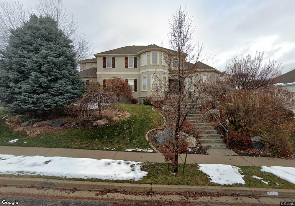
624 W 600 N Alpine, UT 84004
Estimated Value: $1,191,000 - $1,627,000
5
Beds
4
Baths
4,780
Sq Ft
$290/Sq Ft
Est. Value
About This Home
This home is located at 624 W 600 N, Alpine, UT 84004 and is currently estimated at $1,385,568, approximately $289 per square foot. 624 W 600 N is a home located in Utah County with nearby schools including Westfield School, Timberline Middle School, and Lone Peak High School.
Ownership History
Date
Name
Owned For
Owner Type
Purchase Details
Closed on
Sep 17, 2003
Sold by
Grow Jeffrey Douglas and Grow Katina Anett
Bought by
Baer Michael T and Baer Lori L
Current Estimated Value
Home Financials for this Owner
Home Financials are based on the most recent Mortgage that was taken out on this home.
Original Mortgage
$327,285
Outstanding Balance
$152,454
Interest Rate
6.3%
Mortgage Type
Purchase Money Mortgage
Estimated Equity
$1,233,114
Purchase Details
Closed on
Feb 4, 2000
Sold by
Peterson Wayne and Peterson Doris V
Bought by
Peterson Wayne Julius and Peterson Doris Veon
Create a Home Valuation Report for This Property
The Home Valuation Report is an in-depth analysis detailing your home's value as well as a comparison with similar homes in the area
Home Values in the Area
Average Home Value in this Area
Purchase History
We collect this data history from publicly available records. To have your information removed, we recommend requesting removal directly through your county’s website.
| Date | Buyer | Sale Price | Title Company |
|---|---|---|---|
| Baer Michael T | -- | First American Title Co | |
| Peterson Wayne Julius | -- | Signature Title |
Source: Public Records
Mortgage History
We collect this data history from publicly available records. To have your information removed, we recommend requesting removal directly through your county’s website.
| Date | Status | Borrower | Loan Amount |
|---|---|---|---|
| Open | Baer Michael T | $327,285 |
Source: Public Records
Tax History
| Year | Tax Paid | Tax Assessment Tax Assessment Total Assessment is a certain percentage of the fair market value that is determined by local assessors to be the total taxable value of land and additions on the property. | Land | Improvement |
|---|---|---|---|---|
| 2025 | $5,351 | $642,235 | -- | -- |
| 2024 | $5,351 | $623,700 | $0 | $0 |
| 2023 | $4,962 | $620,895 | $0 | $0 |
| 2022 | $5,329 | $647,625 | $0 | $0 |
| 2021 | $4,061 | $766,500 | $374,200 | $392,300 |
| 2020 | $3,965 | $732,500 | $340,200 | $392,300 |
| 2019 | $3,617 | $697,600 | $305,300 | $392,300 |
| 2018 | $3,301 | $628,900 | $287,800 | $341,100 |
| 2017 | $3,340 | $338,690 | $0 | $0 |
| 2016 | $3,438 | $325,050 | $0 | $0 |
| 2015 | $3,161 | $282,700 | $0 | $0 |
| 2014 | $2,857 | $252,725 | $0 | $0 |
Source: Public Records
Map
Nearby Homes
- 684 N Summit Way
- 501 W Devey Dr
- 353 International Way
- 591 N Pfeifferhorn Dr
- 12513 Timberline Dr
- 5886 W Timber Ridge Ln
- 248 Deerfield Dr
- 151 Glacier Lily Dr
- 246 Fort Creek Dr
- 190 N 100 W
- 152 N 100 W
- 965 E Deer Crest Ln Unit 2
- 1765 Elk Ct Unit 14
- 19 E Elk Ct
- 1123 N Deer Crest Ln
- 12643 Ponce de Leon Dr Unit 22
- 12651 Ponce de Leon Dr Unit 21
- 12687 Ponce de Leon Dr Unit 18
- 30 S Main St
- 475 Grove Dr
- 624 W 600 N Unit 5
- 602 W 600 N
- 602 W 600 N Unit 4
- 646 W 600 N
- 646 W 600 N Unit 6
- 602 W Hog Hollow Rd
- 684 Summit Way
- 574 W 600 N Unit 3
- 574 W Hog Hollow Rd
- 702 Summit Way
- 645 W 600 N
- 702 N Summit Way
- 615 W 600 N
- 615 W 600 N Unit 1
- 679 N Summit Way Unit 26
- 679 N Summit Way
- 633 Summit Way
- 633 Summit Way Unit 27
- 665 W 600 N
- 679 Summit Way
Your Personal Tour Guide
Ask me questions while you tour the home.