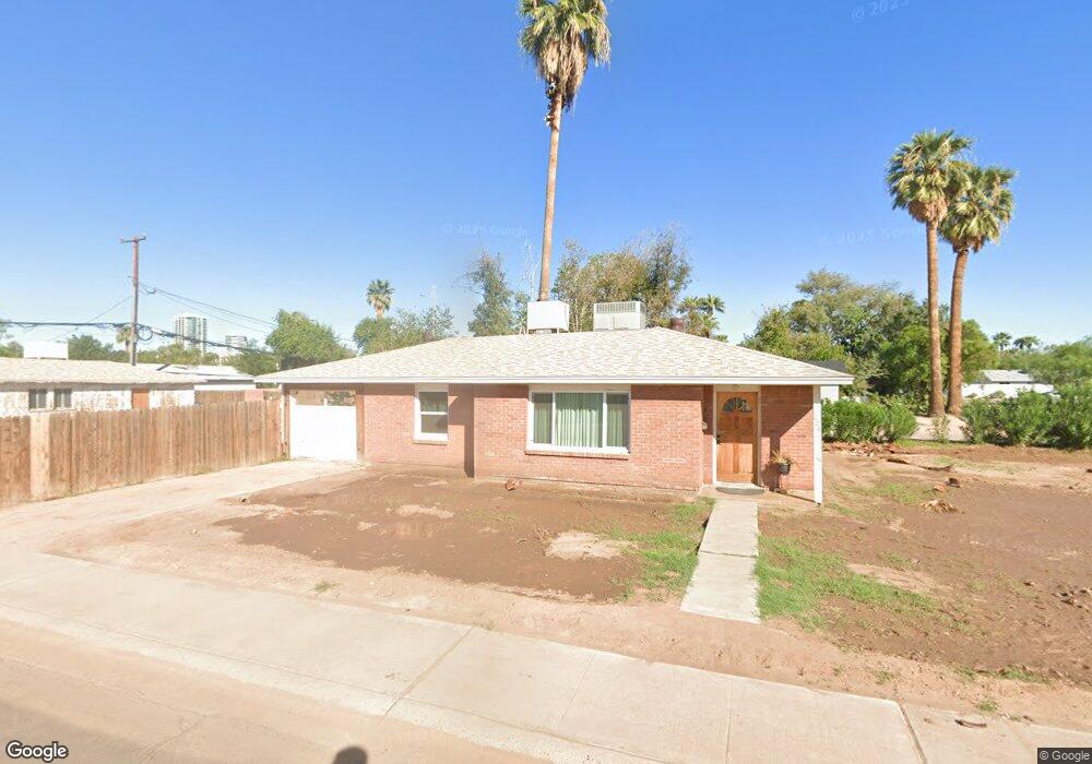
624 W Howe St Tempe, AZ 85281
Mitchell Park West NeighborhoodEstimated Value: $376,000 - $442,000
Studio
1
Bath
989
Sq Ft
$411/Sq Ft
Est. Value
About This Home
This home is located at 624 W Howe St, Tempe, AZ 85281 and is currently estimated at $406,922, approximately $411 per square foot. 624 W Howe St is a home located in Maricopa County with nearby schools including Geneva Epps Mosley Middle School, Tempe High School, and New School for the Arts & Academics.
Ownership History
Date
Name
Owned For
Owner Type
Purchase Details
Closed on
Dec 5, 2024
Sold by
Deodati Carol L
Bought by
Razdan Anjali and Bokowski Andrew
Current Estimated Value
Home Financials for this Owner
Home Financials are based on the most recent Mortgage that was taken out on this home.
Original Mortgage
$319,238
Outstanding Balance
$316,604
Interest Rate
6.54%
Mortgage Type
New Conventional
Estimated Equity
$90,318
Create a Home Valuation Report for This Property
The Home Valuation Report is an in-depth analysis detailing your home's value as well as a comparison with similar homes in the area
Home Values in the Area
Average Home Value in this Area
Purchase History
| Date | Buyer | Sale Price | Title Company |
|---|---|---|---|
| Razdan Anjali | $430,000 | Pioneer Title Agency | |
| Razdan Anjali | $430,000 | Pioneer Title Agency |
Source: Public Records
Mortgage History
| Date | Status | Borrower | Loan Amount |
|---|---|---|---|
| Open | Razdan Anjali | $319,238 | |
| Closed | Razdan Anjali | $319,238 |
Source: Public Records
Tax History
| Year | Tax Paid | Tax Assessment Tax Assessment Total Assessment is a certain percentage of the fair market value that is determined by local assessors to be the total taxable value of land and additions on the property. | Land | Improvement |
|---|---|---|---|---|
| 2025 | $2,383 | $17,026 | -- | -- |
| 2024 | $1,884 | $16,216 | -- | -- |
| 2023 | $1,884 | $35,460 | $7,090 | $28,370 |
| 2022 | $1,807 | $29,470 | $5,890 | $23,580 |
| 2021 | $1,586 | $27,100 | $5,420 | $21,680 |
| 2020 | $1,533 | $23,800 | $4,760 | $19,040 |
| 2019 | $1,504 | $18,880 | $3,770 | $15,110 |
| 2018 | $1,463 | $17,880 | $3,570 | $14,310 |
| 2017 | $1,418 | $15,070 | $3,010 | $12,060 |
| 2016 | $1,411 | $14,920 | $2,980 | $11,940 |
| 2015 | $1,365 | $13,280 | $2,650 | $10,630 |
Source: Public Records
Map
Nearby Homes
- 522 W Howe St
- 1215 S Judd St
- 611 W 13th St
- 617 W 13th St
- 826 W 12th St
- 1218 S Farmer Ave
- 1101 S Farmer Ave
- 919 S Wilson St Unit 5
- 1234 S Farmer Ave
- 1201 S Farmer Ave Unit 1
- 915 S Wilson St Unit 4
- 1219 S Farmer Ave
- 914 S Farmer Ave
- 406 W 14th St
- 410 W Parkway Blvd
- 535 W 15th St
- 942 S Ash Ave Unit 103
- 820 S Farmer Ave
- 948 S Ash Ave
- 700 W University Dr Unit 241
- 616 W Howe St
- 616 W Howe St
- 702 W Howe St
- 623 W 11th St
- 619 W 11th St
- 612 W Howe St
- 1125 S Judd St
- 704 W Howe St
- 621 W Howe St
- 615 W 11th St
- 1108 S Judd St
- 701 W Howe St
- 615 W Howe St
- 611 W 11th St
- 708 W Howe St Unit 1
- 708 W Howe St
- 611 W Howe St
- 705 W Howe St
- 1118 S Roosevelt St
- 1116 S Roosevelt St
Your Personal Tour Guide
Ask me questions while you tour the home.